A Birds-Eye View of a Georgia Barrier Island

All scientists use tools when investigating how the natural world works. Yet as a traditionally trained field scientist – and an ichnologist – I’ve always been wary of adopting anything more complicated than field notebooks, pencils, tape measures, hand lenses, and cameras. Granted, I did add GPS units to my equipment list starting about 12 years ago and now consider these location-finding devices as standard (and essential) field gear. Still, if you told me even a year ago that I would happily welcome the services of flying robots while tracking alligators on the Georgia barrier islands, I would have smiled and said, “Yes, and Bud Light is my favorite beer.” (Just to clarify: It is not, nor will it ever be.)
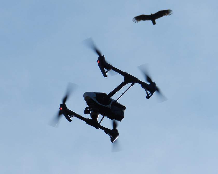
Drone+VultureNeed a better overhead view of barrier-island ecosystems with identified locations, and don’t feel like waiting for the latest satellite photos? I suggest strapping a camera and GPS unit onto a vulture and training it to take pictures while simultaneously recording waypoints. Or, have an aerial drone do the same for you, which will do a much better job, while also not annoying the vulture. (Photograph by Anthony Martin, taken on St. Catherines Island, Georgia.)

So here I am, ready to buy everyone a round of their favorite beverage (perhaps Kool-Aid) in celebration of my being wrong. Earlier this year, an Emory colleague of mine – Michael Page – convinced me that an aerial drone might be a good tool for getting overhead views of ecosystems on the Georgia barrier islands. So as soon as Emory purchased a new, state-of-the-art drone in early 2015, Michael and I plotted to take it to St. Catherines Island for its first real field test in March 2015.
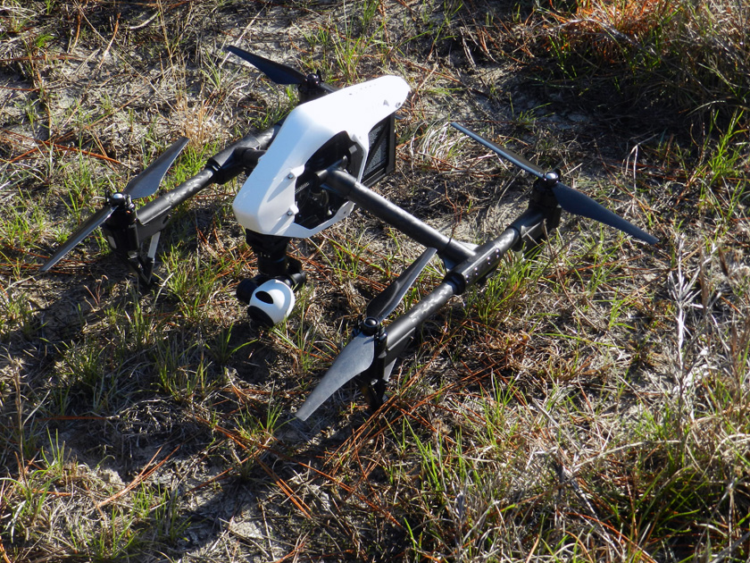
Drone-1Yeah, I know, it’s not New Horizons, but this drone is still a pretty nifty piece of field equipment, and I’m glad to have added it to my ichnology utility belt. (Photograph by Anthony Martin, taken on St. Catherines Island, Georgia.)

The last time Michael and I were on St. Catherines Island together was two years ago, when we had a group of Emory students help us map gopher tortoise burrows and alligator dens there. (That was fun.) We’ve also been working with a few other colleagues at Georgia Southern University to describe the gopher tortoise burrows and alligator dens on St. Catherines Island over the past few years. So Michael and I figured we could use the drone to aid in this research, starting with the gopher-tortoise burrows.

Perhaps the most persuasive point Michael made about the drone’s potential value was its winning combination of built-in GPS and high-definition video camera. This meant we could instantly map (“georeference”) gopher-tortoise trails between their burrows, as well as the burrows themselves. The latter were easily visible from the wide, white, sandy aprons just outside burrows entrances, and sometimes even show up in satellite photos of the area. The big difference with using a drone versus satellite photos, though, would be in their ‘real-time” capture of these traces – rather than a randomly taken satellite image – while also having much better resolution.
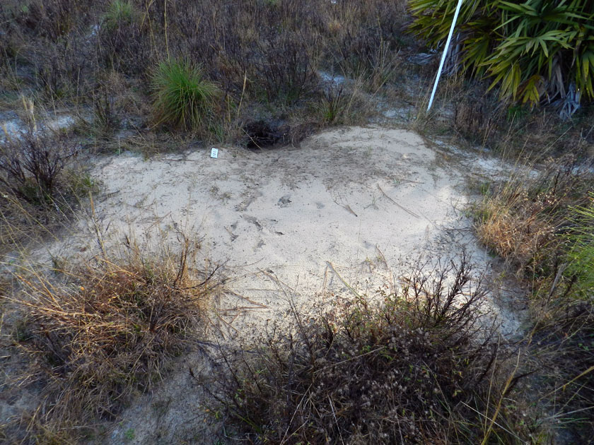
Tortoise-Burrow-ApronSee that hole in the ground? That’s a gopher-tortoise burrow. See those breaks in the grass to the left and right in the foreground, and elsewhere? Those might be trails that connect this burrow to others in the area. How to map all of them? Call in the drone! (Photograph by Anthony Martin, taken on St. Catherines Island, Georgia.)
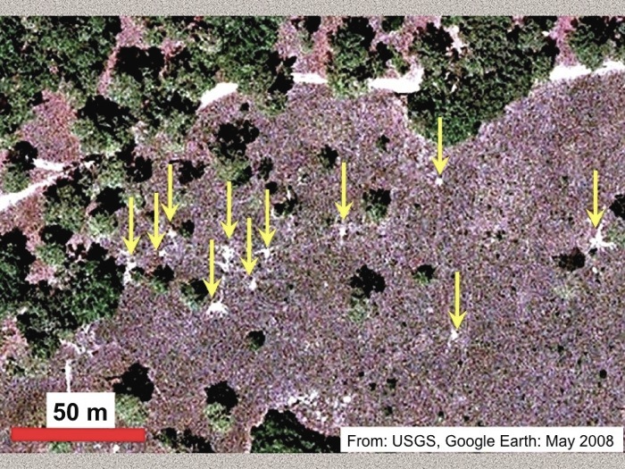
GT-Aprons-Trails-SCICan you see gopher tortoise traces from space? Surprisingly, yes. Not only are burrow aprons visible in this GoogleEarth™ photo (denoted by the arrows), but also trails connecting some of the burrows. Although if you find yourself squinting and turning your head sideways to see these, you’ll understand why sending up a drone with a high-resolution camera might be a better way to map these traces. (Image taken from a presentation I gave at the 2011 annual meeting of the Geological Society of America in Minneapolis, Minnesota.)

Most of the gopher-tortoise burrows are in a broad, flat area on St. Catherines that used to be pasture land, but is now being restored to the tortoises’ long-leaf pine-wiregrass ecosystem. This re-located tortoise population has done quite well here, and because of its isolation on St. Catherines, it’s an example of one that does not face as many human-related problems as their compatriots on the Georgia mainland. Its remote location also helped us with trying out the drone, as we didn’t have to worry about it dodging buildings, power lines, or gawking locals, all of which might have complicated its flights.
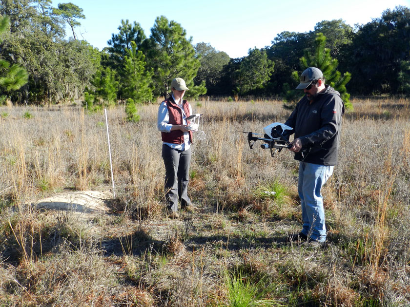
Tortoise-Burrow-Drone-PilotsAlmost ready for take-off! Drone pilots/wranglers Alison Hight (left) and Michael Page (right) look for a flat place near a staked gopher-tortoise burrow for setting down our “eyes in the sky.” (Photograph by Anthony Martin, taken on St. Catherines Island, Georgia.)

This was the drone’s maiden voyage on St. Catherines Island, taking off from the gopher-tortoise field. It did just fine. (Video footage by Anthony Martin, taken on St. Catherines Island, Georgia.)
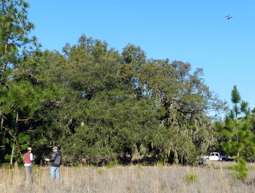
Drone-Above-Tortoise-FieldThe drone pilots doing a great job, sending the drone around the gopher-tortoise field for a spin. (Photograph by Anthony Martin, taken on St. Catherines Island, Georgia.)

This flight was a big success, in that the drone went up, took lots of video and photos while in the air – all of which was georeferenced – and it came down without crashing. So we decided to try it elsewhere. That’s when we remembered the Atlantic Ocean was only about 500 meters away on the eastern edge of St. Catherines, with a lengthy beach, salt marshes, storm-washover fans, tidal creeks, and a bluff of Pleistocene sand with maritime forest on top of it. So off we went, and we did Flight #2 over the storm-washover fans, salt marshes, and tidal creeks near the north end of the island.

Drones (much like me) operate well in places with wide-open spaces that involve Georgia beaches. Check out how quickly it disappears from view once in the air. (Video footage by Anthony Martin, taken on St. Catherines Island, Georgia.)

Following this flight, we decided to send the drone father north to survey the bluff from just offshore. This was probably the most exciting flight, as we watched it go out to sea, then fly parallel to the shore, with its camera trained on the coastline.
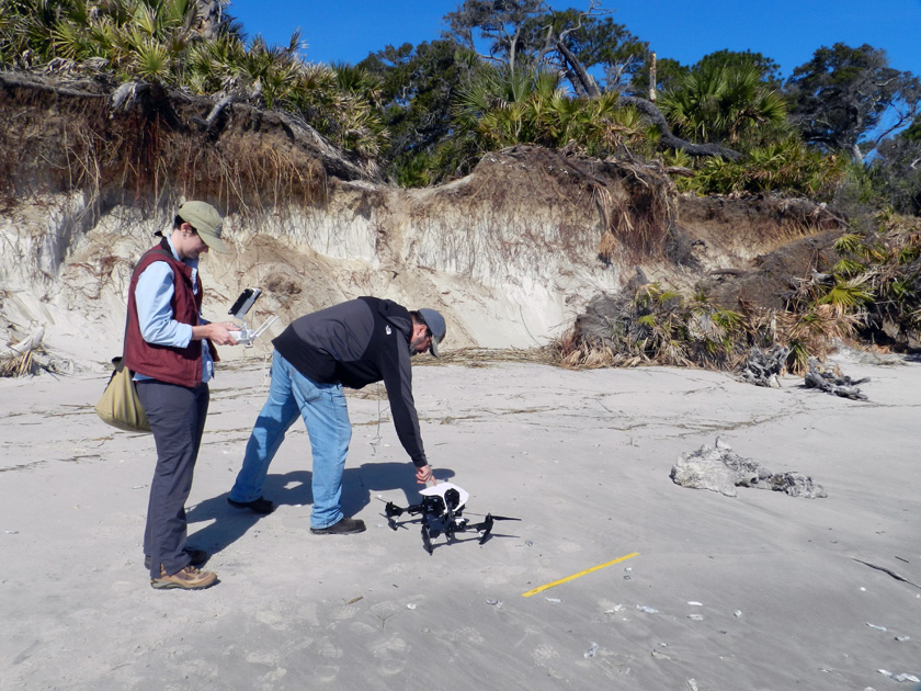
Drone-Yellow-Banks-Bluff-1Michael setting down the drone on a almost-flat surface as Alison prepares it for take-off. The yellow yardstick serves as an easily visible scale that can be used to estimate ground-level distances. (Photograph by Anthony Martin, taken on St. Catherines Island, Georgia.)

Off we go, into the wild blue yonder. (Video footage by Anthony Martin, taken on St. Catherines Island, Georgia.)
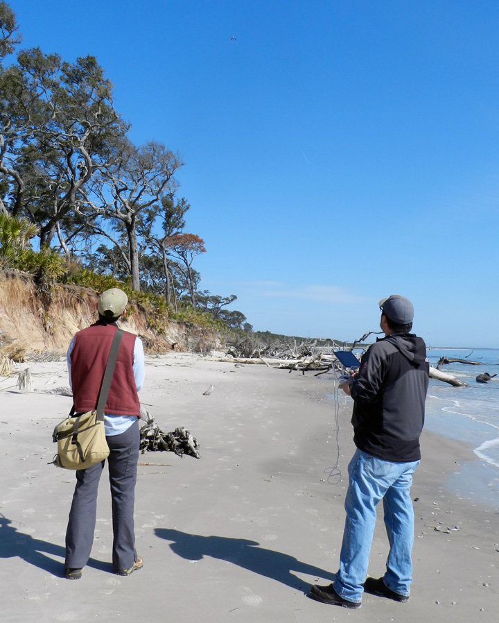
Drone-Yellow-Banks-Bluff-3Bringing it back home. Look for the spot near the top-center of the photo for our “hand lens in the sky.” (Photograph by Anthony Martin, taken on St. Catherines Island, Georgia.)

Coming in for a soft landing, which is much preferred over the other type of landing. (Video footage by Anthony Martin, taken on St. Catherines Island, Georgia.)

So following these inland and coastal successes, which clearly were applicable to studying gopher tortoises and coastal geology, it was time to try using the drone to look at the apex predators of the island – alligators – and their traces. The next day,while scouting areas further to the south for alligator dens and tracks, we paused on a causeway cutting through a salt marsh. Because the marsh was at low tide, its mudflats were exposed, which allowed a few big animals to walk across it and leave their tracks, and for us to see these tracks.

At least two of the trackways were from alligators, made distinctive by their sinuous tail drags, arcing footprints, and belly drags. I suspect the other trackways were from feral hogs, but I couldn’t tell for sure because they were in squishy mud beyond my carrying capacity. Which is to say, I would have quickly immersed myself in this environment had I gone any further out. Gee, if only we had some way to photograph those trackways from above, better helping us to see their lengths, patterns, and directions.
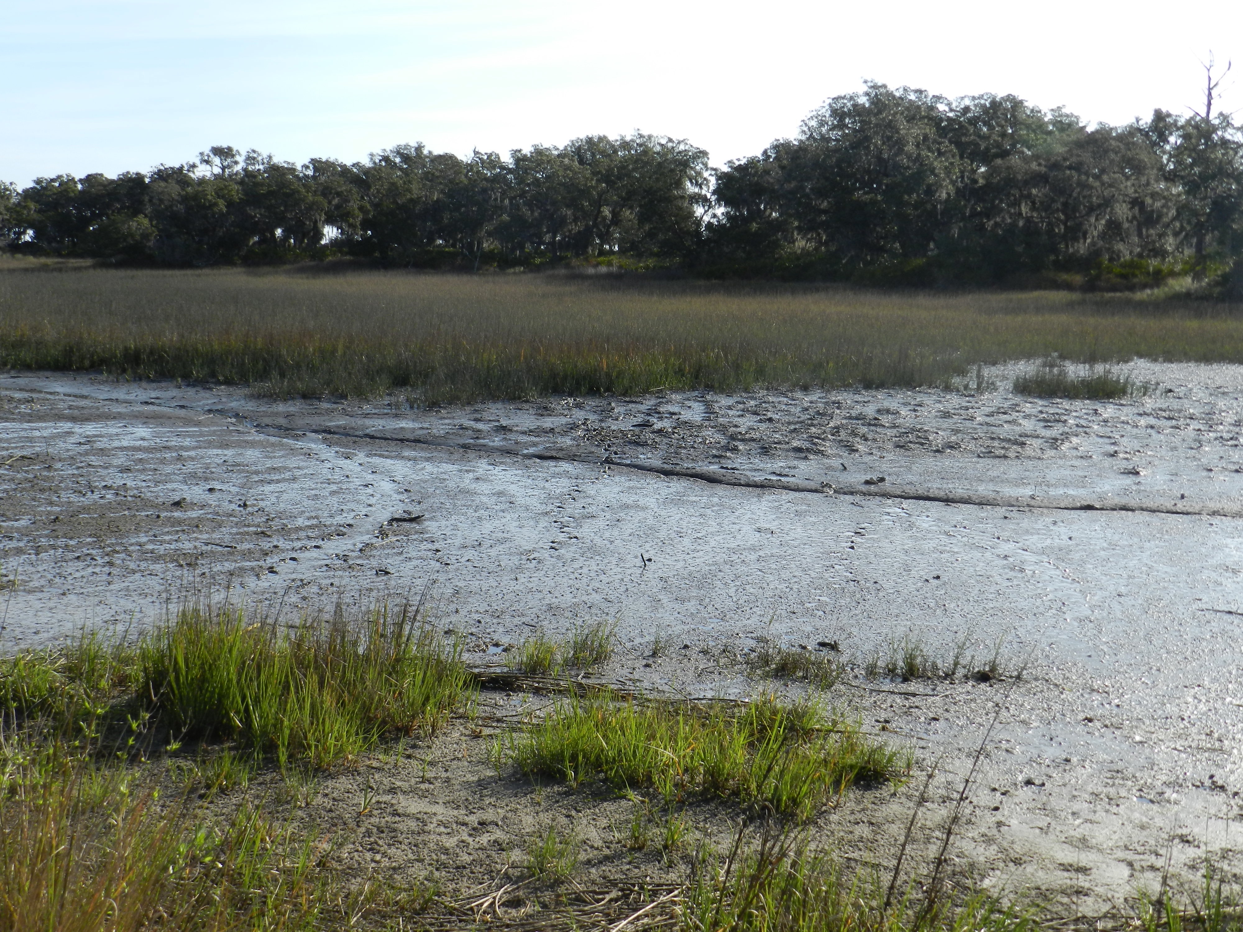
Alligator-Trackways-MarshA salt-marsh mudflat at low tide, with low marsh and a patch of forest (hammock) in the background. See the alligator trackway to the left, where the alligator turned? Look in the middle and you’ll see two more trackways that are probably from feral hogs, and another curving trackway to the right that is from another alligator. (Photograph by Anthony Martin, taken on St. Catherines Island, Georgia.)
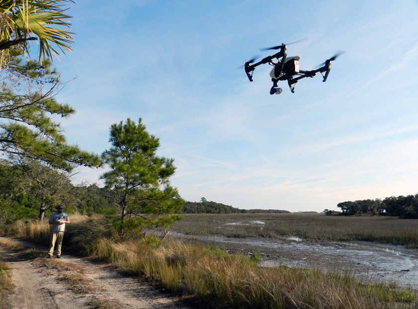
Drone-Landing-Salt-MarshWhy wade into waist-deep salt-marsh mud to track an alligator when you can stay safely (and cleanly) on dry land, telling a drone what to do? (Photograph by Anthony Martin, taken on St. Catherines Island, Georgia.)

So it was time for another flight, and the drone’s first alligator-track-mapping mission, which I’m pleased to say was a success. One example of that success is conveyed by the following photo, which made me gasp when I first saw it. There were the two alligator trackways and the two hog trackways, but also two not-so-clear trackways I had missed and a clear view of where the hogs had dug along the marsh edge. This photo similarly evoked a collective “Ooooo!” when I showed it to an audience the next week at the Southeastern Section meeting of the Geological Society of America meeting in Chattanooga, Tennessee. My talk was a progress report on the alligator dens of St. Catherines Island, but I threw in this photo toward the end of it to show how drones might help with some of our tracking alligator movements through difficult-to-access environments on the island.
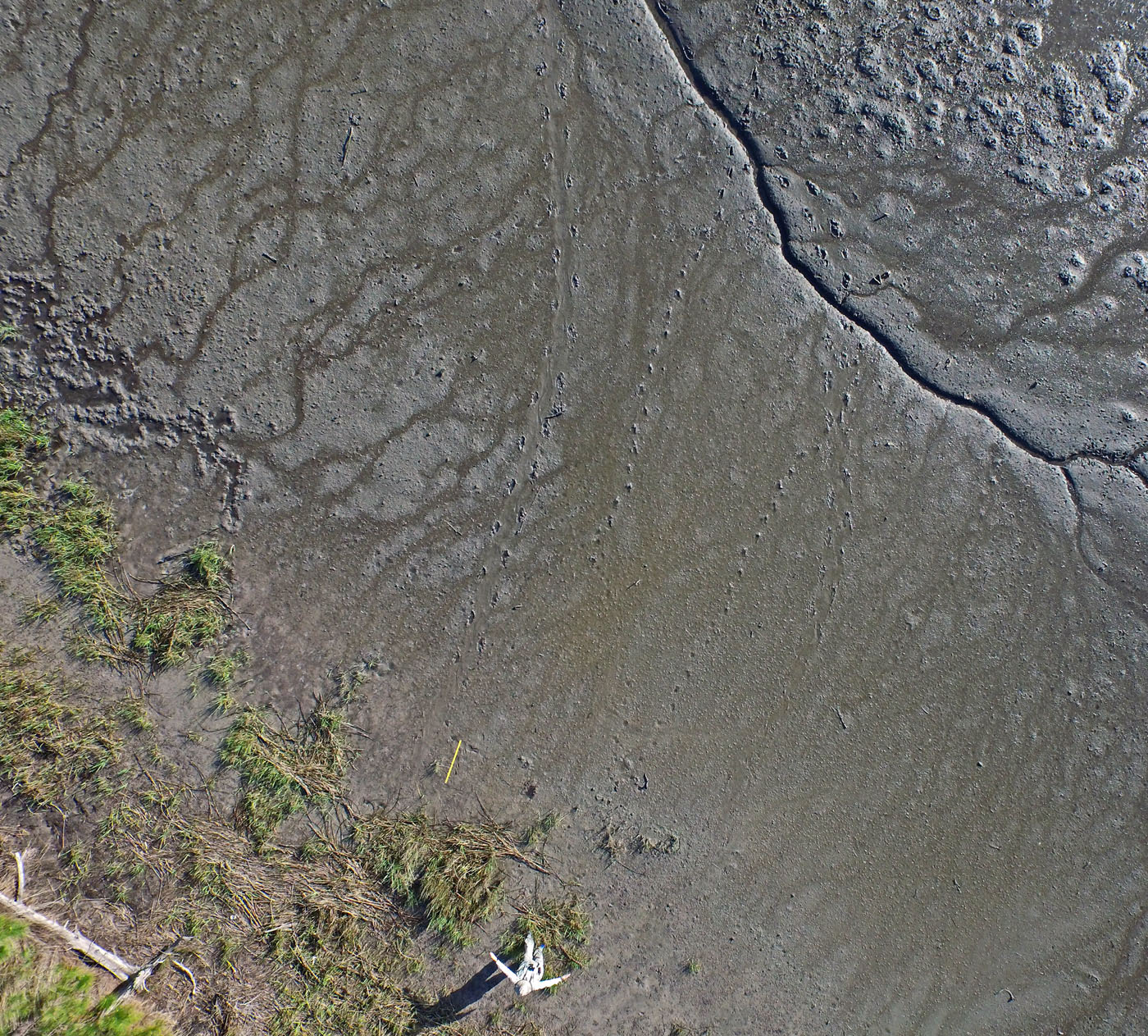
DCIM100MEDIADJI_0100.JPGOK, you’re probably wondering by now how good those photos and videos taken by the drone might be, and whether or not any useful science can come from them. See that guy in the lower center of the photo? That’s me, pointing to each of the two alligator trackways, with the yellow yardstick providing an additional scale to the left. Notice also the probable feral hog trackways in the middle and fainter ones to the right, as well as the “hogturbation” (rooting disturbance caused by hogs) in the upper left of the photo. As an ichnologist, I was pretty darned pleased by this picture, and I want more like it. (Photograph by The Aerial Drone, taken on St. Catherines Island, Georgia.)

Lastly, I was also happy to see that drones have their own ichnology, in that they make flight traces. I’ve been long fascinated by flight traces – called volichnia by ichnologists – and have done my best to describe these in modern birds of the Georgia coast, as well as bird flight traces in the fossil record. Given the right substrate, anatomy, and behavior, the take-off and landing traces of birds and other flighted animals can preserve well enough for us to interpret them for their true nature.

Now, to do the same for a drone requires knowing how they have vertical take-offs and landings, using rapidly moving rotors. This means air will be pushed down onto the substrate directly underneath the drone, then dissipated abruptly outside that zone. The result would be a sem-circular depression slightly more that the maximum width of the drone, and one that would look very much the same whether made by a take-off or landing. The difference would be in the timing of the landing-pad traces: if obscured by the depression, then it was taking off, but if they are impressed on the depression, then it was landing.
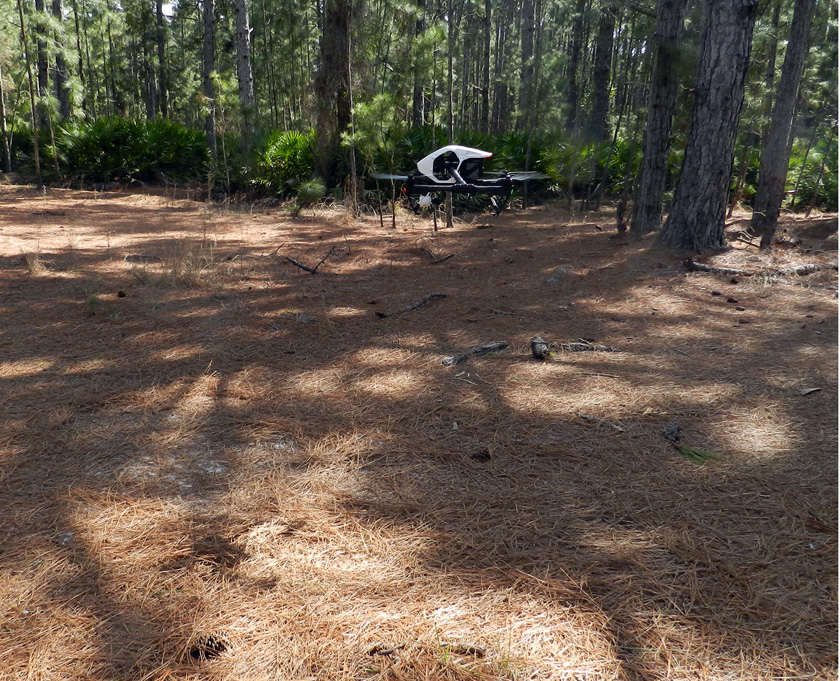
Drone-Making-Landing-TraceDrone coming in for a landing, already pushing aside pine needles on the forest floor and making its landing trace. (Photograph by Anthony Martin, taken on St. Catherines Island, Georgia.)
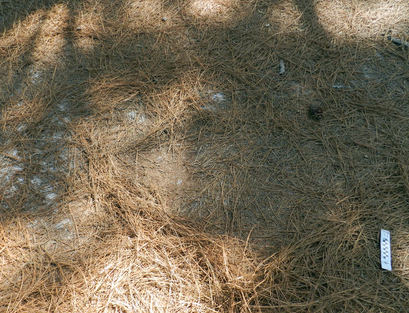
Drone-Landing-Trace-2Drone landing trace, minus the drone. Do you see the square pattern in the middle of the oval depression? That’s the outline of the drone, defined by its landing gear. (Photograph by Anthony Martin, taken on St. Catherines Island, Georgia.)

So now we know that a drone can be used for conservation biology, coastal geology, behavioral ecology, and – most importantly – ichnology. How about art? Yes indeed. Once we got back to the Emory campus, Michael handed over the footage to Steve Bransford, a skilled videographer employed by Emory and founder of Terminus Films. Given all of the drone footage, he snipped out the boring parts (always a good thing to do), added a few maps at the start to orient the viewers, put in a soothing soundtrack, and basically created an aesthetically pleasing and extraordinarily educational video. So we submitted it for consideration as an video in the peer-reviewed online journal Southern Spaces, which was founded at Emory University. Much like an aerial drone on an unobstructed coastline, it sailed through peer review and is now available for viewing by all who have an Internet connection.

St. Catherines Island Flyover from Southern Spaces on Vimeo. Never mind the stern message: just click on the link or the video and it will play. Once it does start playing, please watch it on a big screen, sit back, and enjoy the ride. Also be sure to read the accompanying article linked to the peer-reviewed online journal Southern Spaces.

What’s aerial adventures await us next? We’ll see, as we have plenty of visual information and data to process from our previous visit. But for now we can be pleased to have shown the value of an aerial drone as both a scientific instrument and a means for engaging our senses with soaring imaginations.

Acknowledgements: Many thanks to the St. Catherines Island Foundation for its support of our research on St. Catherines, and to Royce Hayes and Michael Halstead for their assistance on field logistics. We also appreciate the expert piloting of the drone by Alison Hight while on St. Catherines. Steve Bransford did a fantastic job with creating the video for the Southern Spaces article, which should win the Georgia equivalent of an Oscar. Input from the editor of Southern Spaces, Allen Tullos, improved our article accompanying the video, and we are grateful to the staff of Southern Spaces for their quality service in putting this video and article online. And as always, many thanks to Ruth Schowalter for her help and support, in and out of the field.

Emory News (July 15, 2015): Drone Offers Stunning Aerial Views of Georgia’s St. Catherines Island.

A Tale (and Tails) of Two Islands

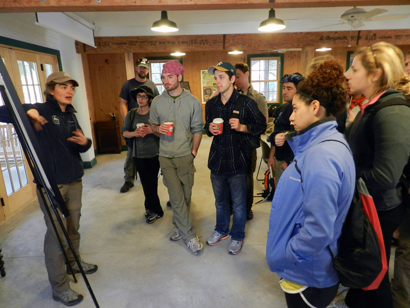
After visiting Cumberland Island and Jekyll Island, our Barrier Islands class had entered its third day (Monday, March 11), and was now about to embark onto our third and fourth barrier islands of the Georgia coast. These islands were a Pleistocene-Holocene pair – St. Simons and Little St. Simons, respectively – and the latter was our primary goal. After all, Little St. Simons is a privately owned and undeveloped island, one of the few that has not been logged or otherwise majorly altered by those ever-nefarious and industrious post-Enlightenment humans. St Simons, though, had its own lessons to teach us, including a realization I had that ichnological factors (bivalve feces, specifically) had played a role in deciding the fate of European power struggles on the Georgia coast during the 18th century.

Just like the previous two posts, this one will be told through photos and captions, which I hope captures much of what my students and I learned during our times on these two islands. Just watch out for those tails.

Little St. Simons is a privately owned island, but is available for day tours of groups like ours that are led by their knowledgeable and friendly naturalists. Soon after arriving by small boats on the island and being greeted by the naturalists assigned to us, Laura (pictured) and Ben (you’ll see him soon enough). While there, Laura provided a brief introduction to the geological history of Little St. Simons: Holocene (probably only a few thousands years old), and rapidly gaining weight (sediment, that is) each year, supplied by the nearby Altamaha River.

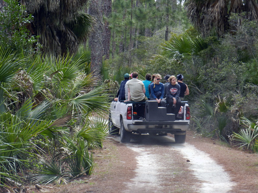
Check out our air-conditioned field vehicles! Seeing that this is a field course, traveling this way was ideal for experiencing the island a bit more directly, yet without descending in a Heart-of-Darkeness or Lord-of-the-Flies sort of mode. Because that would be bad.

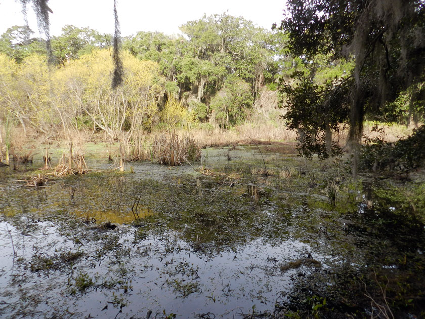
Little St. Simons has a healthy number of freshwater wetlands for such a small island (like this one), more closely resembling what used to be on the Georgia barrier islands before a few people decided that plantations and paper mills were great ideas.

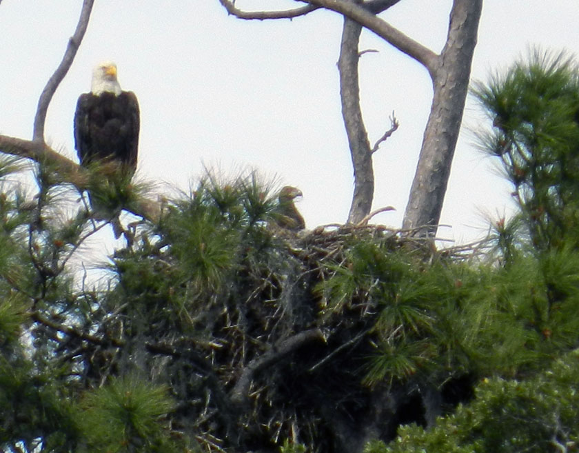
Say, isn’t that an all-American bird? Yes, it is, but more importantly, it has a rather prominent trace next to it – a bald eagle nest – that is also occupied by a couple of young eagles. (Here, one is sticking its head out of the nest while being overseen by a protective parent.) Bald eagle nests are among the largest tree nests made by any modern bird, leading me to wonder what tree-dwelling dinosaur nests from the Cretaceous Period must have looked like.

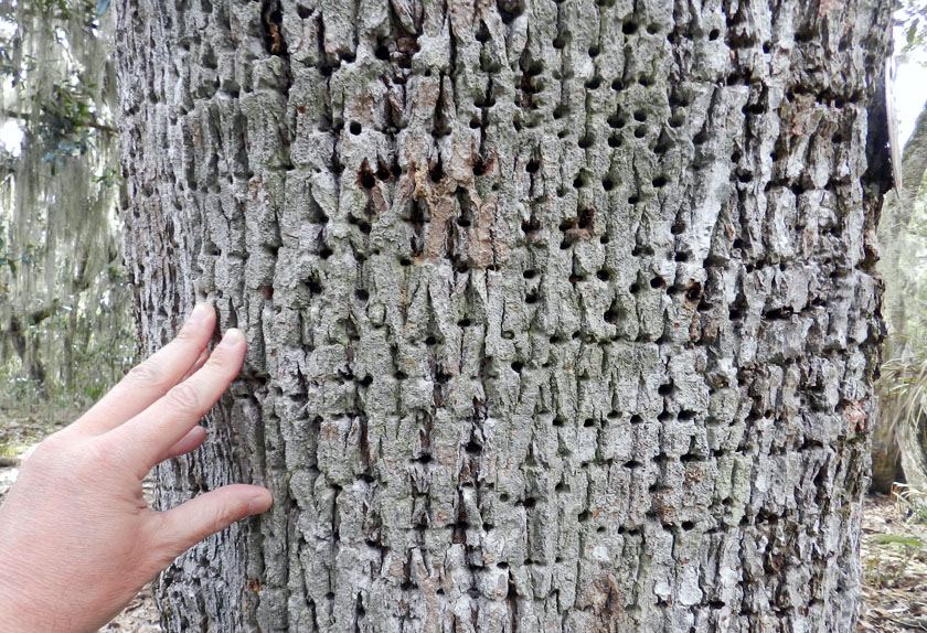
Sorry folks, can’t get enough of bird traces on this island. Many of the tree trunks on Little St. Simons bear the horizontally aligned holes of yellow-bellied sapsuckers. These woodpeckers pierce tree trunks to cause the tree to bleed sap, which attracts insects, which get stuck, which get eaten by the sapsuckers. Sap + insects = tasty treat!

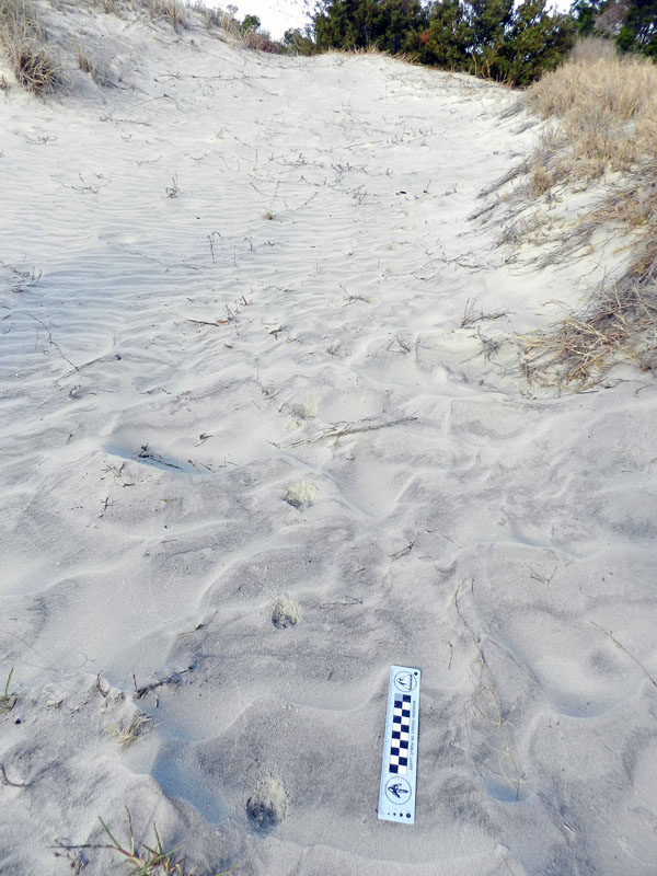
Armadillo tracks on a coastal dune at the north end of the island show just how far-ranging these mammals can get. Having only recently arrived to the Georgia coast since the 1970s, these prolific tracemakers are now on every island.

Near the armadillo tracks, also in the coastal dunes, were these mystery burrows. I had no idea what made these, as they were too small to be mole burrows, too big to be insect burrows, and too horizontal to be mouse burrows. Just a reminder that even the author of a 700-page book about Georgia-coast traces still has a lot more to learn.

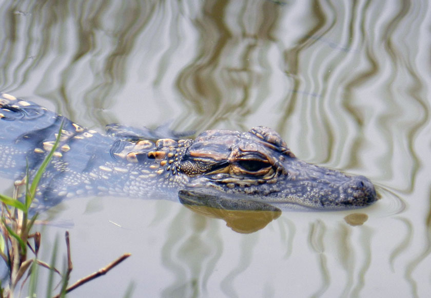
Aw, look at this cute little baby alligator, which was near its momma in one of the freshwater ponds on Little St. Simons. I wonder where it came from originally?

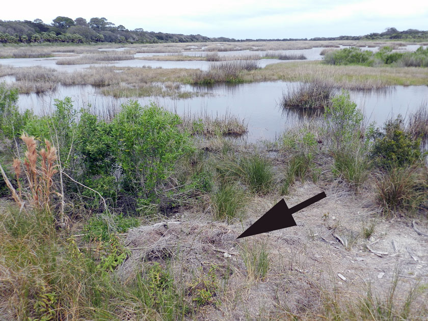
Why, there’s where it came from: it’s momma’s nest! The arrow is pointing toward a now mostly collapsed alligator nest, which hatched the little tykes that are now in the nearby wetland. Alligator nests are composed mostly of loose vegetation that the mother collects and piles, enough that it will give off heat to incubate her eggs. Such nests have very poor preservation potential in the fossil record, but it is still very interesting to study how they disintegrate so rapidly.

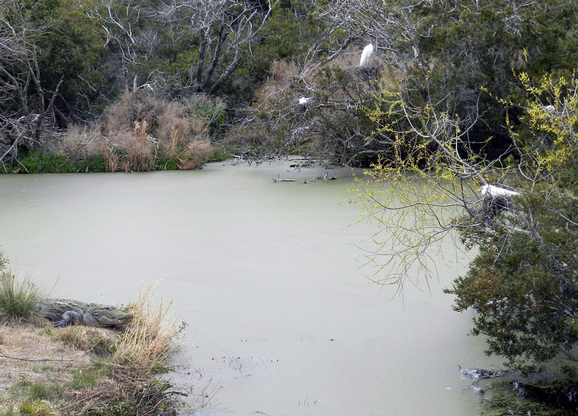
Alligators (left) and birds (right, with one on her nest) last shared a common ancestor early in the Mesozoic Era, but here they are, working together to their mutual benefit. Great egrets and woodstorks nest on islands, which are guarded by large alligators, who are good deterrents to egg predators. (In a grudge match between an alligator and raccoon, who do you think would win?) As payment for this protection, alligators get an occasional chick falling out of the nest, a small evolutionary price for the birds to pay when compared to an entire clutch of eggs getting munched.

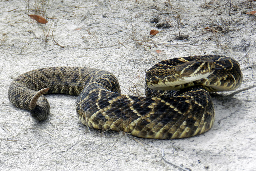
My, what a noisy tail you have! We were delighted to encounter this diamondback rattlesnake on one of the sandy roads of Little St. Simons, which urged us to approach it carefully, using a clearly audible warning and threat postures. (P.S. It worked.)

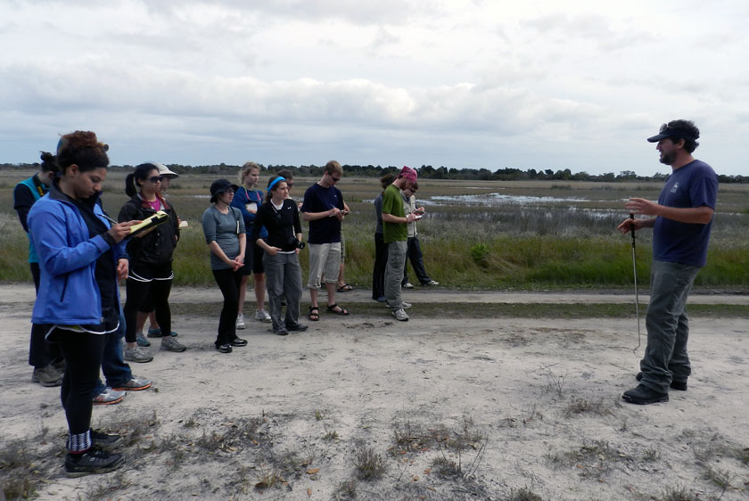
Our other guide, Ben, had an obviously deep affection for venomous reptiles, expressed first through some impromptu snake-handling. (No, he did not use his hands, nor did he speak in tongues. See that snake-handling device in his right hand?) Following our not-too-close encounter, he expounded on the ecological importance of rattlesnakes to the island, and related some interesting facts about rattlesnake behavior. Gee, you think the students might remember some of this lesson? (Personal note: Bring rattlesnakes into the classroom more often.)

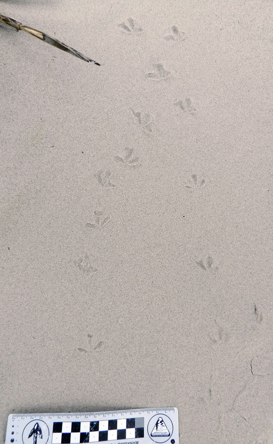
At the south end of Little St. Simons is a very nice beach, and on that beach were – you guessed it – shorebird tracks. Here are some plover tracks, which could be from Wilson’s plovers, semi-palmated plovers, or some other species.

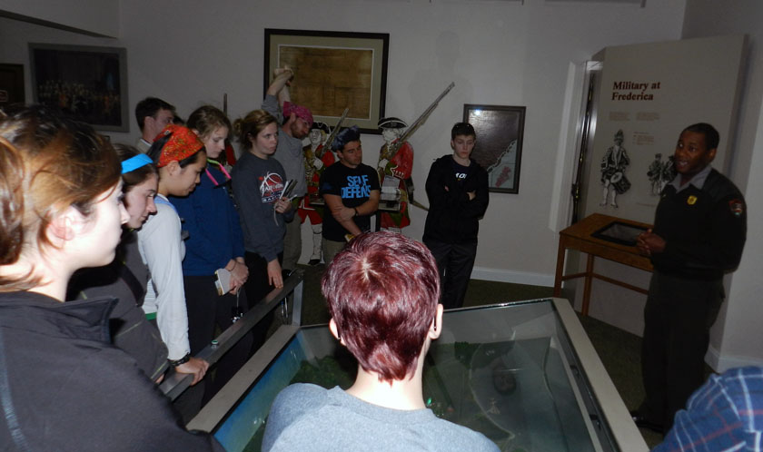
Sadly enough, our tour of Little St. Simons lasted only until 3:00 p.m., so we had some time on St. Simons to do a bit more learning. So I decided we would stop at Fort Frederica National Monument, on the north end of St. Simons Island. It turned out this was a educationally sound decision, especially when one of the rangers on duty – Mr. Ted Johnson (right) – volunteered to give our group a spirited and informative lecture about the former military importance of Fort Frederica. However, judging from the downcast looks on several of the students, I imagine they were already missing alligators, snakes, and shorebirds of Little St. Simons Island, and (of course) their traces.
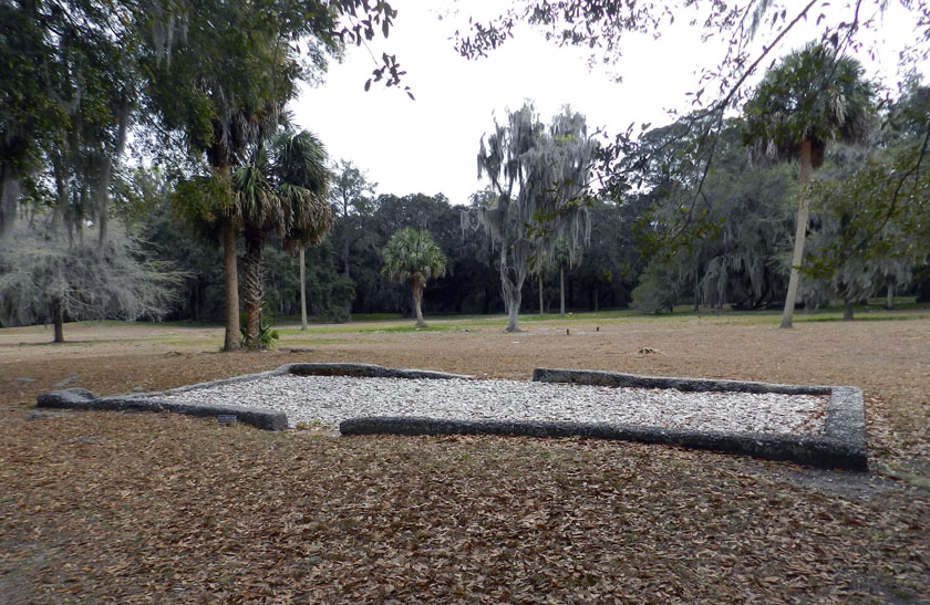
The most obvious human traces at Fort Frederica are these “footprints” (foundations) of some of the buildings there in the 18th century. Established as a British outpost in Georgia to compete with the Spanish presence to the south, Fort Frederica was a thriving town as long as the military was there.

OK, you’ve no doubt read this far to find out how bivalve feces helped the English to defeat the Spanish in the mid-18th century and consequently gain a permanent foothold in Georgia (until those pesky colonials defeated them later that century, that is). See where the fort is located? Right on a point, facing a tidal channel, and with salt marsh on either side of it. Because the salt marshes are largely composed of feces and similar muddy ejecta of ribbed mussels and other invertebrates, these make for wonderfully gooey substrates. Such substrates tend to discourage rapid movement of ordinance-laden ground troops, which forced the Spanish to try other means for attacking the fort, which failed. Bivalve feces for the win! Traces rule! ¡En la cara, los conquistadores!

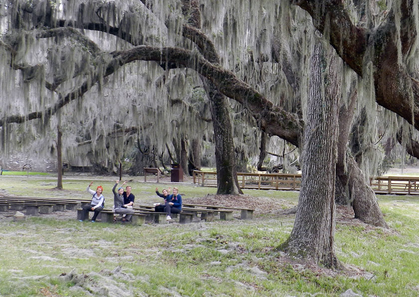
As our day neared an end, my students decided that an appropriate way to signal their pleasure with all they had learned was for them to give me the now-official fiddler crab salute, waving their mock claws in unison. We all plan to still use this when greeting on the Emory campus, which should thoroughly mystify other students, faculty, and especially administrators, the latter of whom will wonder if it is some sort of secret-society sign. (Which, in a sense, it will be. Be afraid. Be very afraid)

What island was next on our journey? My old favorite, Sapelo Island, just to the north of Little St. Simons and St. Simons, and as different from these as the preceding islands were from one another. Stay tuned for those photos and comments in just a few days, and get ready to learn.

Doing Field Work on a Developed Barrier Island

The second day of our Barrier Islands class field trip (Sunday, March 10), which is taking place along the Georgia coast all through this week, involved moving one island north of Cumberland (mentioned in this previous post), to Jekyll Island. I’ve been to Jekyll many times, but none of my students had, so they didn’t quite know what to expect other than what I had told them.
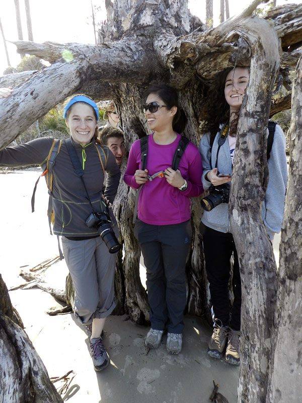
For one, I warned the students that Jekyll was not at all like Cumberland, which is under the authority of the U.S. National Park Service as a National Seashore. Consequently, it has a few residents, but is limited to less than 300 visitors a day. In contrast, many more people visit or live on Jekyll, and people have modified it considerably more. For example, Jekyll has a new convention center, regularly sized and miniature golf courses, a water park, restaurants, bars, and other such items absent during most of its Pleistocene-Holocene history. Another difference is that a ferry was need to get onto Cumberland, whereas we could drive onto Jekyll and stay overnight there in a hotel.

So why go there at all with a class that is supposed to emphasize the geology, ecology, and natural history of the Georgia barrier islands? The main reason for why I chose Jekyll as a destination for these students was so they could see for themselves the balance (or imbalance) between preserving natural areas and human development of barrier islands. Jekyll is one of those islands that is “in between,” where much of its land and coastal areas have been modified by people, but patches of it retain potentially valuable natural-history lessons for my students.

So what you’ll see in the following photos will focus on those more natural parts of Jekyll island, with some of the wonders they hold. However, this series of photos will end with one that will shock and horrify all. Actually, you’ll probably just shake your head and sigh with rueful resignation at the occasional folly of mankind, especially when it comes to managing developed barrier islands.

We started our morning like every day should start, with ichnology. Here, tracks of a gray fox, showing direct register (rear foot stepping almost exactly into the front-foot impression) cut between coastal dunes on the south end of Jekyll Island. The presence of gray foxes on Jekyll has caused some curiosity and concern among residents, with the latter emotion evoked because these canids are potential predators of ground-nesting birds, like the Wilson’s plover. Also, people have no idea how many foxes are on the island. If only we had some cost-effective method for detecting their presence, estimating their numbers, and interpreting their behavior. You know, like tracking.
My students show keen interest in the gray fox tracks, especially after I tell them to show keen interest as I take a photo of them. Funny how that works sometimes.

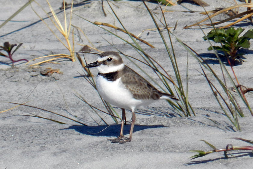
A Wilson’s plover! At least, I think it is.( Birders of the world, please correct me if this is wrong. And I know you will.) We spotted a pair of these birds traveling together on the south end of the island, causing much excitement among the photographers in our group blessed with adequate zoom capabilities on their cameras. Wilson’s plovers are ground-nesting birds, and with both gray foxes and feral cats on the island, their chicks are at risk from these predators. Again, if only we had some cost-effective method for discerning plover-cat-fox interactions. Tracking, maybe?

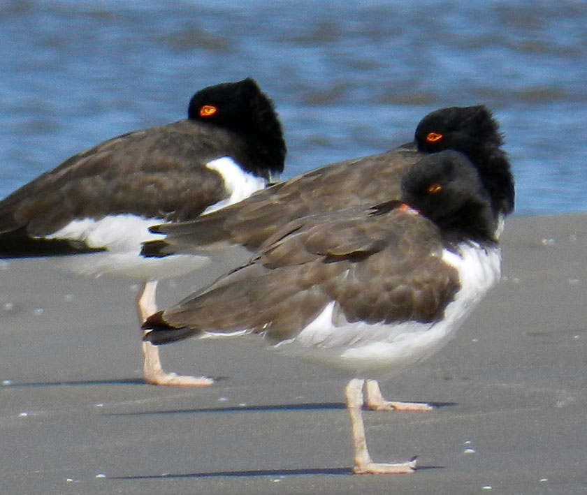
Here’s a little secret for shorebird lovers visiting Jekyll Island. Walk around the southwest corner of the island, and you are almost assured of seeing some cool-looking shorebirds along the, well, shore, such as these American oystercatchers, looking coy while synchronizing their head turns. These three were part of a flock of about twenty oystercatchers all traveling together, which I had never seen before on any of the islands. If you go walking on Jekyll, and know where to walk, you’ll see some amazing sights like this.
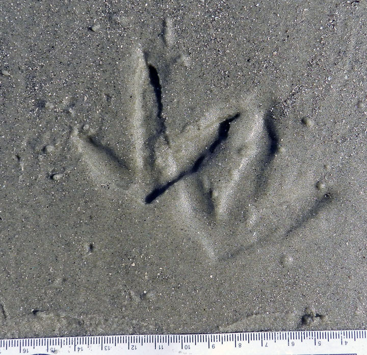
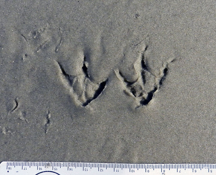
You were probably all wondering what American oystercatcher tracks look like, especially those made by ones that are just standing still. Guess this is your lucky day. Also notice the right foot was draped over the left one, causing an incomplete toe impression on the right-foot one. Wouldn’t it be nice to find a trace fossil just like this?

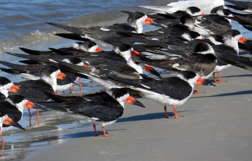
Black skimmers! We didn’t get to see them skim, but we still marveled at this flock of gorgeous shorebirds. These were in front of the oystercatchers, with an occasional royal tern slipping into the party, uninvited but seemingly tolerated.

Yeah, I know, you also wanted to know what black skimmer tracks look like. So here they are. Now you don’t need to use a bird book to identify this species: just look at their tracks instead!

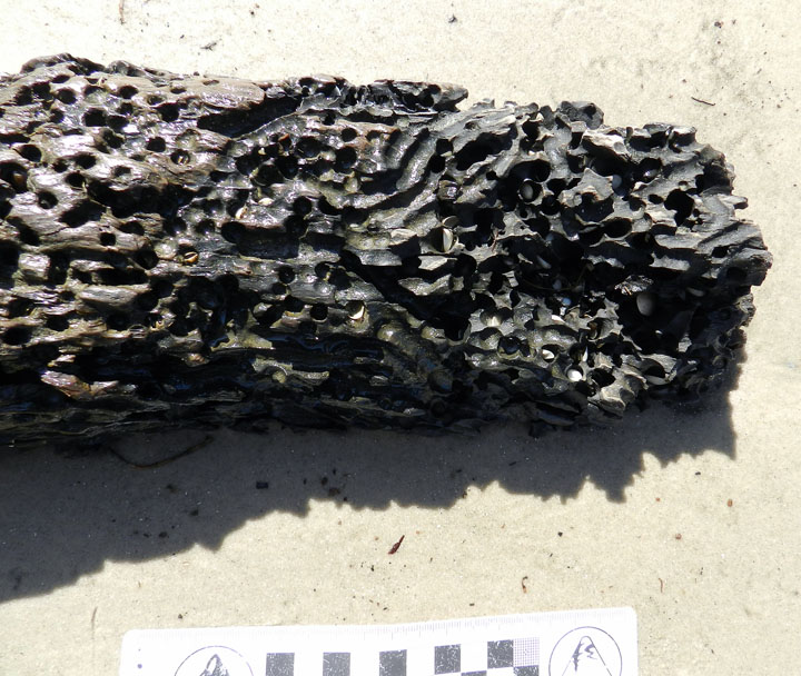
You think you’re bored? Try being driftwood, with marine clams out there adapted for drilling into your dead, woody tissue. This beach example prompted a nice little lesson in how this ecological niche for clams has been around since at least the Jurassic Period, which we know thanks to ichnology. You’re welcome (again).

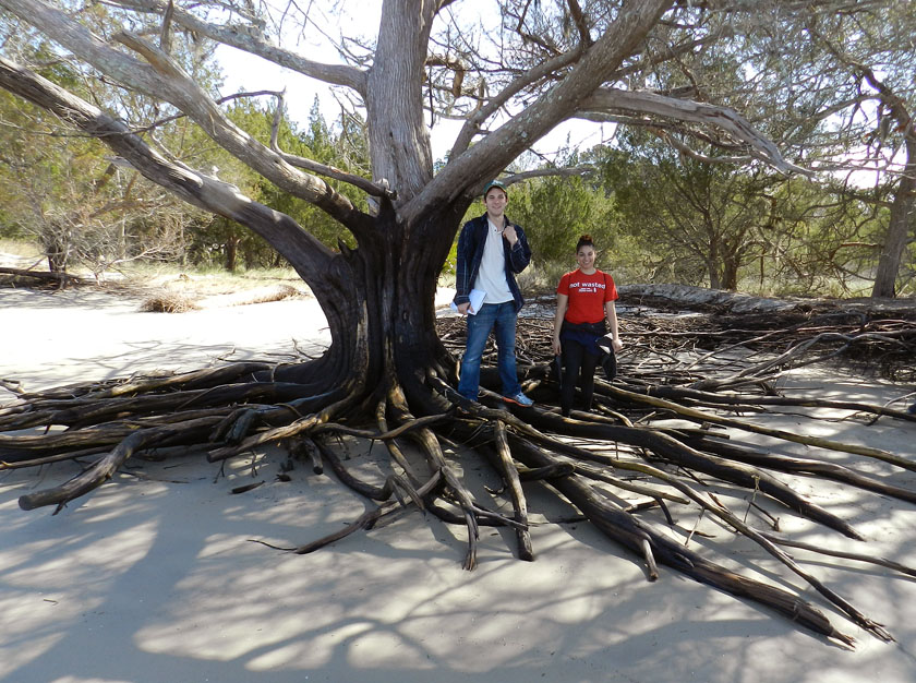
Beach erosion at the southernmost end of Jekyll gave us an opportunity to see the root systems of the main tree species there, such as this salt cedar (actually, it’s a juniper, not a cedar, but that’s why scientists use those fancy Latinized names, such as Juniperus virginiana). My students are also happily learning to become the scale in my photos, although I suspect they will soon tire of this.

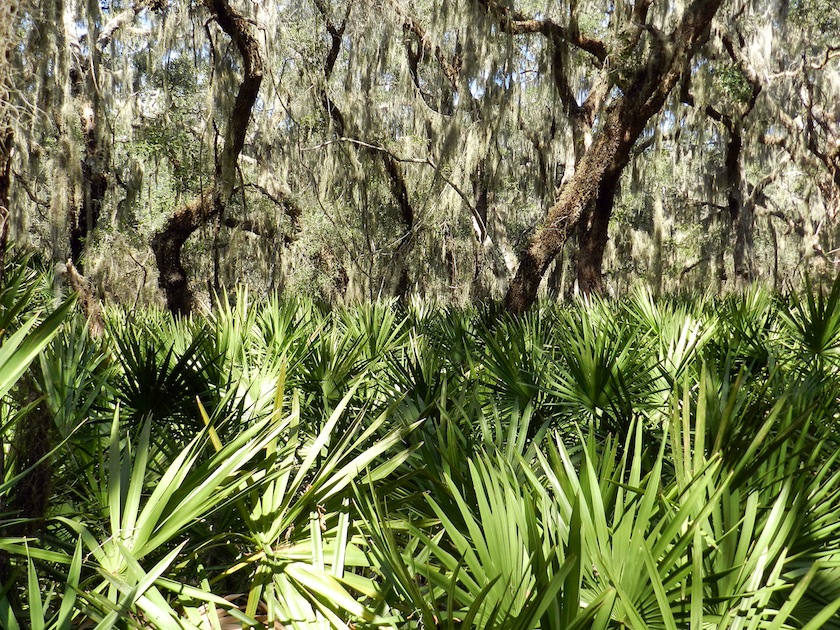
Look at this beautiful maritime forest! This is what I’m talking about when I say “…patches of it [Jekyll Island] retain potentially valuable lessons in natural history.” This is on the south end of the island, and this view is made possible by walking just a few minutes on a trail into the interior.

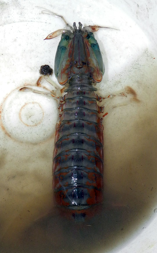
Few modern predators, invertebrate or vertebrate, provoke as much pure unadulterated giddiness in me as mantis shrimp. So imagine how I felt when, through sheer coincidence, a couple walked into the 4-H Tidelands Nature Center on Jekyll, while I was there with my class, and asked if I identify this animal they found on a local beach. The following are direct quotations from me: “Wow – that’s a mantis shrimp!! Squilla empusa!! It’s incredible!!” I had never seen a live one on the Georgia coast, and it was a pleasure to share my enthusiasm for this badass little critter with my students (P.S. It makes great burrows, too.)

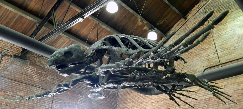
A stop at the Georgia Sea Turtle Center on Jekyll was important for my students to learn about the role of the Georgia barrier islands as places for sea turtles to nest. But I had been there enough times that I had to find a way to get excited about being there yet again. Which is why I took a photo of their cast of the Late Cretaceous Archelon, the largest known sea turtle. I never get tired thinking about the size of the nests and crawlways this turtle must have made during the Cretaceous Period, perhaps while watched by nareby dinosaurs.

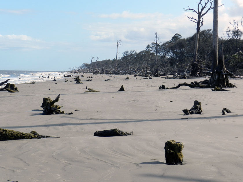
At the north end of Jekyll, shoreline erosion has caused the beach and maritime forest to meet, and the forest is losing to the beach. This has caused the forest to become what is often nicknamed a “tree boneyard,” in which trees die and either stay upright or fall in the same spot where they once practiced their photosynthetic ways.

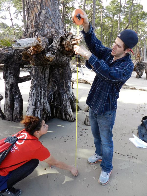
Quantify it! Whenever we encountered dead trees with root systems exposed, I asked the students to measure the vertical distance from beach surface to the topmost horizontal roots. This gave an estimate of the minimum amount of erosion that took place along the beach.

Perhaps a more personal way to convey the amount of beach erosion that happened here was to see how it related to the students’ heights. It was a great teaching method, well worth the risk of being photobombed.

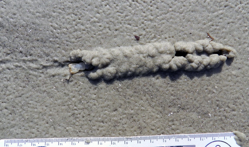
Are you ready? Here it is, in three parts, what was without a doubt the traces of the day. Start from the lower left with that collapsed burrow, follow the tracks from left to right, and look at that raised area on the right.

A close-up of the raised area shows a chevron-like pattern, implying that this was an animal that had legs, and knew how to use them. Wait, is that a small part of its tail sticking out of the left side?

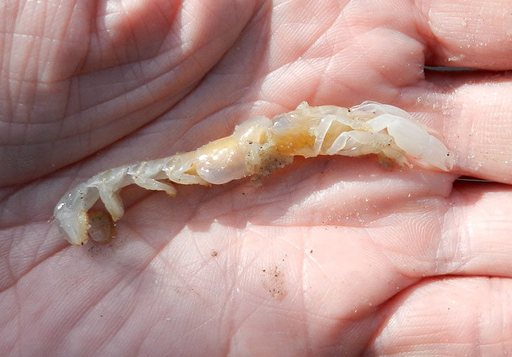
Violá! It was a ghost shrimp! I almost never see these magnificent burrowers alive and outside of their burrows, and just the day before on Cumberland Island, the students had just learned about their prodigious burrowing abilities (the ghost shrimp, that is, not the students). I had also never before seen a ghost shrimp trackway, let alone one connected to a shallow tunnel on a beach. An epic win for ichnology!

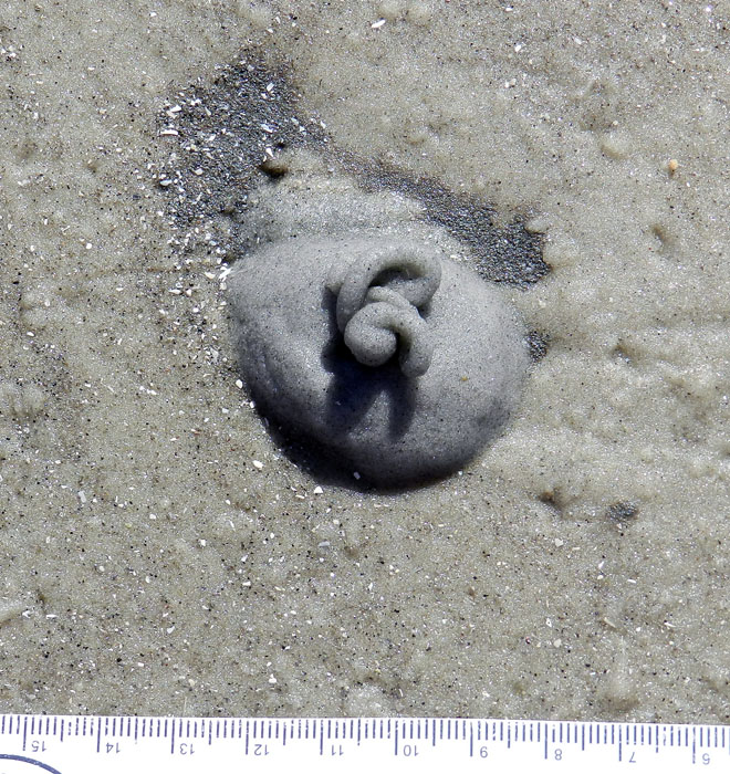
This may look like soft-serve ice cream, but I suspect that it’s not nearly as tasty. It’s the fecal casting of an acorn worm (Balanoglossus sp.), and is composed mostly of quartz sand, but still. These piles were common on the same beach at the north end of Jekyll, but apparently absent from the south-end beach. Why? I’m guessing there was more food (organics) provided by a nearby tidal creek at the north end. But I’d appreciate all of those experts on acorn worms out there to augment or modify that hypothesis.

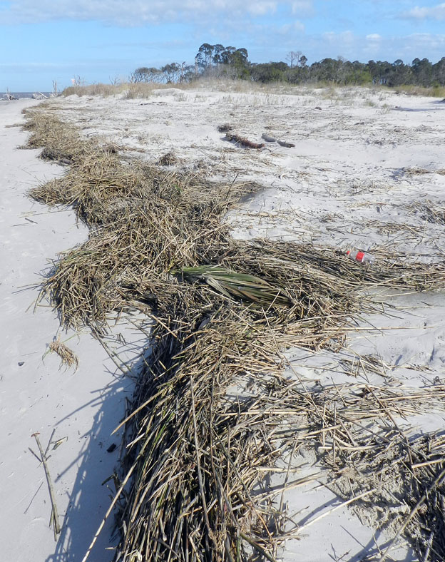
This is how dunes normally form on Georgia barrier-island beaches: start with a rackline of dead smooth cordgrass (Spartina alterniflora), then windblown sand begins to accumulate in, on, and around these. Throw in a few windblown seeds of sea oats and a few other dune-loving species of plants, and next thing you know, you got dunes. Dude.

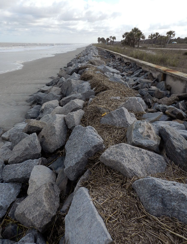
In contrast, here is how not to form dunes on Georgia barrier-islands beaches. Build a concrete seawall on the middle part of the island, truck in thousands of tons of metamorphic rock from the Piedmont province of Georgia, place the rocks in front of the seawall, and watch the beach shrink. So sad to see all of that dune-building smooth cordgrass going to waste. Anyway, the contrast and comparison you just saw is also what my students experienced by standing in both places the same day.

Jekyll Island gave us many lessons, but we only had a day there. Which islands were next? St. Simons and Little St. Simons, with emphasis on the latter. So look for those photos in a couple of days, in between new exploits and learning opportunities.


Different Coastlines, Same Traces, and Time

This past week, I visited North Carolina for varied reasons, but all related to paleontology and geology. First, I gave a well-attended evening lecture about polar dinosaurs, graciously invited and hosted by the Department of Geography and Geology at the University of North Carolina-Wilmington (UNCW). Later in the week, I presented a poster at the Society of Vertebrate Paleontology (SVP) meeting in Raleigh (covered last week here), while also taking in a couple of days of talks, posters, and enjoyably catching up with paleo-friends while meeting neo-friends. Regrettably, I had to leave the meeting early, but with good reason, which was for a field trip to look at fossils in a Pleistocene outcrop near Wilmington with faculty and students from UNCW. Overall, it was a fulfilling week, teeming with paleontological and social variety.

This pithy summary, though, omits lots of details (and if it didn’t, then it wouldn’t be pithy). But one item worth explaining a bit more here was a brief trip to Wrightsville Beach, which is a barrier island was just east of Wilmington. Dr. Doug Gamble, a geography professor in the UNCW Department of Geography and Geology, offered to take me there just before my talk, which I eagerly accepted. Considering all of the field work I had done on the Georgia barrier islands to the south of there, and that I would be teaching a course on barrier islands next semester, going to this beach was an opportunity to learn more about the similarities and differences between Georgia and North Carolina beaches.

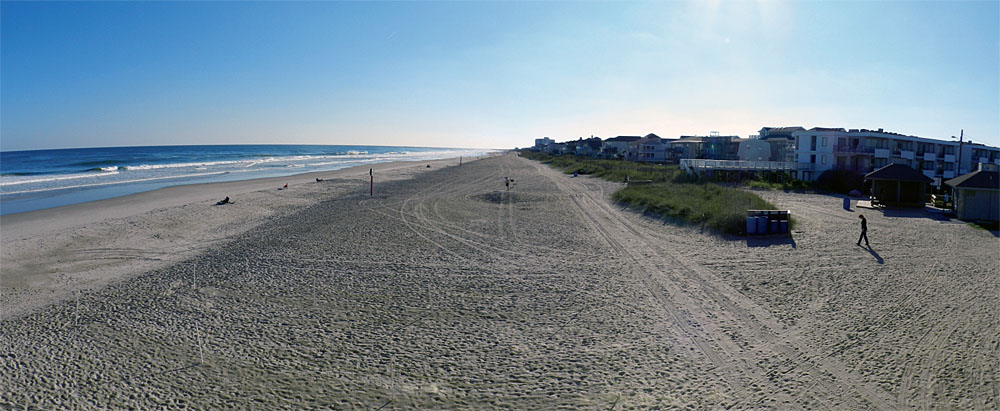
Panorama of Wrightsville Beach on the coast of North Carolina, replete with human locomotion traces and dwelling structures. These features make it very different from most beaches in Georgia. But what about other traces? Don’t you just love rhetorical questions? Including this one? (Photograph by Anthony Martin.)

Many North Carolina beaches are famous (or infamous) as examples of what can go wrong with unrestrained development of barrier islands. Many such case studies have been explored through the research, writings, and activism of geologist Dr. Orrin Pilkey of Duke University, as well as other coastal geologists who have looked at the effects of human alterations of these habitats. Wrightsville Beach is such a barrier-island beach, having  been heavily modified by human activities during the past 150 years or so. When comparing it in my mind to the Georgia barrier islands, it most resembled Tybee Island, which is also next to a relatively large city (Savannah), easily accessible by a bridge, and developed as a sort of “vacation destination” for people who like beaches, but also want them to have all of the amenities of the places they left behind. Otherwise, it held little resemblance to the mostly uninhabited and undeveloped beaches I prefer to peruse on the Georgia barrier islands.

After driving over the bridge to the island, we walked onto the beach in several places, and I began looking for traces. At first there was little to see, which was a direct result of there being too much to see. Because it was a pleasant day and we were visiting in the afternoon, much of the beach had been heavily trampled by humans, with more than a few of these people aided in their bioturbation by canine companions. Obvious restructuring of the beach included a jetty at the north end that combined a concrete wall and boulders, and pilings of concrete blocks at the south end. Dunes were modest, low-profile, and capped by sparse stands of sea oats (Uniola paniculata), and behind these were hotels, condominiums, and houses, all chock-a-block. It would be too strong to say this beach was alien to me, let alone post-apocalyptic, but it did seem like an altered reality compared to my experiences in Georgia.

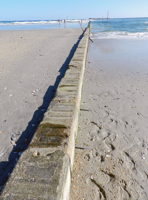
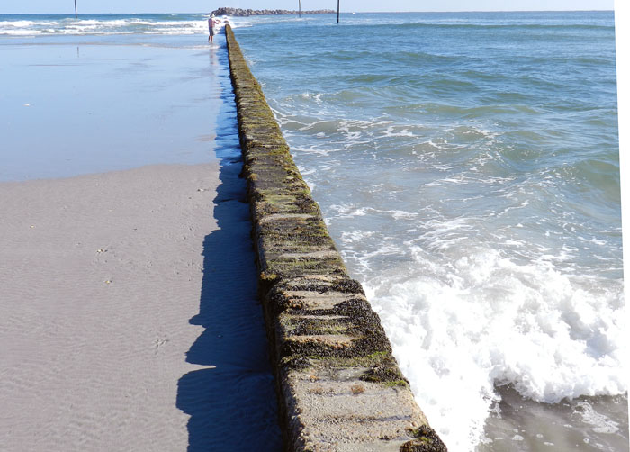
A jetty at Wrightsville Beach (North Carolina) composed of concrete and rocks, intended to preserve sand on the beach, which it is doing here, but also results in an imbalanced distribution of sand along it. Note the abundant human and canine tracks on the right, shouting out any other animal traces that might have been in the sand. (Photograph by Anthony Martin.)
Another view of the jetty at Wrightsville Beach, sharply contrasting sand deposition and erosion on either side of it. (Photograph by Anthony Martin.)

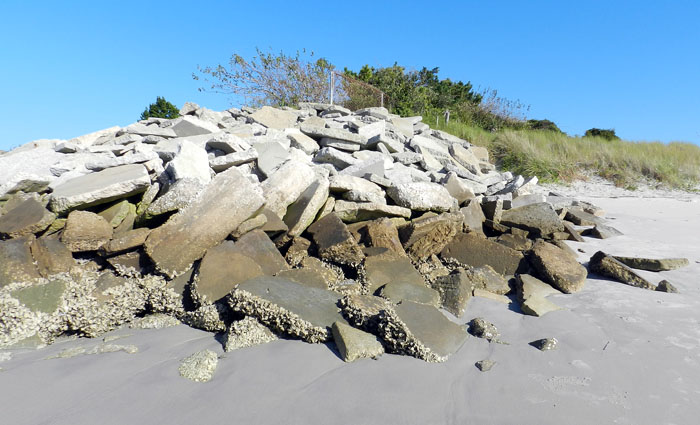
A pile of broken concrete being used as rip-rap at the south end of Wrightsville Beach in an attempt to slow erosion there. Or something. (Photograph by Anthony Martin.)

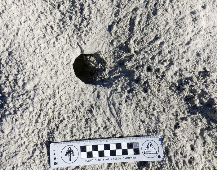
Only with more walking toward the south end of the beach did we see less of an overwhelming human-dog ichnoassemblage and start noticing signs of the native fauna. With this, I became comforted by the familiar. These traces included some I had seen many times on Georgia beaches, including: the soda-straw-like burrows of parchment worms (Onuphis microcephala); the volcano-like sand mounds and chocolate-sprinkle-like feces of callianassid shrimp (either Biffarius biformis and Callichirus major); the soft-serve-ice-cream-like fecal mound of acorn worms (Balanoglossus aurantiactus); and the hole-in-the-ground-like burrows of ghost crabs (Ocypode quadrata). (OK, so I ran out of metaphors.) Seagull tracks abounded as well, lending more of a dinosaurian flavor to the trace assemblage.

Two burrows of parchment worms (Onuphis microcephala) on Wrightsville Beach, exposed by a little bit of erosion, with tiny fecal pellets at their bases. Scale in millimeters. (Photograph by Anthony Martin.)

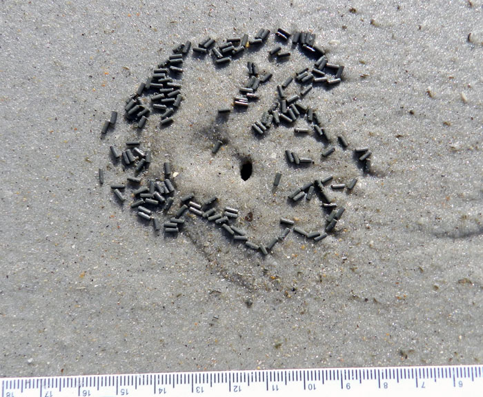
Burrow aperture and fecal pellets of a ghost shrimp (either Biffarius biformis or Callichirus major) on Wrightsville Beach. Scale in millimeters again. (Photograph by Anthony Martin.)

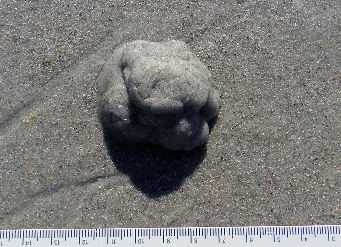
Fecal casting of an acorn worm, and probably that of a golden acorn worm (Balanoglossus aurantiactus) on Wriightsville Beach. One end of its burrow is underneath this pile, and that would be its anal end, which is sensibly located in a different place from its oral end. And I think you know the scale by now. (Photograph by Anthony Martin.)
Ghost crab (Ocypode quadrata) burrow and tracks, out of the intertidal zone and more into the dunes on Wrightsville Beach. (Photograph by Anthony Martin.)

These traces thus showed us that this North Carolina beach, one majorly changed by humankind during the past 150 years, actually was more biodiverse than one might think at first glance. In my mind, then, it became just a bit more wild through these signs of life hinting at what laid beneath our feet.

At this point, I could depress everyone by listing what traces and biota were not there, but that’s not the point, so I won’t. In a more progressive sense, what traces we saw represented traces of hope, of life hanging on despite environmental change, living almost invisibly beneath our feet. So as human development continues on beaches like these, and sea level rises through the rest of this century, I felt assured of their being survivors of this change, and of their traces outlasting our humanity. The trace fossils of the future are now, and recording our effects on the life that makes these traces. How many will wink out with our species, and how many of their marks will outlast us?

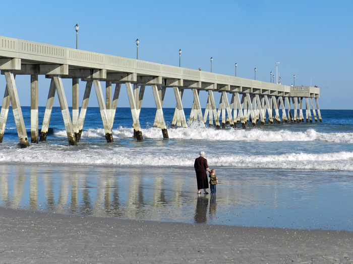
An intergenerational stroll – a grandmother and grandson? – alongside the pier on Wrightsville Beach in North Carolina. Did she have memories of this beach in her childhood? How do these compare to what she sees there now? What memories will this child have of it in the future, especially as the sea continues to rise? If these memories are not recorded, what will be left behind? (Photograph by Anthony Martin.)

Further Reading

Pilkey, O., and Fraser, M.E. 2005. A Celebration of the World’s Barrier Islands. Columbia University Press, New York: 309 p.

Thieler, E.R., Pilkey, O., Cleary, W.J., and Schwab, W.C. 2001. Modern sedimentation on the shoreface and inner continental shelf at Wrightsville Beach, North Carolina, U.S.A. Journal of Sedimentary Research, 71: 958-970.

Tracking the Wild Horses of Cumberland Island

(The following post is one of a series about traces of important invasive species of mammals on the Georgia barrier islands and the ecological effects of these traces. An introduction to this topic from last week is here.)

Perhaps the most charismatic yet problematic of non-native animals on any of the Georgia barrier islands are the wild horses (Equus caballus) of Cumberland Island. These horses are the source of much controversy, which becomes even more apparent whenever anyone tries to apply some actual science to them. So I will talk about them here from my perspective as a paleontologist and geologist in the hope that this will add another dimension to what is often presented as a two-sided and emotional argument.
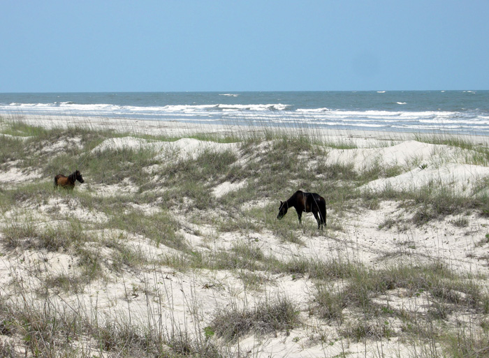
Ah, the wild horses of Cumberland Island, Georgia, roaming free since the time of the Spanish in a pristine, unspoiled landscape, grazing contently on the sea oats and strolling through the coastal dunes, in perfect harmony with nature. How much of the preceding sentence is wrong? Almost all of it. If you want to find out why, please read on. But if your mind is already made up about the feral horses of Cumberland and you don’t want to hear anything bad said about them, then you might like this site. (Photograph by Anthony Martin.)

Cumberland Island, much of which is part of the U.S. National Park system as a National Seashore, is the only Georgia barrier island with a population of feral horses. Nevertheless, despite their uniqueness and fame – the latter figuring as key attractions in advertisements about Cumberland and inspiring dreamy book titles – their origins remain murky. One of the recurring romanticized claims is that these horses descended from livestock brought there by Spanish expeditions in the 16th century. This idea is reassuring to the people who repeat it for two reasons:

(1) It establishes horses as living in the landscape for a long time (especially by American standards), meaning that their presence there now is considered “natural.”

(2) It lends itself to the comforting thought that the horses connect to a European cultural heritage, putting an Old World imprint on a New World place.

However, once said enough times, such just-so stories become faith-based and any evidence contradicting them is not tolerated. Thus even when genetic studies of the Cumberland horses show they are not appreciably different from populations of horses on other islands of the eastern U.S. (arguing against a purely Spanish origin), any questioning of the stated premise – in my experience – provokes angry responses from its defenders.

I suspect this virulent reaction is a direct result of challenging both the “naturalness” and “cultural heritage” of the horses on Cumberland. In reality, though, these are opposing values. After all, an admission that these feral horses came from European stock at any point during the past 500 years supports how they clearly do not belong on Cumberland Island, or anywhere else in the Western Hemisphere if we’re talking about the last 10,000 years or so. In other words, the point is moot whether the current horse population originated in the 16th, 17th, 18th, 19th, or 20th century, or is a mixture of older and newer stock. If only horses could talk, then we would know for sure. (A detailed history of the horses on Cumberland Island is provided here for anyone interested in learning more about this.)

Arguments of heritage aside, these horses are newcomers in a geological and ecological sense. The fossil record of the modern Georgia barrier islands backs this up, as some of the islands (including Cumberland) have sediments more than 40,000 years old, but none have body or trace fossils of horses, or anything like a horse. Although three species of horses were living on the mainland part of North America during the Pleistocene Epoch until their respective extinctions more than 10,000 years ago, none were known to have inhabited any of the barrier islands, Pleistocene or recent. The closest ancient analogue to horses on any of the Georgia barrier islands would have been bison (Bison bison), but their bones are rare. This scarcity leads paleontologists to wonder whether the islands ever had self-sustaining populations of large herbivores.

So with all of that human history and pre-history in mind, the traces made by the feral horses of Cumberland and their ecological effects are exceptional to it and every other Georgia barrier island, and hence worth our attention. Just to keep this simple, I will cover three primary types of traces made by these horses. What these traces all have in common (other than being made by a horse, of course) is the decidedly negative impacts these have on the native plants and animals of Cumberland, including keystone species in the oft-labeled “pristine” ecosystems of the island.

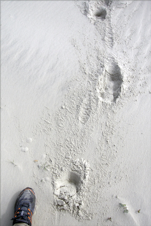
Tracks and trails – These traces are the abundant and easily spotted on Cumberland, even to someone with little or no training in ichnology. Horses are unguligrade, which means they are walking on their toenails (unguals), and the ungual (more popularly called a hoof) is on a single digit. Hooves make circular to slightly oval compression shapes, but if preserved in the right substrate – like a firm mud or fine sand – they will show a “Pac-Man”-like form. Front-foot (manus) tracks are slightly larger than rear-foot (pes) tracks; manus impressions are 11-14 cm (4.3-5.5 in) long and 10-13 cm (4-5.1 in) wide, whereas pes impressions are 11-13 cm (4.3-5.1 in) long and 9-12 cm (3.5-4.7 in) wide, with variations in size depending on ages of the horses making the tracks.

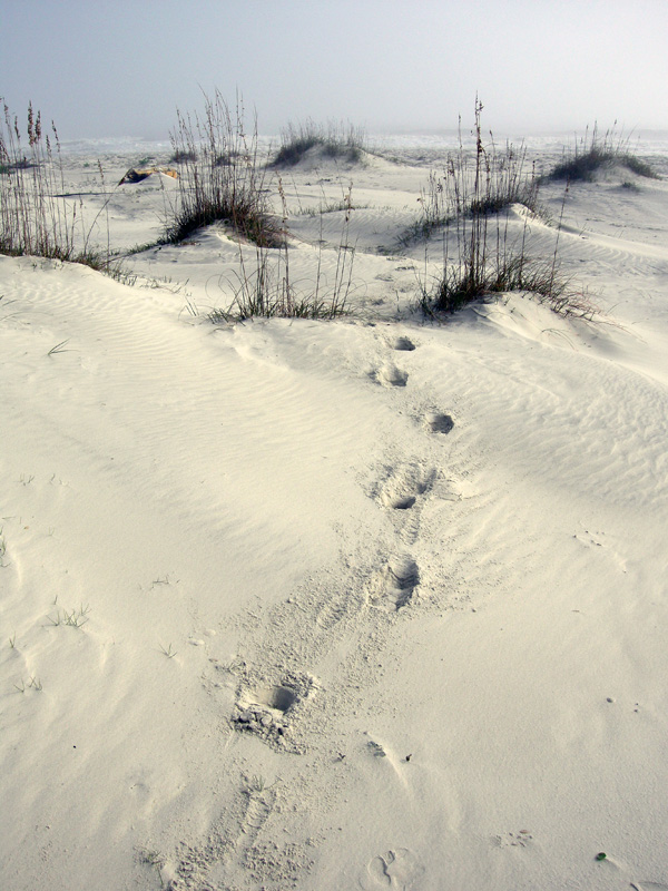
Trackway of feral horse moving through the coastal dunes of Cumberland Island. Note the diagonal walking pattern and how front- and rear-foot impressions merge to make oblong compound traces.

An important point to keep in mind when tracking horses or any other hoofed animals is that their feet readily cut through sediments and vegetation, leaving much more sharply defined and deeper impressions than padded feet of an equivalent-sized animal. Because Georgia-coast sands contain whitish quartz and darker heavy minerals, these contrasting sand colors help to outline horse tracks on surfaces and in cross-section as deep and sharply defined structures that cut across the bedding.

When asked to think about horses in motion, it might be tempting to imagine them galloping, especially along a beach at sunset. Nonetheless, a horse would tire quickly if it galloped all day, especially for no valid reason. Instead, its normal gait is a slow walk, which causes the rear foot to register partially on top of the front-foot impression, but slightly behind; with a slightly faster walk, the rear foot will exceed the front-foot impression. The overall trackway pattern then is what many trackers call “diagonal-walking,” as the right-left-right alternation of steps can be linked with imaginary diagonal lines. Trackway width, also known as straddle, is about 20-40 cm (8-16 in) if a horse was just walking normally, but narrows noticeably once it starts picking up speed.

Feral-horse tracks on Cumberland Island, a close-up of the same trackway shown in the previous photo. This one was likely doing a slow walk, with indirect register of the rear foot just behind and onto the front-foot impression. The scale (my shoe) is a size 8½ mens. (Photograph by Anthony Martin.)

Given enough back-and-forth movement along preferred paths, repeating and overlapping trackways result in trails, which can be picked out as linear bare patches of exposed sand or mud cutting through vegetation. Because horses are much larger than the native white-tailed deer (Odocoileus virginianus) on Cumberland, their trails are considerably wider.

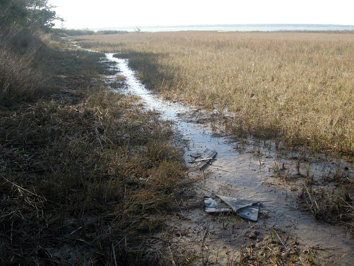
Feral-horse trail along the edge of a low salt marsh where they have trampled and overgrazed the smooth cordgrass in that marsh (Spartina alterniflora). (Photograph by Anthony Martin, taken on Cumberland Island.)

Chew marks – Horses are grazers and low-level browsers, and they eat a wide variety of vegetation on Cumberland. The most important plant species they eat through grazing are smooth cordgrass (Spartina alterniflora), sea oats (Uniola paniculata), and live oak (Quercus virginiana).  All three of these plants are keystone species in their respective ecosystems: smooth cordgrass predominates in the low salt marshes, sea oats are the mainstay plants of coastal dunes, and live oaks are the largest and most long-lived trees in the maritime forests. Their effects of horses consuming  smooth cordgrass and sea oats is straightforward, as these plants hold in sediments in place keep them from eroding, but how do horses affect live oaks? They eat the seedlings, which means that older oaks are being replaced by younger ones at a slower rate.

Grazing traces consist of clean cuts of vegetation within a vertical swath and over a broad area. Horses, unlike white-tailed deer, have teeth on both their upper and lower jaws, thus they shear plants on the branches, stems, or leaves. In contrast, deer leave more ragged marks, as they only have teeth on their lower jaws and hence have to pull on vegetation to break it off. Horses also can make a browse line, which is an abrupt horizontal line of decreased vegetation at a certain consistent height that more-or-less correlates with the average head height of the horses.

Dung – During any given stroll on Cumberland, you cannot avoid seeing, smelling, and stepping in horse feces. This abundance of fecal material means that the feces are not being recycled quickly enough into the ecosystems, which implies that native populations of dung beetles are overwhelmed by such abundance. I have seen a few traces of dung beetles in fresh piles of feces, but no matter how hard I have looked, I have yet to witness great thundering herds of beetles rolling balls of dung across the Cumberland Island landscape.

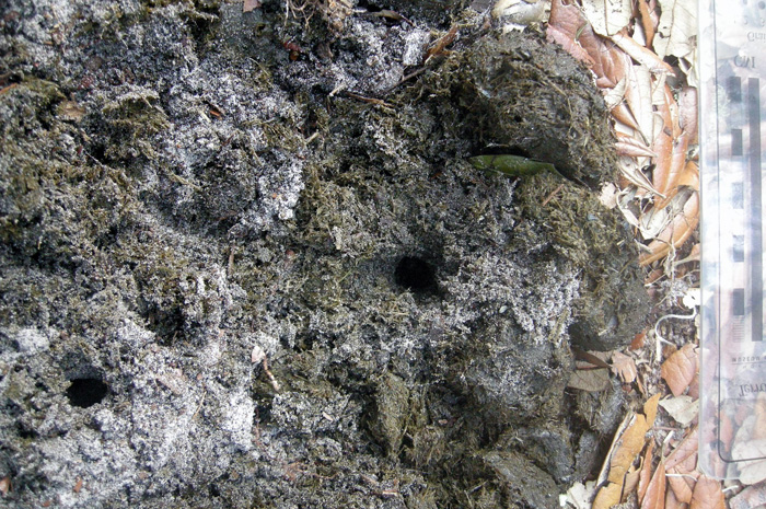
An impressive collection of horse dung, which was probably dropped by a single horse. Note the small holes in the middle, which were likely made by dung beetles that tunneled into this rich supply of food for their offspring.

Close-up of those probable dung-beetle burrows, some with short trails attached. The white quartz sand sprinkled on top shows how it was pulled up by beetles from underneath the dung pile and onto the top surface, thus giving a minimum depth of the burrows. (Both photographs by Anthony Martin, taken on Cumberland Island.)

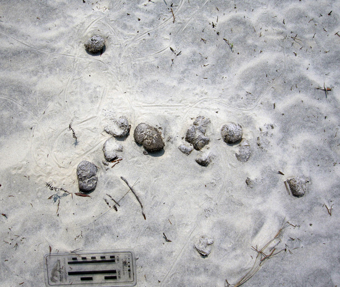
One of the more interesting ecological consequences of horse dung I have seen on Cumberland is how it influences the behavior of smaller animals as pellets or piles form a microtopography. For example, on some of the dunes near Lake Whitney on Cumberland – the largest body of fresh water on any of the Georgia barrier islands – I was surprised to see that small lizards – probably skinks – were moving around the dung piles or burrowing under them.

Horse droppings as a part of the landscape for small lizards. Here their tracks, accompanied by tail dragmarks, wind around partially buried feces in a sand dune. (Photograph by Anthony Martin, taken on Cumberland Island.)

Small lizard burrow entrance immediately below a horse pellet, showing its use as a sort of roof. This could probably inspire some clever statement on shingles and, well, you know, but I’ll refrain for now. (Photograph by Anthony Martin, taken on Cumberland Island.)

All three categories of traces – tracks, chew marks, and dung – can be found together in ecosystems wherever horses are trampling, grazing, and defecating, respectively.

So now let’s put on our paleontologist or geologist hats (not to be confused with archaeologist hats) and ask ourselves about the likelihood of such traces making it into the fossil record, and how we would recognize them if they did. Their likelihood of preservation, in order, would be tracks, feces, and chew marks. Tracks would be evident as large compression shapes in horizontal bedding planes or deep disruptions of bedding planes in vertical section. Feces, or their fossil versions called coprolites, might get preserved, although herbivore feces, filled with vegetative material, is less likely to make it into the fossil record compared to carnivore feces, which may have lots of bone material in it. The last of these – chew marks – would be nearly impossible to tell from normal tearing and other degradation of plant material before it became fossilized. Good luck on that.

But could the ecological damage caused by an invasive species, in which the introduction of a species serve as a sort of trace fossil in itself? In the case of horses or ecologically similar animals, subtle changes to the landscape over time might take place. This experiment actually has been done on Assateauge Island (North Carolina), which also has a feral horse population. In areas where horses were excluded by fences, the dunes were on average 0.6 meters (2 ft) feet higher than those of overgrazed and trampled dunes. Geologists conducted another study done on Shackleford Banks (North Carolina) in which they examined areas where fences had separated non-horse from horse-occupied parts of the island. These geologists similarly found that horses caused dunes to be less than 1.5 m (5 ft) high, whereas dunes without horses were as much as 3.5 m (11.5 ft) high. This meant that storms more easily penetrated the barriers provided by coastal dunes, more commonly resulting in storm-washover fans.

This change in the coastal geology of back-dune areas also means that ground-nesting shorebirds will become less common, as their nests and nestlings will be drowned or buried more frequently. Horses also are known to step on shorebird eggs and nests, or can scare away parents from nests, which increases the likelihood of egg or nest predators taking out the next generation of shorebirds.

If any horses made it to the Georgia barrier islands during the Pleistocene and established breeding populations, a geologic sequence following their arrival would look like this, from bottom to top: high dunes suffused with root traces (before horses); lower dunes corresponding with fewer root traces and deep disruptions of bedding (horse tracks); increased numbers of storm-washover fans; and a high salt-marsh. In short, a geologist would see an overall progression from a dune-dominated shoreline to a high salt marsh. Similarly, a paleontologist might see a decrease in root trace fossils and shorebird nests, eggshells, and tracks, possibly culminating in local extinctions of each.

This is your Georgia coast.

This is your Georgia coast with horses. Any questions?

Top panorama is of high-amplitude coastal dunes and well-vegetated back-dune meadows on Sapelo Island, whereas the bottom panorama is of low-amplitude dunes with no appreciable back-dune meadows on Cumberland Island. (Both panoramas based on photos taken by Anthony Martin.)

Based on what we know then, should the feral horses of Cumberland Island be removed? Yes. Will they be removed? Probably not. However, regardless of happens, I will keep teaching about the horses of Cumberland Island and their traces, both as an educator and a concerned citizen. Perhaps with enough awareness, circumstances will change for the better so that Cumberland Island can not only remain a beautiful place, but also will become more like what it was before the arrival of horses there.

(Next week in this series about invasive mammal species of the Georgia barrier islands and their traces, I’ll cover a less inflammatory but still intriguing topic: the feral cattle of Sapleo Island.)

Further Reading

Buynevich, I.V., Darrow, J.S., Grimes, T.A.Z., Seminack, C.T., and Griffis, N. 2011. Ungulate tracks in coastal sands: recognition and sedimentological significance. Journal of Coastal Research, Special Issue 64: 334-338.

De Stoppalaire, G.H., Gillespie, T.W., Brock, J.C., and Tobin, G.A. 2004. Use of remote sensing techniques to determine the effects of grazing on vegetation cover and dune elevation at Assateague Island National Seashore: impact of horses. Environmental Management, 34: 642-649.

Dilsaver, L.M. 2004. Cumberland Island National Seashore: A History of Conservation Conflict. University of Virginia Press, Charlottesville, Virginia: 304 p.

Elbroch, M. 2003. Mammal Tracks and Sign: A Guide to North American Species. Stackpole Books, Mechanicsburg, Pennsylvania: 779 p.

Goodloe, R.B., Warren, R.J., Osborn, D.A., and Hall, C. 2000. Population characteristics of feral horses on Cumberland Island and their management implications. The Journal of Wildlife Management, 64: 114-121.

Sabine, J.B., Schweitzer, S.H., and Meyers, J.M. 2006. Nest Fate and Productivity of American Oystercatchers, Cumberland Island National Seashore, Georgia. Waterbirds, 29: 308-314.

Turner, M.G. 1987. Effects of grazing by feral horses, clipping, trampling, and burning on a Georgia salt marsh. Estuaries and Coasts, 10: 54-60.

Turner, M.G. 1988. Simulation and management implications of feral horse grazing on Cumberland Island, Georgia. Journal of Range Management, 41: 441-447.