Ballast of the Past

While strolling through the beautiful and historic city of Savannah, Georgia last week, I made sure to pay attention to the thousands of time machines below my feet. Yes, I know, everyone other than geologists stubbornly refer to these objects as “rocks.” Fortunately, though, we earth scientists don’t have to limit our imaginations by using such simplistic labels. These pieces of a pre-human past all have stories to tell of their origin, and sometimes they even connect to our treatment of one another as human beings.
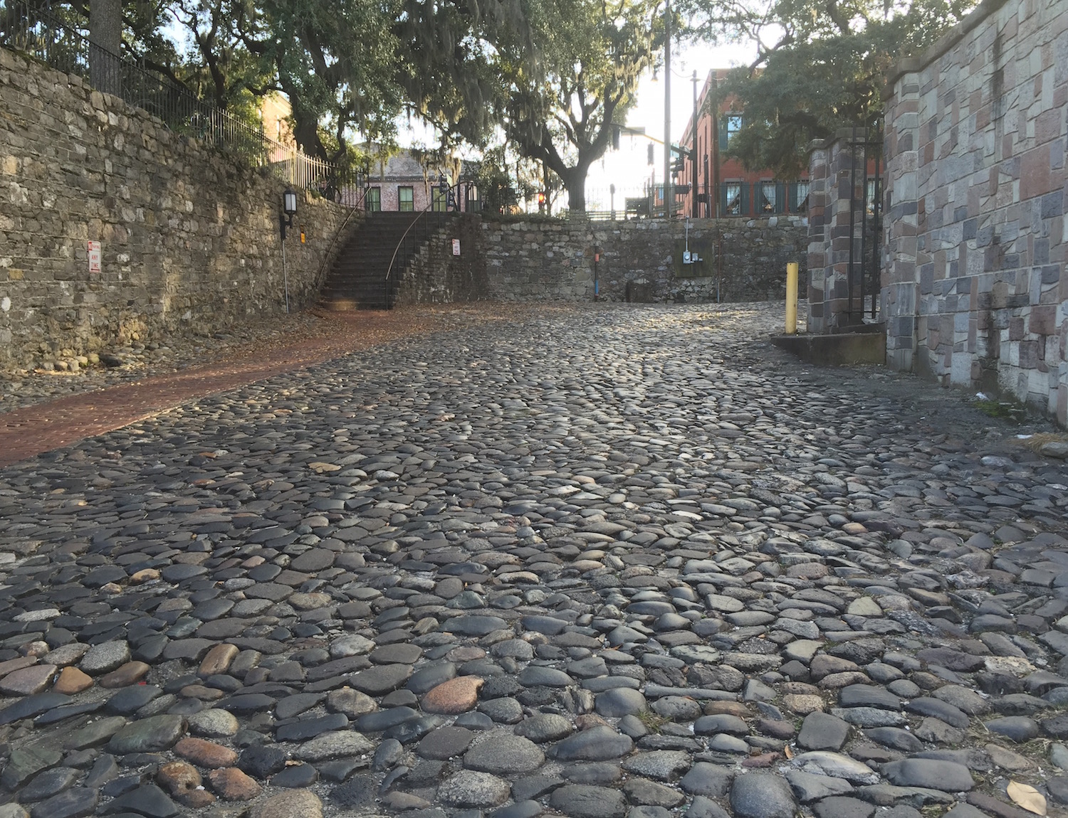
Ballast-Stones-Street-Wall-SavannahA street on the north edge of Savannah, Georgia leading down to the Savannah River, composed of rocks from afar. How did these rocks get there, and what stories do they tell us about themselves and us? (Photo by Anthony Martin.)

Temporal considerations aside, the rocks of Savannah don’t really belong there. This is especially true for those on the north end of town cobbling the roads and reinforcing walls next to the Savannah River. A quick glance at these stones by the geologically informed reveals how these are all foreign to this part of Georgia. Sure enough, most are from across the Atlantic Ocean, with the majority probably originating in the British Isles. Yet they also have been part of Savannah history for at least a few hundred years. What are they, how did they get there, and why are they there?
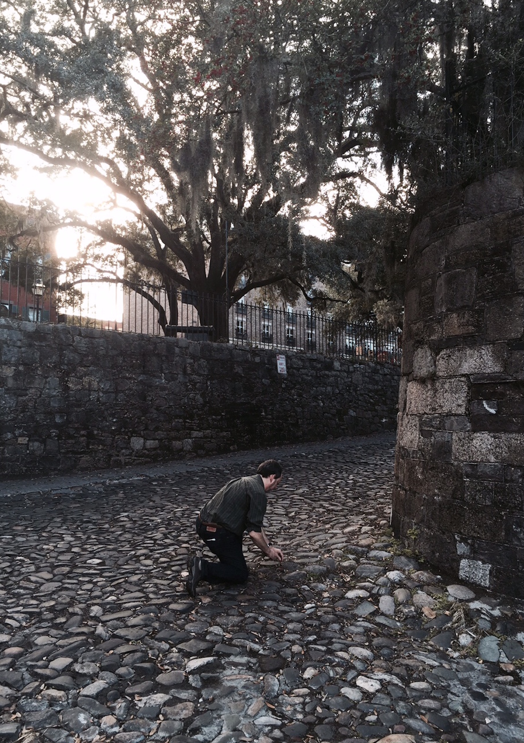
Studying-Ballast-Stones-SavannahA fine example of how rocks and a geologist (me, in this instance) get along just fine, especially when that geologist kneels in their presence. Note also the stone walls on either side of the street, which also figure into the origin story of these stones. (Photo by Ruth Schowalter.)

These are ballast stones, which filled the holds of ships during the 18th and 19th centuries as they sailed across the Atlantic Ocean from England. Were these ships exporting rocks to eager colonists who wished to collect nostalgic (and solid) reminders of their former homelands? No, ballast stones were used to keep ships weighted down, which helped to stabilize them as they moved across seas both calm and rough.

Once a ship reached Savannah – which began as a British settlement in 1733 – its crew would dump its rocky cargo and replace its relatively uneconomic value with goods grown in Georgia, such as rice, cotton, and indigo. Those economic commodities then went across the ocean, where they were used for food (rice) or textiles (cotton and indigo). Meanwhile, the ballast stones were repurposed as durable materials for the streets, walls, and houses along the Savannah River, as well as in some of the older homes in the historic district of Savannah.

The rocks on the streets and in the walls of Savannah are amazingly varied, reflecting the geological diversity of the United Kingdom and perhaps other places. (Admittedly, I haven’t done an exhaustive literature search on this topic yet: This is only a blog post, y’all.) Igneous, metamorphic, and sedimentary rocks are all represented, but perhaps the most common type I saw was basalt, which is a black, fine-grained extrusive (volcanic) igneous rock.
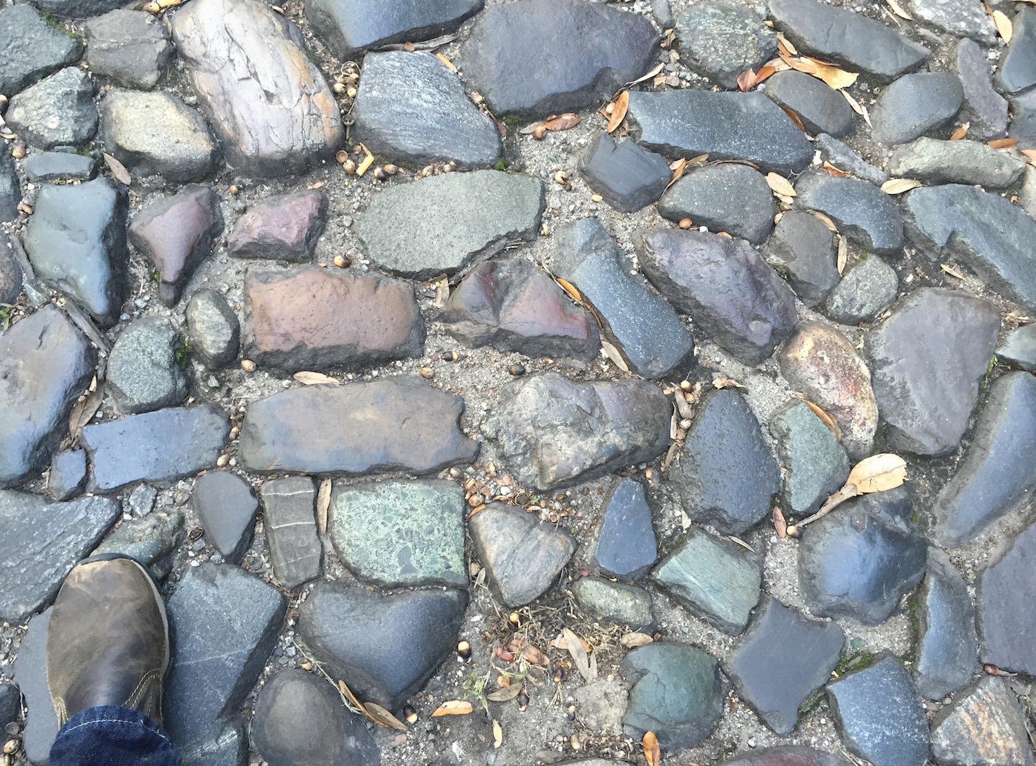
Ballast-Stones-Savannah-Close-UpA nice sample of the geologically diverse rocks composing a street in downtown Savannah, Georgia. Geologists glancing at this photo will no doubt spot representatives of the Holy Trinity of Lithology in this assemblage: Igneous, Metamorphic, and Sedimentary. Amen! (Scale = size 8 1/2 shoe (mens); photo by Anthony Martin.)
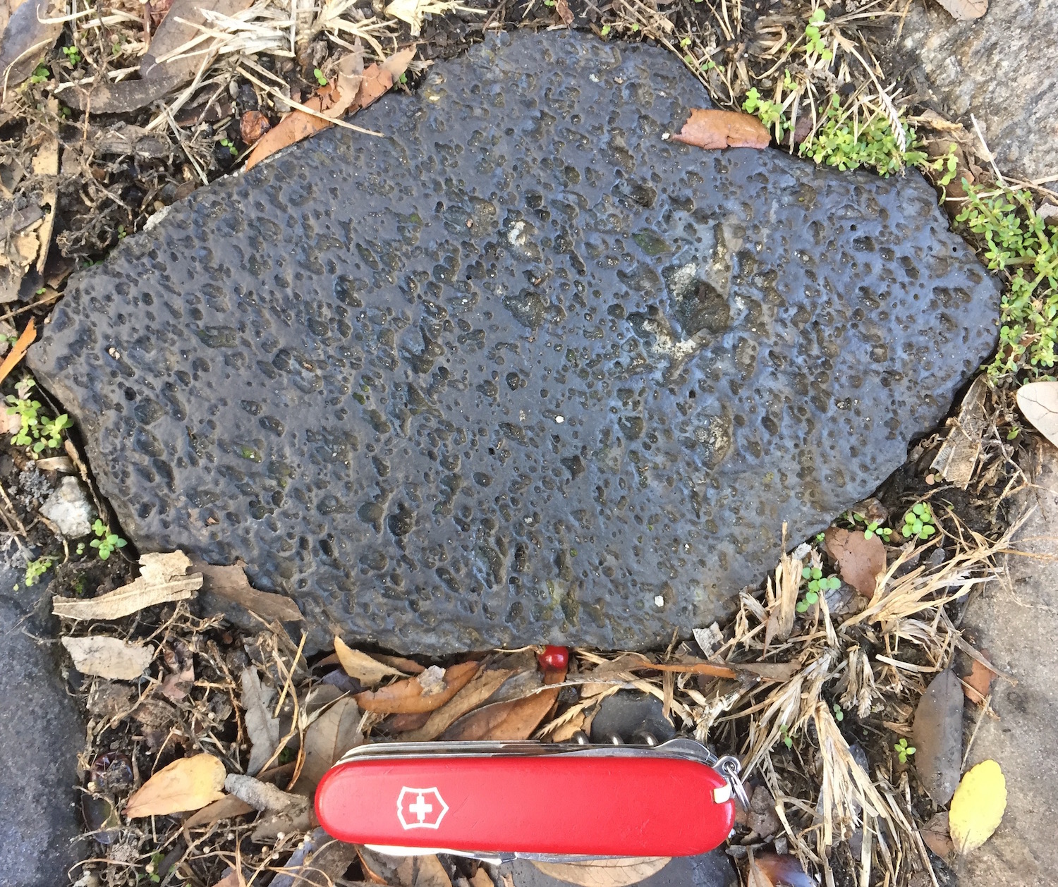
Ballast-Stone-Basalt-SavannahA good example of vesicular basalt, an igneous extrusive (volcanic) rock that formed from hot magma that cooled at or near the surface of the earth, and nowhere near present-day Savannah. The “vesicular” part of its name is from vesicles formed by gases in the magma, evidenced by those little holes in the rock. (Photo by Anthony Martin.)

However, I also saw intrusive (plutonic) igneous rocks, at least one of which was intruded by basalt, defined by a clean, black band cutting across the older rock. Sedimentary rocks included sandstones, some of which were placed parallel to their original bedding, fitting like bricks in some of the walls above the street.
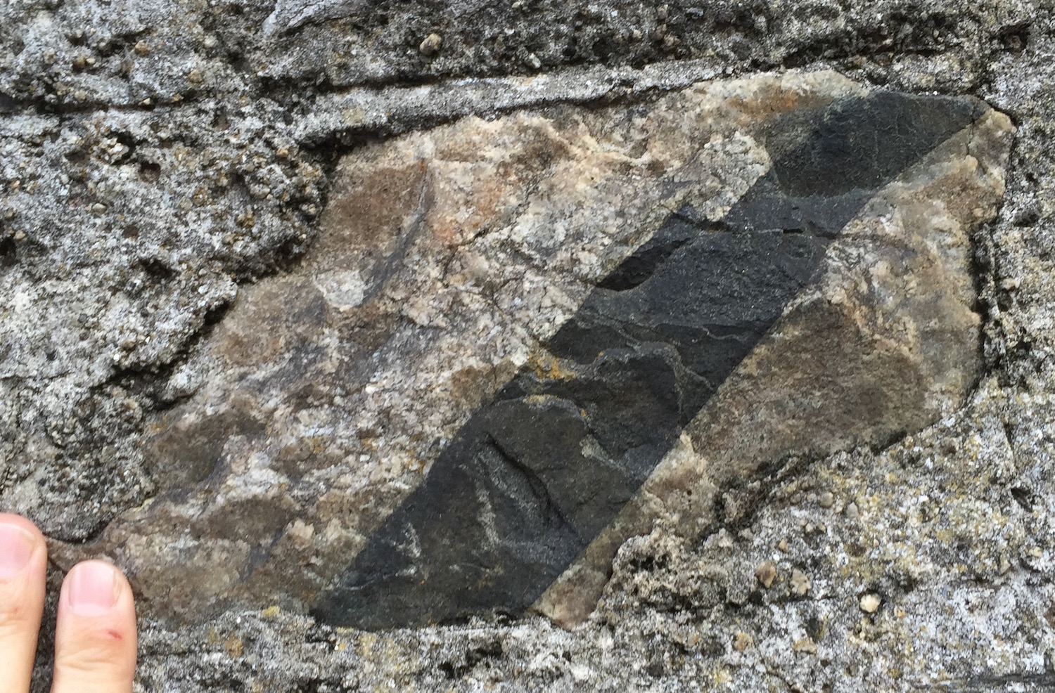
Ballast-Stone-Basalt-Crosscutting-Intrusive-SavannahForget paper and scissors: This time, rock cuts rock. The black band is a basalt dike, which is cutting across the coarser-grained igneous rock, which may be a pegmatitic granite. Based on the simple principle of cross-cutting relations, the basalt is geologically younger than the pegmatite. (Photo by Anthony Martin.)
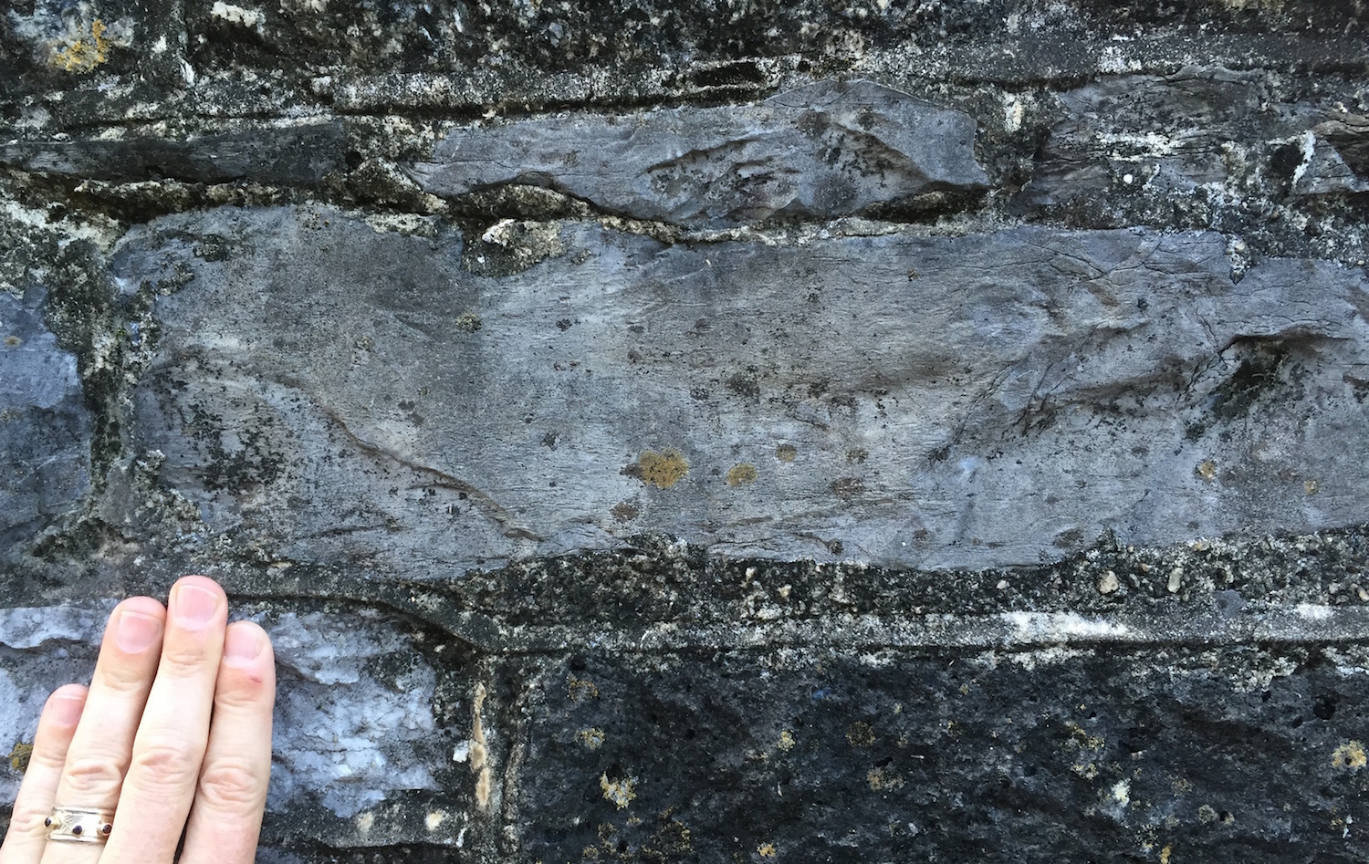
Ballast-Stone-Sandstone-SavannahAs a sedimentary geologist, I’m always happy to see a sedimentary rock, and this one was no exception. This sandstone had some low-angle cross-bedding, which was likely made by the sorting of sand, moved and deposited by water millions of years ago. (Photo by Anthony Martin.)

At least a few sedimentary rocks even contained fossils, such as a limestone with gorgeous length-wise and cross-sections of crinoid stems. This one was probably from the Carboniferous Period, from more than 300 million years ago. It was next to another limestone containing what looked to me like cyanobacterial or algal structures, called oncolites. Such rocks were common earlier in the Paleozoic Era, say, 450-500 million years ago.
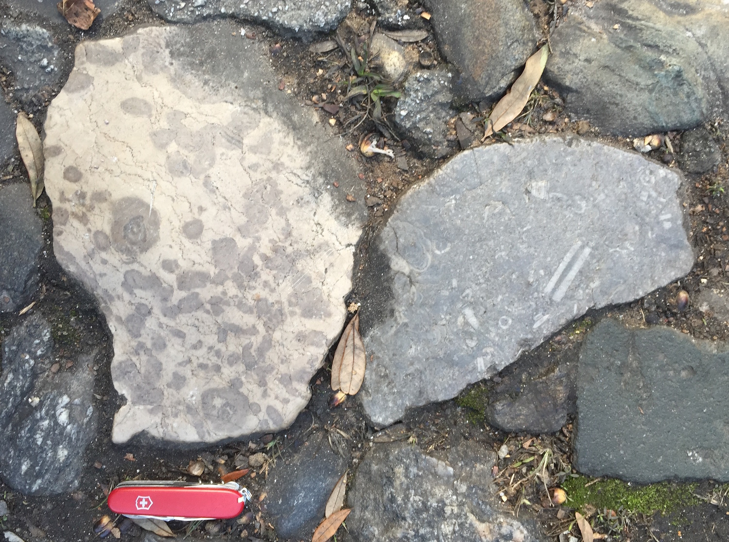
Ballast-Stones-LimestonesLimestones from another land, but now paving a street in Savannah, Georgia. The one on the left bears what I think are algal structures called oncolites, and the one on the right has nicely preserved crinoid parts. Where are they from, and what are their geological ages? I can only answer “Great Britain” for the former, and “Paleozoic” for the latter. But I suspect the oncolititic limestone is older (Cambrian) than the crinoidal limestone (Carboniferous). At any rate, these rocks are not from the Savannah area, which is composed of sands and muds from much more recent rivers and tides.
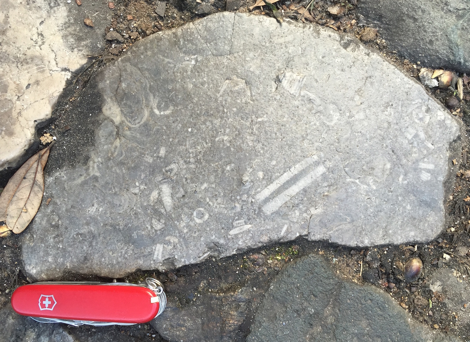
Ballast-Crinoidal-LimestoneA close-up of that crinoidal limestone, with the length-wise section of a crinoid stem (center bottom) and cross-sections of their columnals throughout. (Photo by Anthony Martin.)

So like most normal people, you are probably wondering how these ballast stones relate to ichnology. For instance, do any of the sedimentary rocks contain trace fossils? Maybe, although I didn’t see any really convincing ones. Only one rock of the many I examined had some possible vertical burrows, exposed as holes in a sandstone cobble.
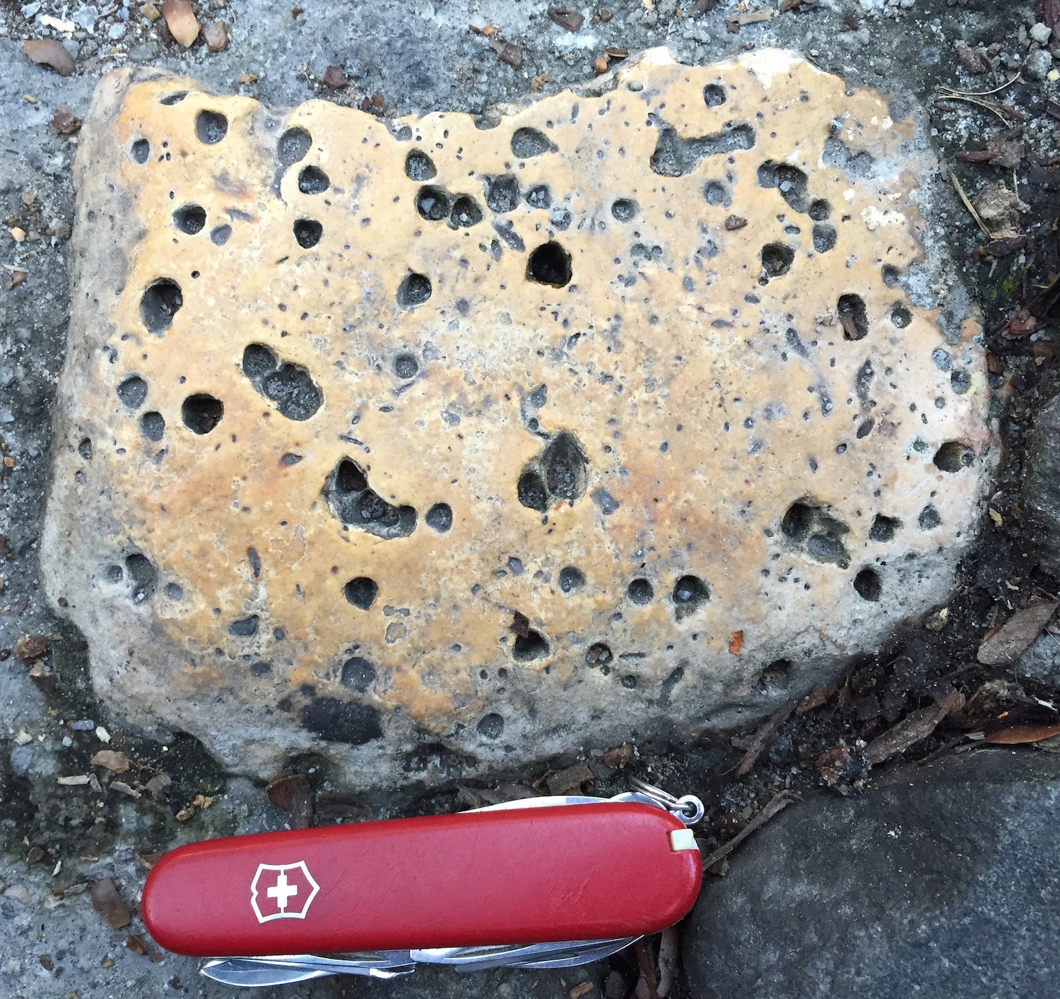
Ballast-Stone-Trace-Fossils-SavannahA sandstone with some good candidates for trace fossils, in which the holes may be cross-sections of vertical burrows. It may even have a U-shaped burrow, which looks like a little dumbbell when viewed from above (upper right). Sadly, out of all the rocks I saw on the street, I didn’t see any others like this, so I wasn’t able to test my hypothesis any further. (Photo by Anthony Martin.)

But there is another trace here, one much larger and more conceptual than what can be discovered in a single stone. Think of how these ballast stones collectively represent a human trace, tangible evidence of a grand transference of geological heritage from one continent to another.

From more of a moral perspective, however, these ballast stones are also a trace of slavery. The labor of enslaved people – abducted from their homes in western Africa and, like ballast stones, packed into cargo holds on ships and taken to a foreign land – produced the agricultural goods that went back in ships to Europe.

Although slavery was at first banned from Savannah, it was allowed soon after its founding (starting in 1750) and continued after American independence in the latter part of the 18th century. Savannah one of the most productive ports in the world for the shipping of rice and cotton during the antebellum times in the 19th century, and the heinous exploitation of human lives continuing until the advent of the American Civil War in the mid-1860s. This meant more ships arriving over the years, still bringing their ballast stones, and taking back cotton, rice, and other fruits of this cruel labor. Meanwhile, slave labor was also used to construct many of the streets, walls, and homes in Savannah composed of ballast stones.
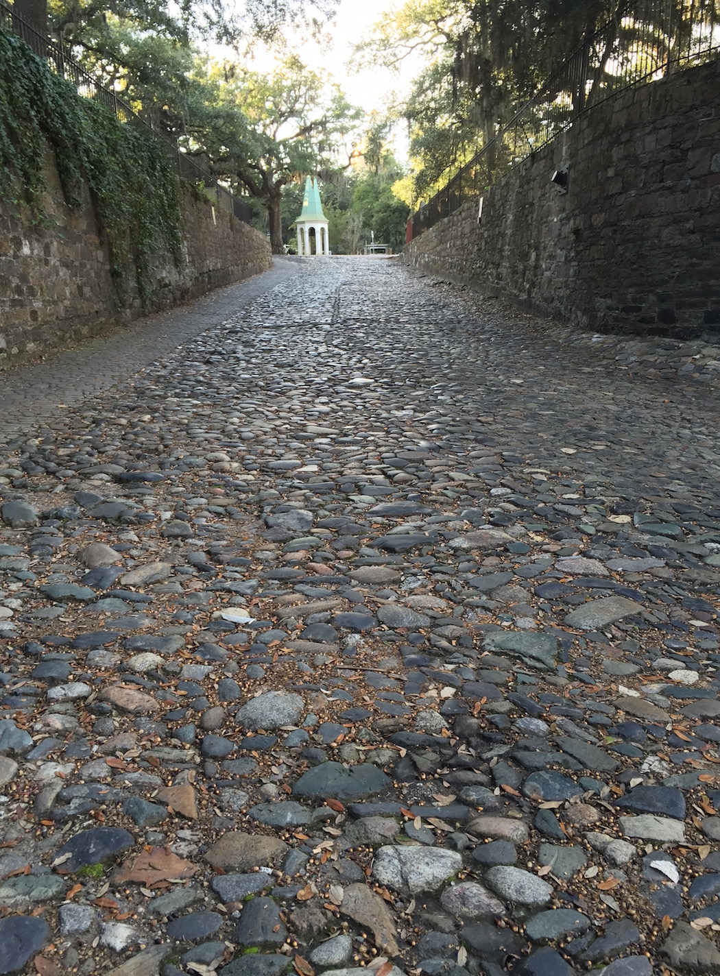
Ballast-Stones-Street-Walls-Savannah-2A Savannah street and walls, built with rocks from another land, and by people from another land, some of whom did not have a choice in building them.

So there would be far fewer ballast stones on the streets and in the walls of Savannah if not for this brutal part of English and American history. The legacy of these stones also links to the family lineages of millions of African Americans, whether they live in Savannah, other parts of Georgia, the U.S., or abroad. As we walk on these rocks in the streets of Savannah, I am mindful of how their physical weight later became an emotional one, one still carried by many of us as we view and walk on these traces of that past.
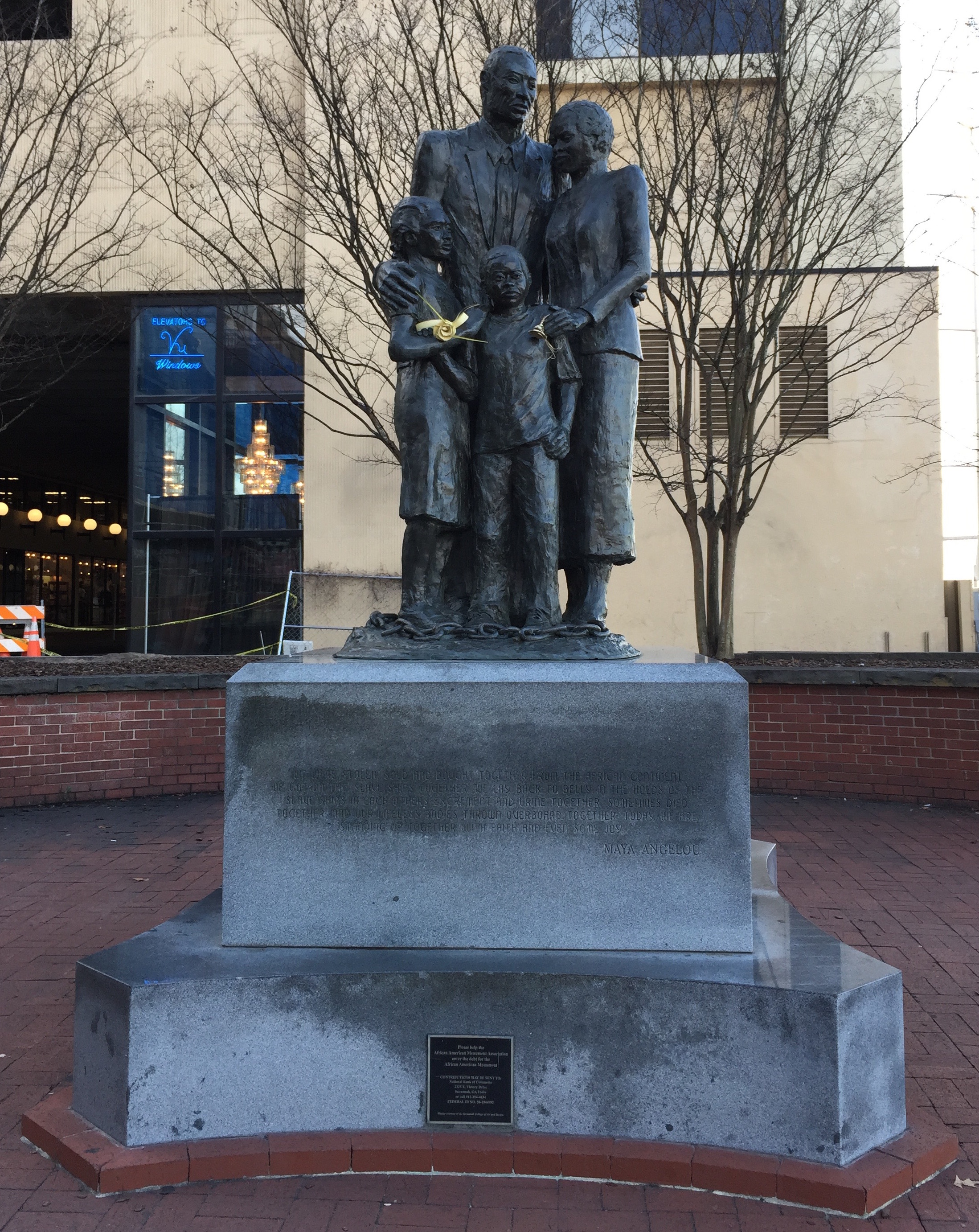
IMG_2738African American Family Monument, a bronze sculpture designed by Dorothy Spradley, on River Street in Savannah, Georgia. The foundation – which I think is  composed of more geographically appropriate granite from Elberton, Georgia – is inscribed with the following words by Maya Angelou (1928-2014), which, like the ballast stones, remind us of a past we might like to forget, but should not.

We were stolen, sold and bought together from the African continent. We got on the slave ships together. We lay back to belly in the holds of the slave ships in each others excrement and urine together, sometimes died together, and our lifeless bodies thrown overboard together. Today, we are standing up together, with faith and even some joy.

(For a bit more information about Savannah’s ballast stones, and to see them for yourself while visiting Savannah – which I highly recommend – visit the Historical Markers Database site at Savannah’s Cobblestones.)

Fossil Visions in the Two Medicine

(This post is the third in a series of three about my field work on the trace fossils of the Late Cretaceous (75 million-year-old) Two Medicine Formation, which I just completed a week ago. My previous two posts, which mostly explain the scientific importance of this field work, are Tracing the Two Medicine and Burrowing Wasps and Baby Dinosaurs.)

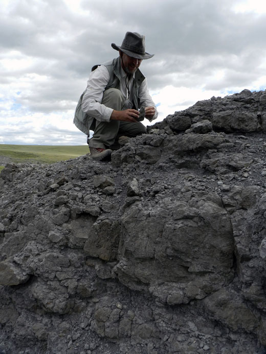
Looking back on three weeks of field work in the Late Cretaceous Two Medicine Formation, one of the realizations I had was how long it took before I could see more of what was there. The most frustrating part of this realization, though, is also knowing that I still missed plenty. This mix of satisfaction and unease is the duality that often accompanies the birthing and honing of search images, a visual training that enables paleontologists to find the fossils we want to find whenever we walk around a field site and look.

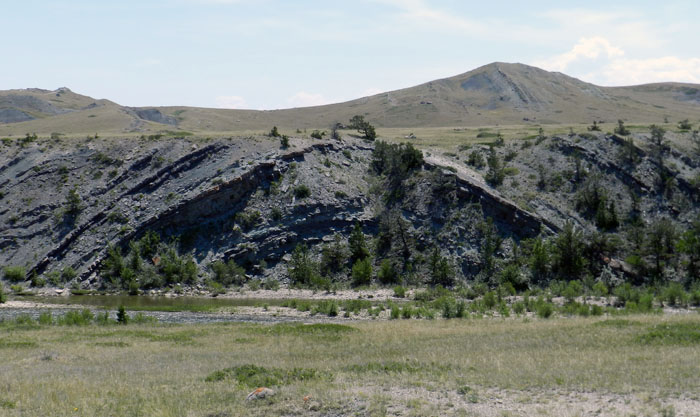
Tony-Martin-Searching-Fossils-Two-MedicineThis outcrop of the Late Cretaceous (75 mya) Two Medicine Formation in central Montana is chock-full of fossils, but you might not know that from just looking at this picture. That means you have to get out onto the rocks and look closely for them, but first make sure you have the right search images for finding them. (Photograph by Ruth Schowalter.)

The Two Medicine Formation in particular presents a major challenge for cultivating search images because of the variety of fossils in it. Moreover, most of these fossils require very different search images. For example, over my three weeks of prospecting, I looked for the following fossils:

  • Plant root traces
  • Invertebrate burrows and tracks
  • Insect cocoons and pupal chambers
  • Dinosaur tracks
  • Dinosaur nests
  • Dinosaur eggshells
  • Dinosaur coprolites
  • Dinosaur bones
  • Dinosaur toothmarks (on dinosaur bones)

I also found a few other fossils I didn’t expect to find, but there they were. This happenstance served as a good reminder that simply going out into the field with a bullet-point checklist of what you think you’ll find (like what you just read) isn’t good enough. In other words, you also need to see what’s there, rather than just what you expect to be there.

On top of looking for these fossils, I’m a geologist, too. This means I also paid close attention to the rock types in the Two Medicine Formation – sandstones, mudstones, conglomerates, limestones – and their physical sedimentary structures – such as cross-bedding or graded bedding. Moreover, Two Medicine strata in the field area are not necessarily in their original horizontal positions, but instead are bent, tilted, and faulted in places. This is where training I had in structural geology – the study of how rocks were deformed – came in handy.

Geologic-Anticline-Two-MedicineOriginally horizontal sedimentary strata were bent upward into a fold, which we geologists normally call an anticline. In such folds, the fossils in the center of the fold are geologically older, whereas the fossils on the outside of the fold are younger. That is, unless the strata were overturned, in which case we’d call it antiformal syncline, then the fossils would have the opposite age relations. Thank you for teaching this, structural geology professors! (Photograph by Anthony Martin.)

Geologic-Fault-Two-MedicineIt’s not my fault, so we’ll blame the Two Medicine Formation for this breakage of sedimentary rocks. Based on how it looks like the fault block on the right moved up relative to the one on the left, I think this is a reverse fault, which – like the anticline and almost everything else on earth – was caused by plate tectonics. (Photograph by Anthony Martin.)

Thus whenever I stepped into the field each day, I had to rapidly switch, combine, or otherwise tap into different types of vision. I’ve often jokingly referred to my ability to spot traces and trace fossils in the field as “ichnovision” (my most likely comic-book hero superpower), and my geological training means I’m using “geovision.” Yet in the Two Medicine Formation – a rock unit world-famous for its dinosaur bones and eggs – I also had to use “osteovision” (seeing fossil bones) and “oovision” (seeing fossil eggshells). These forms of fossil vision are tough for me, as I never see dinosaur bones or eggshells in the southeastern U.S., which is where I spend most of my time in the field.

So just to give you an appreciation of what it was like during my three weeks of looking for fossils in the Two Medicine Formation, here are a few photos and brief descriptions of some fossils I found. To be sure, there was much more than this, but at least I can share these for now so you can begin to see through my eyes.

Fossil-Plant-Root-Traces-Two-MedicineThese odd-looking structures weathering out of an outcrop in the Two Medicine Formation had variable diameters, central cores filled with calcite, and branched in places. I’m fairly sure these are fossil plant root traces, but they were the only ones I saw like them during three weeks of field work. So I remain a little skeptical of my identification, and remain open to their being some geological features I’ve just never seen before then. (Photograph by Anthony Martin.)

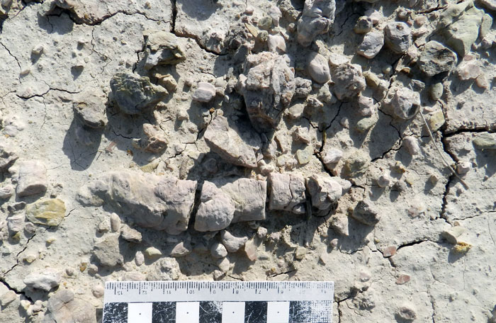
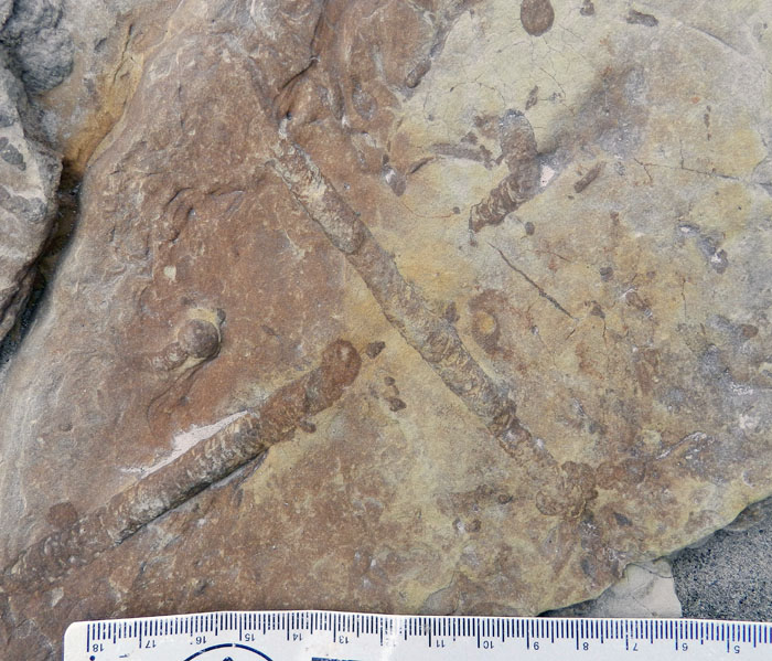
Horizontal-Burrows-Two-MedicineThese are longitudinal sections of horizontal burrows in a sandstone, showing off their beautifully expressed internal structures called meniscae. Meniscae are formed by burrowing invertebrates – such as beetle larvae or cicada nymphs – that pack their burrow with sediment behind them as they move. This means the convex side of the meniscae points in the direction the animal was moving. Go ahead, apply that principal and see what you figure out for yourself. (Photograph by Anthony Martin.)

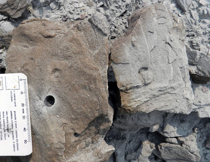
Vertical-Burrows-Two-MedicineThese are more invertebrate burrows, but they’re vertically oriented, meaning you only see their circular cross-sections when you look at the top bedding-plane surface of this sandstone. Notice how some of them are open but others are filled with sandstone. The open ones were filled with mud originally, but that softer sediment has since weathered out, leaving them hollow. (Photograph by Anthony Martin.)

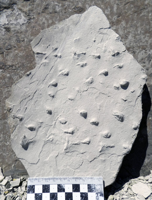
Limulid-Tracks-Two-MedicineThese are invertebrate tracks, and they form a distinctive enough pattern that I recognized them as a trackway, where the trackmaker (probably a freshwater horseshoe crab) turned. But they’re also preserved in positive relief (“sticking out”) because the original traces were filled with sand, which made a natural cast of the tracks. Think about how you have to reverse your concept of tracks to recognize these. (Photograph by Anthony Martin.)

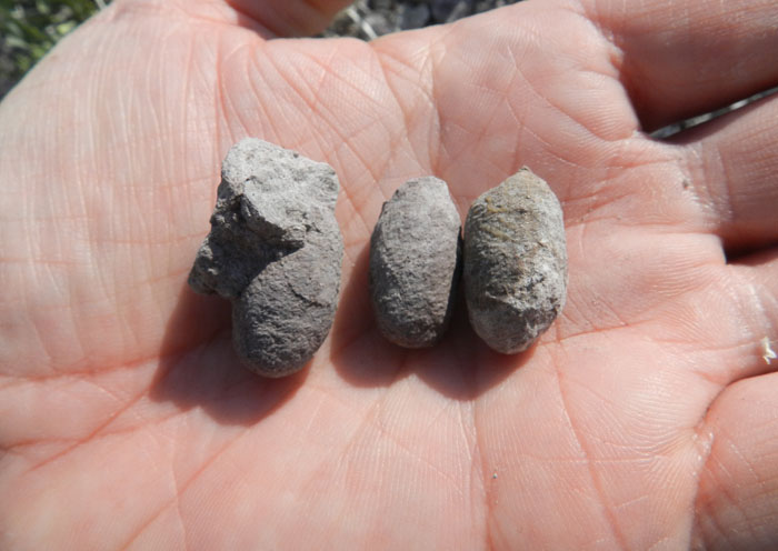
Fossil-Cocoons-Two-MedicineOne of my main research interests in the Two Medicine Formation is its insect trace fossils, which include some of the best-preserved fossil insect cocoons I’ve ever seen in the geologic record. See where the patterns of their original weaves? These cocoons were likely made by wasps – or something acting very much like wasps – 75 million years ago. I usually prospected for these cocoons by looking for their distinctive oval shapes on the ground, then looked more closely for the weave pattern. (Photograph by Anthony Martin.)

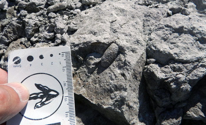
Fossil-Cocoon-in-situ-Two-MedicineThis is what a fossil insect cocoon looks like in an outcrop. Sometimes a burrow would be connected to the cocoon, showing where the original mother insect dug a brooding chamber for its intended offspring. (Photograph by Anthony Martin.)

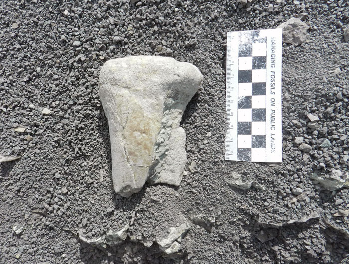
Dinosaur-Bone-Two-MedicineA rare piece of dinosaur bone that actually looks like a bone, even to an untrained eye. Although this one is white, the dinosaur bones in the Two Medicine Formation varied wildly in their colors. So spotting these fossils was more a matter of looking for both a shape and texture that translate into “bone.” (Photograph by Anthony Martin.)

Fragmented-Dinosaur-Bone-Two-MedicineThis is more what most dinosaur bones looked like when I found them in the field area. You probably spotted the big chunk right away, but how about the smaller ones that tend to blend in with the non-dinosaur-bone rocks around them? (Photograph by Anthony Martin.)

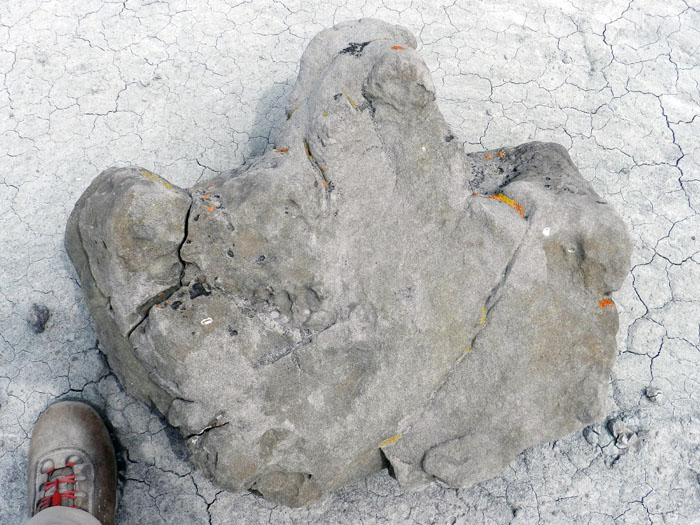
Adult-Hadrosaur-Track-Two-MedicineHere’s another example of how fossil tracks are not like modern ones in size, shape, and how it’s preserved. This is a three-toed dinosaur track (probably made by a hadrosaur), but it was originally made in mud, then sand filled in the track-sized hole to make a natural cast, which 75 million years later weathered out so that it’s sitting by itself on the eroded surface of a mudstone. What’s the scale? My boot’s a size 8 1/2 (men’s). Yes, I felt a little inadequate.  (Photograph by Anthony Martin.)

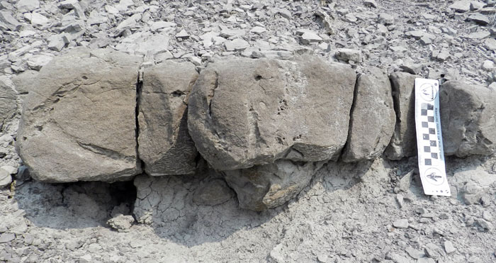
Hadrosaur-Track-in-situ-Two-MedicineWhat does a natural sandstone cast of a dinosaur track look like when it’s still in outcrop? Look for a lump on the bottom of a sandstone bed. From a side view, you might then see a couple of “toes” pointing in one direction, like in this one: the central toe is to the left and one of the outer toes is on the side, clser to you. Note how the sandstone bed also has a few open invertebrate burrows in it, too. Ichnobonus! (Photograph by Anthony Martin.)

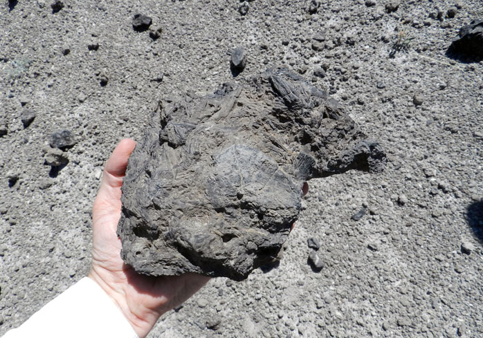
Hadrosaur-Coprolite-Two-MedicineCheck out this big piece of, well, dinosaur coprolite. These trace fossils contained blackened (carbonized) wood fragments that originally passed through the gut of a dinosaur (probably a hadrosaur), and were later cemented by calcite. But you had to look at them doubly, because some of these trace fossils included their own trace fossils made by insects, namely dung beetle burrows. (Photograph by Anthony Martin.)

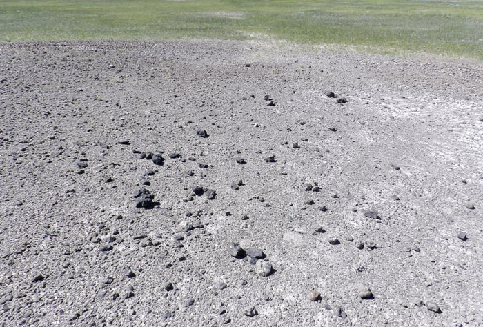
Field-of-Feces-Two-MedicineYou’ve heard of ‘Field of Dreams’? This is a ‘Field of Feces.’ The ground here is adorned with dinosaur coprolites, which are weathering out of the mudstone and breaking apart on the surface. This serves as a good example of how once you know what the dinosaur coprolites look like in this area, you’re less likely to just walk by them, singing “Where Have All the Coprolites Gone?”. (Photograph by Anthony Martin.)
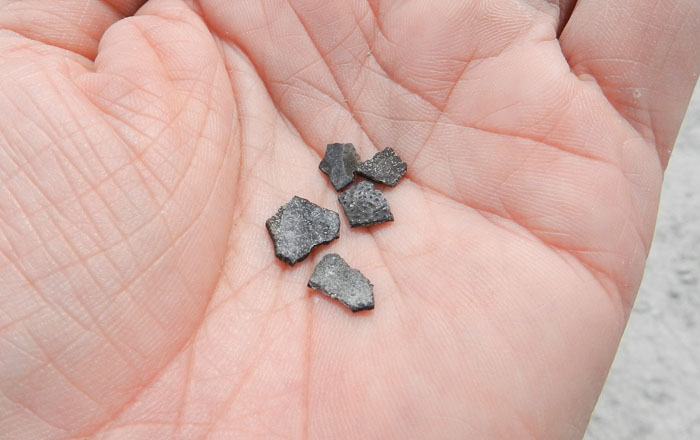
Eggshell-Fragments-Two-MedicineThe Two Medicine Formation is famous for its dinosaur eggs and babies, but even more common than those are bits and pieces of dinosaur eggshells. These show up as black flakes on ground surfaces and sometimes in a rock, which you then must distinguish from all other black flakes that are not dinosaur eggshells. (Photograph by Anthony Martin.)
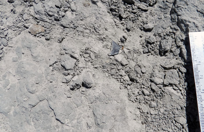
Find-Dinosaur-Eggshell-Two-MedicineCan you find the dinosaur eggshell in this photo? I’ll bet the answer was “yes,” but I made it a little easier for you by cropping the photo, placing the eggshell near the center of the image, and oh yea, showing you what typical eggshells look like in the previous photo. Now think about detecting this bit of eggshell from a standing height and while walking. (Photograph by Anthony Martin.)

After viewing the photos and reading the descriptions, do you think you could recognize each of these fossils if you were somehow magically transported to the Two Medicine Formation in Montana?

The likely answer to that question is, maybe, maybe not. For instance, despite all of my previous paleontological and geological field experience, it took me about two weeks of being in the field before I started accurately identifying dinosaur bones and eggshells. This humbling situation gave me a renewed appreciation for the people who regularly work in the Two Medicine Formation, but also imparted a lesson about taking the time to learn from misidentified burrows, cocoons, coprolites, bones, and eggshells in it. Most things I saw in the Two Medicine were not these fossils, meaning my ways of seeing had to become more discriminating over time.

Thus given enough practice and “dirt time” seeking fossil in the field and correcting your mistakes – preferably with an expert peer-reviewing your finds beside you – the fossil visions will come to you. Then, next thing you know, you start noticing more of what you didn’t see before, expanding your consciousness of the lives that preceded your own.

* * *

Many thanks to Dr. David Varricchio for inviting me to be part of his NSF-sponsored research project in the Two Medicine Formation this summer, and by extension, my deep appreciation to Montana State University and Museum of the Rockies for their logistical support at Camp Makela. May it have many more successful field seasons.

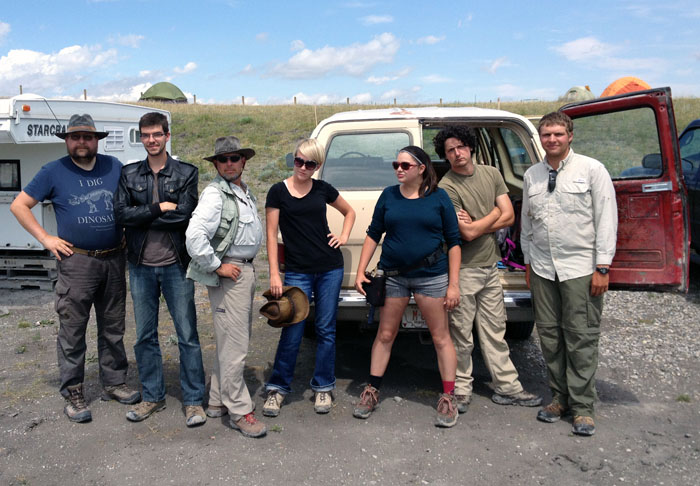
Seven-Samurai-PaleontologyThe Seven Samurai of paleontology at Camp Makela, ready for action in the Two Medicine Formation of central Montana. These ruffians/malcontents/Guardians of the Cretaceous Galaxy are otherwise known as (left to right): Ulf, Jared, me, Ashley, Emmy, Paul, and Eric. (Photograph and choreography by Ruth Schowalter.)

For more about these people and other human connections between the paleontological research that took place in the Two Medicine Formation – and told from a non-paleontological perspective – go to Cretaceous Summer 2014, which had links to four blog posts done on site by my wife Ruth Schowalter. Also be sure to check out Brad Brown’s blog post from the Burpee Museum of Natural History about his experiences at the field site, Just What the Doctor Ordered: Two Medicine Delivers High Biodiversity in a Low Profile Area.

Cumberland Island, Georgia: Not a Barrier to Education

When learning about the natural sciences, there comes a time when just reading and talking about your topics in the confines of a classroom just doesn’t cut it. This semester, we had reached that point in a class I’m teaching at Emory University (Barrier Islands), in which we all needed a serious reality check to boost our learning. So how about a week-long field trip, and to some of the most scientifically famous of all barrier islands, which are on the coast of Georgia?

Last Friday, March 8, our excursion officially began with a long drive from the Emory campus in Atlanta, Georgia to St. Marys, Georgia. Fortunately, Saturday morning was much easier, only requiring that we walk across the street, step onto a ferry, and ride for 45 minutes to Cumberland Island. Cumberland was our first island of the trip, and the southernmost of the Georgia barrier islands. I have written about other topics there, including the feral horses that leave their mark on island ecosystems, the tracks of wild turkeys, and those marvelous little bivalves, coquina clams.

So rather than my usual loquacious ramblings, punctuated by whimsical asides, this blog post and others later this week will be more photo-centered and accompanied by mercifully brief captions. This approach is not only a practical necessity for proper time management while teaching full-time through the week, but also is meant to give a sense of the daily discoveries that can happen through place-based learning on the Georgia coast. I hope you learn with us, however vicariously.

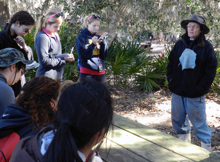
After a 45-minute ferry ride to Cumberland Island, the students received a different sort of lecture when naturalist extraordinaire Carol Ruckdeschel – who is writing a book about the natural history of Cumberland Island – met with them and gave them a brilliant overview of the island ecology. She mostly talked with the students about the effects of feral animals on the island, then spent another hour with us in the maritime forest and through the back-dune meadows. It was a real treat for the students and me, and a great way to start the field trip.

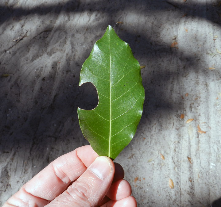
A leaf-cutter bee trace! Despite my writing about these and illustrating them in my book, these distinctive incisions were the first I can recall seeing on the Georgia barrier islands. These traces were abundantly represented in the leaves of a red bay tree we spotted along a trail through the maritime forest, making for a great impromptu natural history lesson for the students.

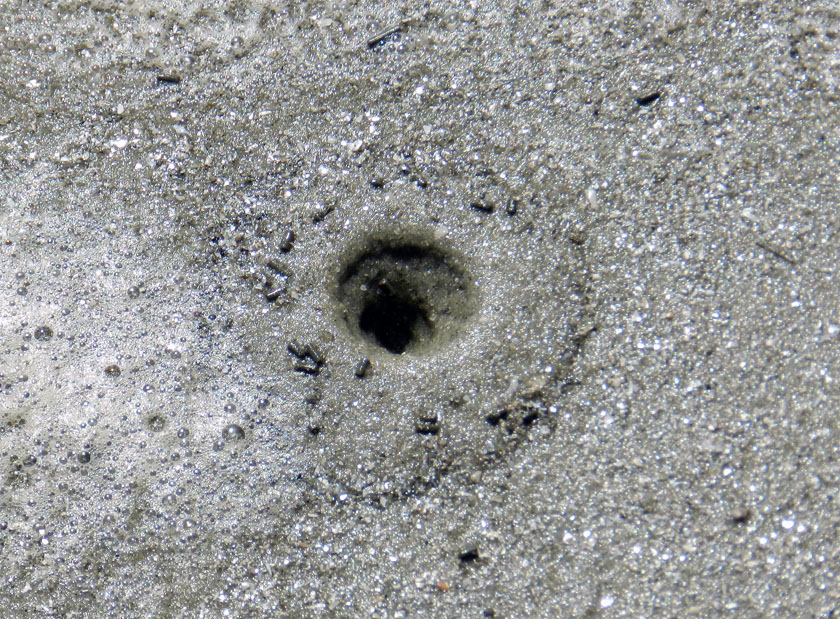
A freshly erupted ghost shrimp burrow on the beach at Cumberland, in which the students were lucky enough to witness the forceful ejection of muddy fecal pellets by the shrimp from the top of its burrow. I mean, really: explain to me how the life of an ichnologist-educator can get any better than that?

The fine tradition a field lunch, made even more fine by the addition of fine quart sand to our meals, freely delivered by a brisk sea breeze. Did the sand leave any microwear marks on our teeth? I certainly hope so.

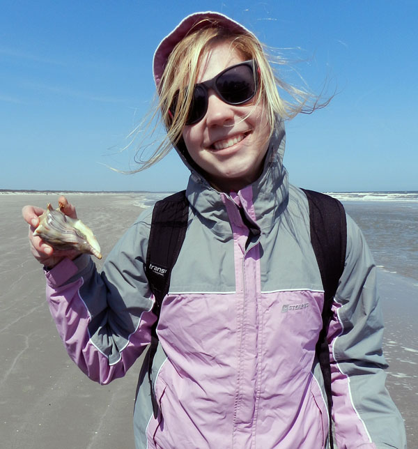
A student is delighted to test my ichnologically based method for finding buried whelks underneath beach sands, and find out that it is indeed correct. (Was there any doubt?) Here she is proudly holding a live knobbed whelk, which I can assure you she promptly placed back into the water once its photo shoot was finished for the day.

Just to join in the fun, other students decided my “buried whelk prospecting” method required further testing. Let’s just say this student did not disprove the hypothesis, but rather seemed to confirm it, and doubly so. It’s almost as if ichnology is a real science! (Yes, these whelks went back into the water, too.)

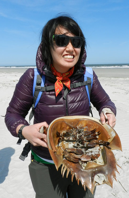
OK, enough about marine predatory gastropods (for now). How about some of the largest horseshoe crabs (limulids) in the world? We found a large deposit of their carapaces above the high-tide mark, some of which were probably molts, but others recently dead. Sadly, though, we did not see any of their traces. Bodies only do so much for me.

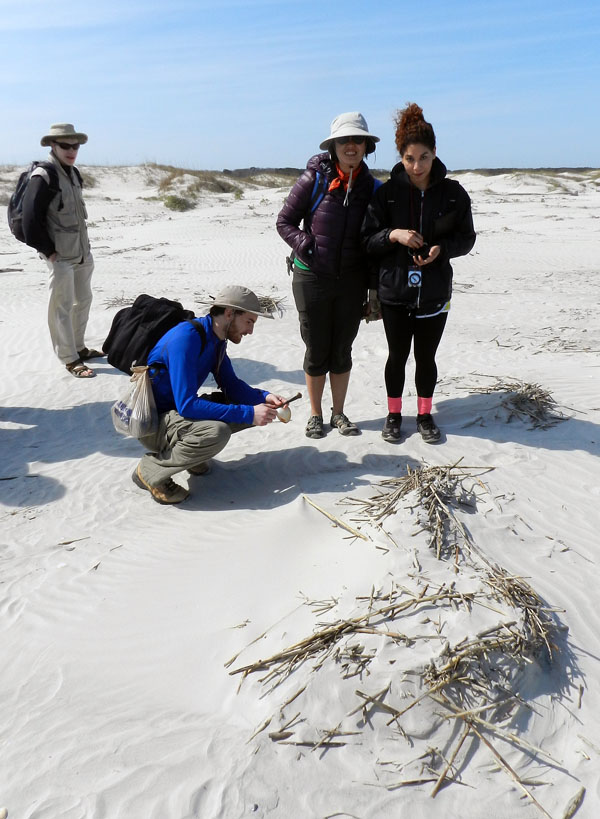
Where do dunes come from? Well, a mother and father dune love each other very much… No wait, wrong story. What happens is that dead cordgrass from the salt marshes washes up onto the beach, where it starts slowing down wind-blown sand enough that it accumulates. Now it just needs some wind-blown seeds of sea oats and other plants to start colonizing it, and next thing you know, dune. Dude.

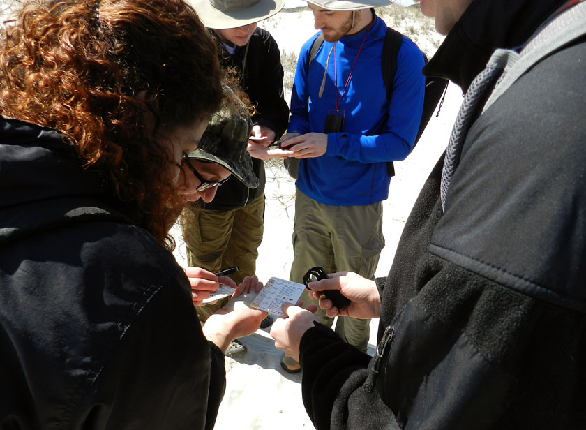
Ah, a geological tradition in action: comparing actual sand from a real outdoor environment to the sand categories on a handy grain-size chart, and using a hand lens. It’s enough to bring a tear to the eyes of this geo-educator. Or maybe that was just the wind-blown sand.

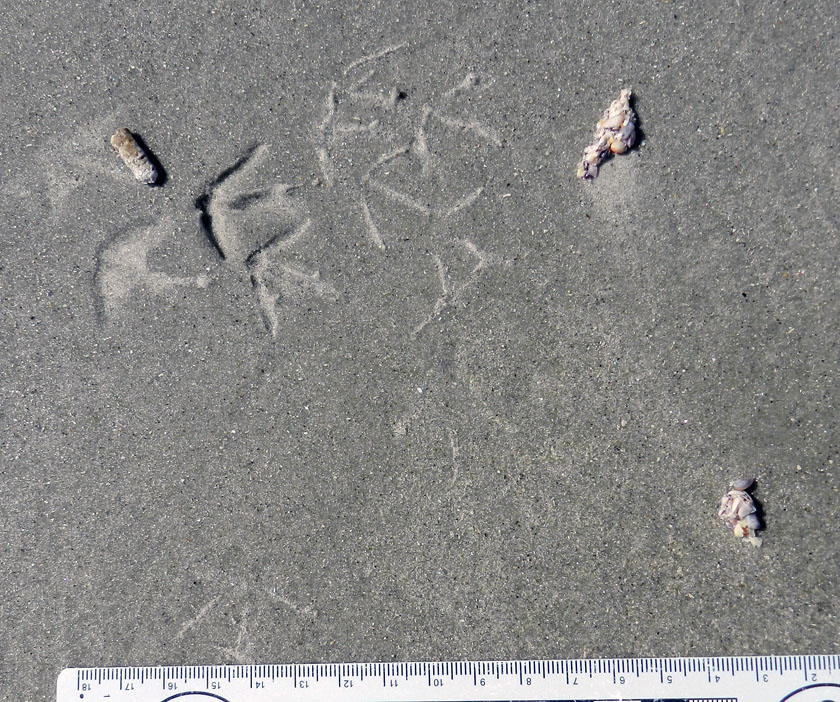
Finally, something that really matters, like ichnology! This is a three-for-one special, too: sanderling feces (left), tracks, and regurgitants (right), the last of these also known as cough pellets. Looks like it had coquina and dwarf surf clams for breakfast.

Wow, more shorebird traces! The tracks are from a loafing royal tern, and it clearly needed to get a load off its mind before moving on with the rest of its day.

Tired of shorebird traces? How about a modern terrestrial theropod? Wild turkey tracks in the back-dune meadows of Cumberland were a happy find, leading to my grilling the students with the seemingly simple question, “What bird made this?” They did not do well on this, but hey, it was the first day, and at least no one said “robin” or “ostrich.”

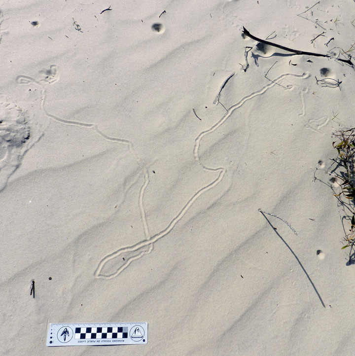
Did somebody say “doodlebug?” This long, meandering, and collapsed tunnel of an ant lion (a larval neuropteran, or lacwing) tells us that this insect was looking for prey in all the wrong places.

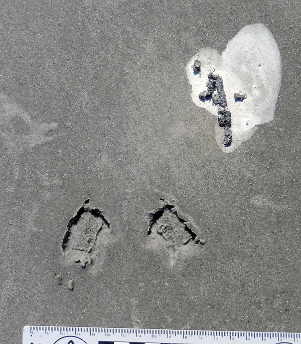
Behold, tracks that bespeak of great, thundering herds of sand-fiddler crabs that used to roam the sand flats above the salt marsh. Where have they gone, and will they ever come back? Who knows where the males might be waving their mighty claws? Do the female fiddler crabs suffer from big-claw envy, or are they enlightened enough to reject cheliped-based hierarchies imposed upon them by fiddler-crab society? All good questions, deserving answers, none of which make any sense.

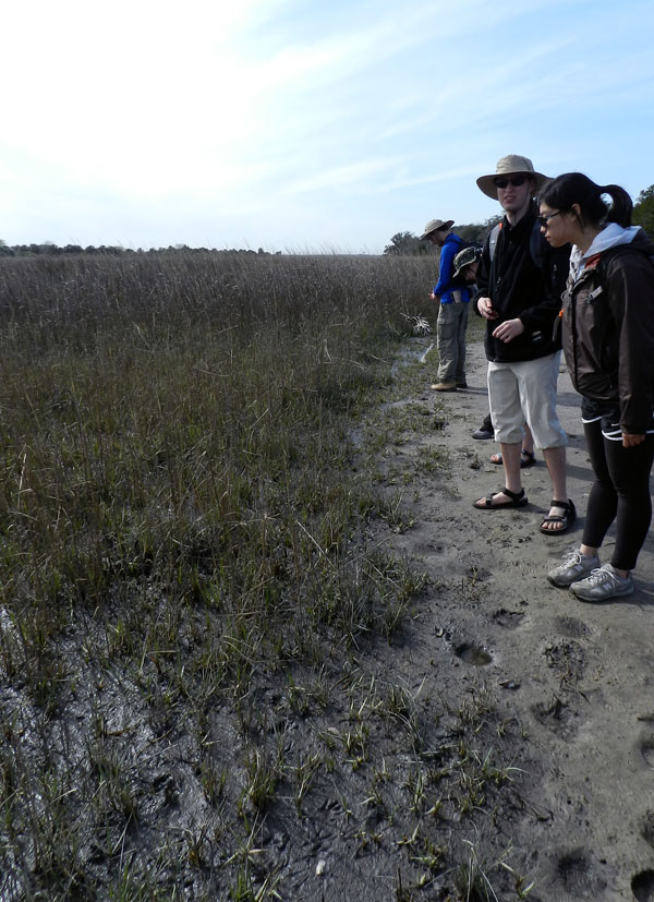
Yes, that’s right, feral horses are really bad for salt marshes. Between overgrazing and trampling, they aren’t exactly what anyone could call “eco-friendly.” My students had heard me say this repeatedly throughout the semester, and Carol Ruckdeschel said the same thing earlier in the day. But then there’s seeing it for themselves, another type of learning altogether.

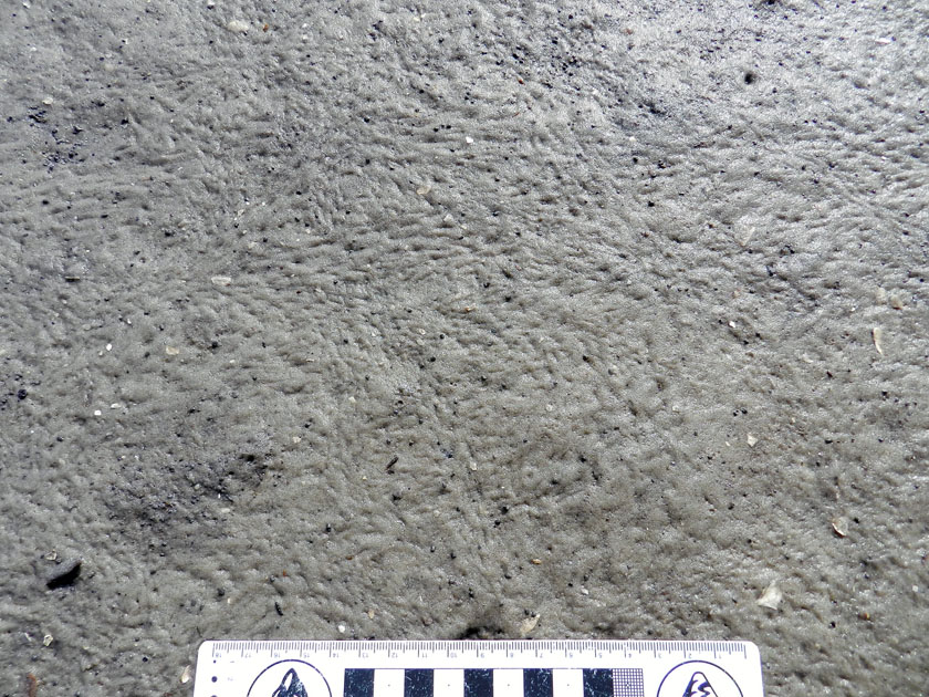
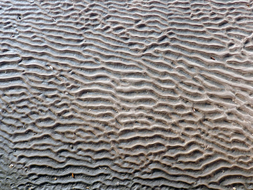
And the day ended with beautiful ripple marks, beckoning from the sandflat below the boardwalk on our trip back onto the ferry. Even this ichnologist can appreciate the aesthetic appeal of gorgeous physical sedimentary structures.

What’s the next island? Jekyll, which is just north of Cumberland along the Georgia coast, visited yesterday. Stay tuned, and look for those photos soon.

The Lost Barrier Islands of Georgia

The Georgia coast is well known for its historic role in the development of modern ecology, starting in the 1950s and ongoing today. But what about geologists? Fortunately, they were not long behind the ecologists, starting their research projects on Sapelo Island and other Georgia barrier islands in the early 1960s. Indeed, through that seminal work and investigations afterwards, these islands are now renown for the insights they bestowed on our understanding of sedimentary geology.

Why would geologists be attracted to these islands made of shifting sand and mud that were nearly devoid of anything resembling a rock? Well, before sedimentary rocks can be made, sediments are needed, and those sediments must get deposited before solidifying into rock. So these geologists were interested in learning how the modern sands and muds of the barrier islands were deposited, eroded, or otherwise moved in coastal environments, a dynamism that can be watched and studied every day along any Georgia shoreline. The products of this sediment movement were sedimentary structures, which were either from physical processes – such as wind, waves, or tides – or biological processes, such as burrowing. Hence sedimentary structures can be classified as either physical or biogenic, respectively.

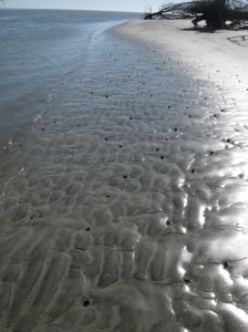
Cabretta Beach on Sapelo Island at low tide, its sandflat adorned with beautiful ripples and many traces of animal life. Sand is abundant here because of a nearby tidal channel and strong ebb-tide currents that tend to deposit more sand than in other places around the island. This sand, in turn, provides lots of places for animals that live on or in the sand, making trails and burrows, demonstrating how ecology and geology intersect through ichnology, the study of traces.  Speaking of traces, what are all of those dark “pipes” sticking out of that sandy surface? Hmmm… (Photograph by Anthony Martin.)
These geologists in the 1960s were among the first people in North America to apply what they observed in modern environments to ancient sedimentary deposits, and just like the ecologists, they did this right here in Georgia. For example, in 1964, a few of these geologists – John H. Hoyt, Robert J. Weimer, and V.J. (“Jim”) Henry – used a combination of: geology, which involved looking at physical sedimentary structures and the sediments themselves; modern traces made by coastal Georgia animals; and trace fossils. Through this integrated approach, they successfully showed that the long, linear sand ridges in southeastern Georgia were actually former dunes and beaches of ancient barrier islands.

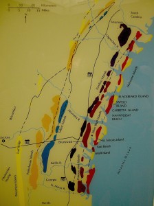
These sand ridges, barely discernible rises on a mostly flat coastal plain, are southwest-northeast trending and more-or-less parallel to the present-day shoreline. Remarkably, these ridges denote the positions of sea-level highs during the last few million years on the Georgia coastal plain. The geologists applied colorful Native American and colonial names to each of these island systems – Wicomico, Penholoway, Talbot, Pamlico, Princess Anne, and Silver Bluff – with the most inland system reflecting the highest sea level. So how did these geologists figure out that a bunch of sand hills were actually lost barrier islands? And what does this all of this have to do with traces and trace fossils?

Map showing positions of sand ridges that represent ancient barrier islands, with each ridge marking the fomer position of the seashore. The one farthest west (Wicomico) represents the highest sea level reached in the past few million years, whereas the current barrier islands reflect an overlapping of two positions of sea level, one from about 40,000 years ago (Silver Bluff), and the other happening now. (Photograph by Anthony Martin, taken of a display at the Sapelo Island Visitor Center.)

Here’s how they did it. They first observed modern traces on Georgia shorelines that were burrows made by ghost shrimp, also known by biologists as callianassid shrimp. On a sandy beach surface, the tops of these burrows look like small shield volcanoes, and a burrow occupied by a ghost shrimp will complete that allusion by “erupting” water and fecal pellets through a narrow aperture.

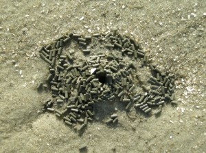
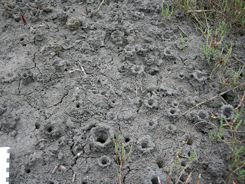
Top of a typical callianassid shrimp burrow, looking much like a little volcano and adorned by fecal pellets, which coincidentally resemble “chocolate sprinkles,” but will likely disappoint if you do a taste test. (Photograph by Anthony Martin, taken on St. Catherines Island.)

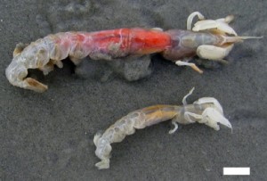
A couple of ghost shrimp, which are either a male-female pair of Carolina ghost shrimp (Callichirus major) or a Carolina ghost shrimp and a Georgia ghost shrimp (Biffarius biformis). Sorry I can’t be more accurate, but I’m an ichnologist, not a biologist (although I could easily play either role on TV). Regardless, notice they have big claws, which they use as their main “digging tools.” The tracemakers look a little displeased about being outside of their protective burrow environments, but be assured I thanked them for their contribution to science, and promptly threw them back in the water so they could burrow again. Scale = 1 cm (0.4 in) (Photograph by Anthony Martin, taken on St. Catherines Island, Georgia.)

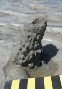
Just below the beach surface, these interior shafts widen considerably, making these burrows look more like wine bottles than volcanoes. This widening accommodates the ghost shrimp, which moves up and down the shaft to irrigate its burrow by pumping out its unwanted feces (understandable, that) and circulating oxygenated water into the burrow. Balls of muddy sand reinforce the burrow walls like bricks in a house, stuck together by shrimp spit, and the burrow interior is lined with a smooth wall of packed mud.

A small portion of a ghost-shrimp burrow, showing its wall reinforced by rounded pellets of sand and stuck together with that field-tested and all-natural adhesive, shrimp  spit. Photograph by Anthony Martin, taken on Sapelo Island.

Amazingly, these shafts descend vertically far below the beach, as much as 2-3 meters (6.5-10 feet) deep. Here they turn horizontal, oblique, and vertical, and tunnels intersect, branch, and otherwise look like a complex tangle of piping, perhaps reminding baby-boomers of “jungle gyms” that they used to enjoy as children in a pre-litigation world. Who knows what goes on down there in such adjoining ghost-shrimp burrow complexes, away from prying human eyes?

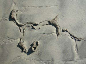
The deeper part of a modern ghost-shrimp burrow, exposed by erosion along a shoreline and revealing the more complex horizontally oriented and branching networks. Gee, do you think these burrows might have good fossilization potential? (Photograph by Anthony Martin, taken on Sapelo Island.)

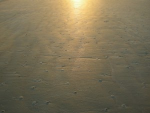
See all of those burrow entrances on this sandy beach? Now imagine them all connecting in complex networks below your feet the next time you’re walking along a beach. Feels a little different knowing that, doesn’t it? (Photograph by Anthony Martin, taken on Sapelo Island.)

Interestingly, these burrows are definitely restricted to the shallow intertidal and subtidal environments of the Georgia coast, and their openings are visible at low tide on nearly every Georgia beach. Hence if you found similar burrows in the geologic record, you could reasonably infer where you were with respect to the ancient shoreline.

I think you now know where this is going, and how the geologists figured out what geologic processes were responsible for the sand ridges on the Georgia coastal plain. Before doing field work in those area, the geologists may have already suspected that these sandhills were associated with former shorelines. So with such a hypothesis in mind, they must have been thrilled to find fossil burrows preserved in the ancient sand deposits that matched modern ghost-shrimp burrows they had seen on the Georgia coast. They also found these fossil burrows in Pleistocene-age deposits on Sapelo Island, which helped them to know where the shoreline was located about 40,000 years ago with respect to the present-day one. This is when geologists started realizing that the Georgia barrier islands were made of both Pleistocene and modern sediments as amalgams of two shorelines, and hence unlike any other known barrier islands in the world.

Vertical shaft of a modern ghost-shrimp burrow eroding out of a shoreline on Cabretta Beach, Sapelo Island. Scale in centimeters. (Photograph by Anthony Martin.)
Vertical shaft of a fossil ghost-shrimp burrow eroding out of an outcrop in what is now maritime forest on Sapelo Island, but we know used to be a shoreline because of the presence of this trace fossil. Scale in centimeters. (Photograph by Anthony Martin.)
Geology and ecology combined further later in the 1960s, when paleontologists who also were well trained in biology began looking at how organisms, such as ghost shrimp, ghost crabs, marine worms, and many other animals changed coastal sediments through their behavior. So were these scientists considered geologists, biologists, or ecologists? They were actually greater than the sum of their parts: they were ichnologists. And what they found through their studies of modern traces on the Georgia barrier islands made them even more scientifically famous, and these places became recognized worldwide as among the best for comparing modern traces with trace fossils.

Further Reading:

Hoyt, J.H., and Hails, J.R. 1967. Pleistocene shoreline sediments in coastal Georgia: deposition and modification. Science, 155: 1541-1543.

Hoyt, J.H., Weimer, R.J., and Henry, V.J., Jr. 1964. Late Pleistocene and recent sedimentation on the central Georgia coast, U.S.A. In van Straaten, L.M.J.U. (editor), Deltaic and Shallow Marine Deposits, Developments in Sedimentology I. Elsevier, Amsterdam: 170-176.

Weimer, R.J., and Hoyt, J.H. 1964. Burrows of Callianassa major Say, geologic indicators of littoral and shallow neritic environments. Journal of Paleontology, 38: 761-767.

Georgia Salt Marshes: Places Filled with Traces

The Georgia coast has long captured the attention of scientists interested in its biological and geological systems and how these two realms overlap. For example, starting in the 1950s, ecologists – people who study the connections between living and non-living things in ecosystems – began investigating the exchange of energy and matter between the plants and animals of the Georgia barrier islands. In particular, they were interested in the Georgia salt marshes, most of which are between the mainland and the upland portions of the barrier islands. Why study salt marshes in Georgia, and not somewhere else? And how do the traces of plants and animals in these marshes, such as root disturbances, scrapings, burrows, and feces, actually play a major role in the functioning of these ecosystems?

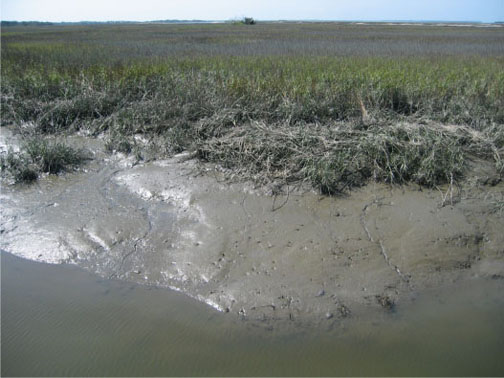
The muddy bank of a tidal creek in a typical salt marsh on St. Catherines Island, Georgia. See the traces? No? It’s a trick question: it’s made of nothing but traces. Photograph by Anthony Martin.

Georgia salt marshes are flat, extensive coastal “prairies” dominated by a tall, marine-adapted grass, smooth cordgrass (Spartina alterniflora) in their lowermost parts. These ecosystems turned out to be fantastic places for scientists to study basic principles of ecology, and are among the most productive of all ecosystems, besting or equaling tropical rain forests in this respect. Georgia salt marshes also represent about one-third of all salt marshes in the eastern U.S. by area. How did this happen?

Such an unusual concentration of salt marshes along the relatively small Georgia coastline is a result of several factors. One is its semi-tropical climate, only rarely dipping below freezing, which allows marsh plants and animals to thrive and actively participate in their ecosystems nearly year-round. Another is the high tidal range of the Georgia coast of about 2.5-3 meters (8-10 feet), which causes enormous amounts of organic material – living and nonliving – to get cycled in and out of the marshes by this moving water.

A third reason, and perhaps the most important, is what people did not do to the marshes, which was to develop them in ways that would have completely altered their original ecological characters. (Take a look at the barrier islands of New Jersey as examples of what could have happened in Georgia.) Salt marshes that were not drained, filled in, paved over, or otherwise irreparably altered could be studied for what they were, not what we supposed.

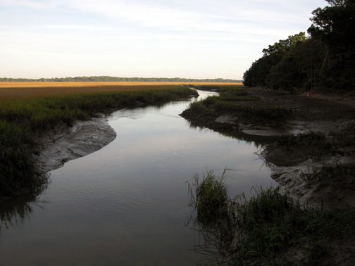
Salt marsh and tidal creek adjacent to a maritime forest on Cumberland Island. Fortunately, this is a typical sight on the Georgia barrier islands, which gladdens ecologists and lots of other people who prefer to see their landscapes unpaved.

The scientists interested in the Georgia salt marshes, among them Eugene (“Gene”) Odum, Mildred Teal, and John Teal, were astonished by the amount of organic matter produced in these marshes, especially in their lower parts, which were appropriately called low marsh. Amazingly, much of this flux is controlled by tides and just five species of organisms you can easily see any given day in these marshes:

  • Smooth cordgrass (Spartina alterniflora)
  • Ribbed mussels (Geukensia demissa)
  • Eastern oysters (Crassostrea virginica)
  • Marsh periwinkles (Littoraria irrorata)
  • Mud fiddler crabs (Uca pugnax)

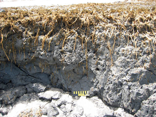
Just to oversimplify matters, but to assure that you get the big picture, the flow of matter and energy goes like this. Smooth cordgrass is the primary producer of organic material in the salt marshes, converting sunlight into food for it and, as it turns out, lots of other organisms. This is relatively easy for these plants because they are powered by intense Georgia sunlight much of the year. Smooth cordgrass also has extensive and complicated root systems, which help to hold most of the marsh muds in place when marshes are flushed by the tides. These roots locally change the chemistry of the surrounding mud and otherwise leave visible traces of their deeply penetrating networks, which are noticeable long after the plants had died and decayed.

Cross-section of a relict salt marsh preserved on Sapelo Island, Georgia, buried for about 500 years but just now being exhumed by shoreline erosion. See how deeply those roots of smooth cordgrass (Spartina alterniflora) penetrate the mud and still hold it in place? Modern ones do the same thing. Scale = 15 cm (6 in).

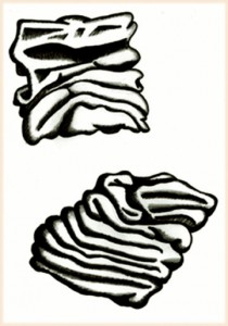
What produces the mud in a marsh? Mostly the ribbed mussels, oysters, and similar suspension-feeding animals, which: suck in water made cloudy by suspended clays; consume any useful organics that might be in that water; and excrete massive amounts of mud-filled feces, packaged with mucous as sand-sized particles. The oysters, along with cordgrass roots, stabilize the banks of tidal creeks, keeping these from washing away with each ebb tide.

If you’ve ever wondered what ribbed mussel (Geukensia demissa) feces look like, you’re in luck. Each one is only about 1 millimeter (0.04 inches) across, which makes them behave more like sand instead of much tinier clay particles. Also think of them as little packets of mud shrink-wrapped by mucous. Illustration by Anthony Martin, based on a figure by Smith and Frey (1985).

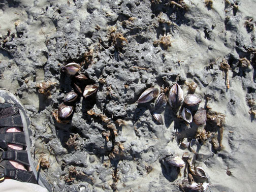
A view of what used to be a marsh surface – the relict marsh on Sapelo Island, that is – with stubs of long-dead smooth cordgrass accompanied by equally long-dead clusters of ribbed mussels (Geukensia demissa). Back in the day (about 500 years ago), these mussels were happily pumping out mud-filled feces, and their modern descendants are still doing the same thing. Sandal (left) is size 8½ (mens). Photograph by Anthony Martin.

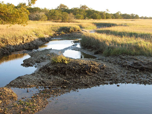
Prominent clumps of eastern oysters (Crassostrea virginica), exposed at low tide in the middle of a tidal creek on Sapelo Island. These not only help to produce mud, but keep it in place, while also slowing down flow and helping to deposit mud. Photograph by Anthony Martin.

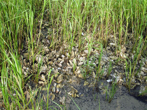
A close-up look at more oysters surrounded by smooth cordgrass, with both working together to bind and accumulate mud on Sapelo Island. Now that’s ecological teamwork! Photograph by Anthony Martin.

Both the cordgrass and oysters also baffle and otherwise slow down the water flow, causing mud – fecal or otherwise – to get deposited. In short, a Georgia salt marsh with its thick deposits of beautifully dark, rich, gooey mud, much of which consists of the traces of mussels and oysters, would cease to exist without these bivalves and smooth cordgrass, and would become more like an open lagoon.

Meanwhile, marsh periwinkles are constantly moving up and down the stalks and leaves of the smooth cordgrass, grazing on algae growing on the cordgrass. This activity causes visible damage to the plants, tearing them into small bits and pieces that fall onto the marsh surface.

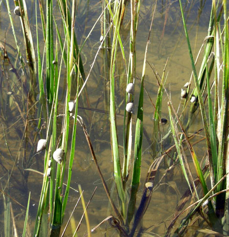
Marsh periwinkles (Littoraria irrorata) doing what they do best, which is graze on the stalks and leaves of smooth cordgrass, leaving many traces from damaging these plants while also contributing plant debris to the marsh surface. Photograph by Anthony Martin, taken on Sapelo Island.

Fungi and bacteria further break down this “gentle rain from heaven” of cordgrass debris once it reaches the marsh surface. Here, mud fiddler crabs consume this stuff, along with any algae that might be growing on marsh surfaces. Their scrape marks and discarded balls of processed sediment are everywhere to be seen on the marsh surface and add to the sediment load of a marsh. Furthermore, as we may have learned in grade school, all animals poop, so in this way these fiddler crabs and other species of crabs living in the salt marshes donate even more enriched organic material. They also dig millions of burrows, some adorned by prominently pelleted turrets, churning the uppermost part of the marsh mud like earthworms would do to a soil in a forest or field.

Mud fiddler crabs (Uca pugnax) and their many traces on a salt marsh surface, including feeding pellets, scrape marks, and burrows. Photo by Anthony Martin, taken on Sapelo Island.

Mud-fiddler crab burrows exposed at low tide in a marsh, many with pellet-lined turrets. Why do they make these structures? Good question, which I’ll try to answer in the future. Photo by Anthony Martin, taken on Sapelo Island.

Hence you cannot go to a Georgia salt marsh and say, “I can’t see any traces,” unless you are closing your eyes or are otherwise sight deprived. The entire salt marsh is composed of traces, and these traces, which are the products of plant and animal behavior, actually control the ecology of the salt marshes. Thus I often refer to Georgia salt marshes as examples of “ichnological landscapes,” places that are the sum of all traces. This concept then better prepares us for viewing these and other Georgia coastal environments as places where geologists can begin to understand how organisms can leave their marks – both big and small – in the geologic record.

Further Reading:

Craige, B.J. 2001. Eugene Odum: Ecosystem Ecologist and Environmentalist. University of Georgia Press, Athens, Georgia: 226 p.

Odum, E.P. 1968. Energy flow in ecosystems; a historical review. American Zoologist, 8: 11-18.

Odum, E.P., and Smalley, A.E. 1959. Comparison of population energy flow of a herbivorous and a deposit-feeding invertebrate in a salt marsh ecosystem. Proceedings of the National Academy of Sciences, 45: 617-622.

Smith, J.M., and Frey, R.W. 1985. Biodeposition by the ribbed mussel Geukensia demissa in a salt marsh, Sapelo Island, Georgia. Journal of Sedimentary Research, 55: 817-825.

Teal, J.M. 1962. Energy flow in the salt marsh ecosystem of Georgia. Ecology, 43: 614-624.

Teal, J.M., and Teal, M. 1983. Life and Death of a Salt Marsh. Random House, New York: 274 p.

Teal, M., and Teal, J.M. 1964. Portrait of an Island. Atheneum, New York: 167 p. [reprinted by University of Georgia Press in 1997, 184 p.]

Why Study Traces in Georgia? A Celebration of the Familiar

For those of us who live in Georgia, we either forget or don’t know about the ecological and geological specialness of this part of the U.S. For example, my undergraduate students here in Atlanta often talk dreamily about their desire to visit the Amazon River basin, Costa Rica, Kenya, Australia, or other places far removed from Georgia, beguiled as they are by the exotic “other” qualities of those places with their biota and landscapes. On the other hand, almost none of these students have been to the Okefenokee Swamp, the Blue Ridge Mountains, the Cumberland Plateau, the long-leaf pine forests of Ichauway, or the Georgia barrier islands, unless my colleagues or I have taken them there on field trips. Yet these places, especially those with freshwater ecosystems, collectively hold a biodiversity nearly matching that of the Amazon River basin, an evolutionary consequence of the long geologic history of the Appalachian Mountains.

To be fair, I have likewise found myself succumbing to such place-based deflection and lack of appreciation for what is more-or-less in my backyard. In 2001, I realized that I had been to Brazil (three times) more often than Fernbank Forest (two times), even though Fernbank was only a five-minute bicycle ride from home in Decatur, Georgia. This imbalance was soon corrected, though, and many visits later, I learned to appreciate how this old-growth southern Appalachian forest in the middle of metropolitan Atlanta is a gem of biodiversity, every native species of plant and animal a facet testifying to their long evolutionary histories. Still, I wonder why we often ignore what is nearby, even if it is extraordinary?

Related to this quandary is one of the most common questions I encountered from friends, family, and colleagues while writing my book – Life Traces of the Georgia Coast – which was, “Why are you, a paleontologist and geologist, writing about the traces of modern plants and animals in Georgia?” This is a legitimate inquiry, but my answer surprises most people. I tell them that my main reason for staying here in Georgia to study the tracks, trails, burrows, nests, and other traces of its barrier islands is because these traces and their islands are world-class and world-famous. This high quality is directly linked to the biodiversity of the Georgia barrier islands, but also their unique geological histories compared to other barrier-island systems. Furthermore, these islands have inspired more than a few major scientific discoveries related to modern ecology and geology, some of which, made nearly 50 years ago, are still applicable to diagnosing the fossil record and the earth’s geologic history. In short, the Georgia barrier islands and their traces also reflect a legacy recognized by scientists far outside the confines of Georgia.

How so? I’ll explain in upcoming posts, and hope to demonstrate how the marvelous ecosystems of the Georgia coast and its geological processes are the proverbial gift that keeps on giving, continually helping us to better understanding the earth’s geologic past. Now that’s special!

Burrows at dawn: a partial view of the thousands of ghost-shrimp burrows dotting a Georgia beach at low tide, their entrances looking like tiny volcanoes. What makes these burrows so important, scientifically speaking, and why are they something that would cause scientists from outside of Georgia to travel and see in person? Photo by Anthony Martin and taken on Sapelo Island, Georgia.