Rooted in Time

As a paleontologist and geologist, time is always on my mind. Nonetheless, such musings do not always connect with millions or billions of years, the so-called “deep time” that earth scientists love to use whenever shocking people who normally ponder shorter time intervals used when, say, measuring the life of a fruit fly, or the length of a cat-themed video.

Still, sometimes other paleontologists and I also try to interpret brief time spans, such as a few minutes, hours, or years, but ones that elapsed millions of years ago. This is where ichnology comes in handy as a tool, as animal traces in particular – such as tracks or burrows – can give “snapshots” of animal behavior in the context of their original ecosystems. For instance, when I look at a limestone layer that was first laid down 95 million years ago and see burrows in that limestone, I think of it as soft, carbonate-laden mud with many small crustaceans digging into it. This is an instance of where imagination becomes a time machine, helping us to create evidence-based explanations that hopefully can be later honed with further scrutiny and re-imagining. When trace fossils are preserved as an assemblage in the sediments of that past ecosystem, whether it was a soil, lake bottom, or beach, the stories can be told in chronological order.

Throw plants into the mix, though, and they can screw up those linear-time stories to the point where you doubt every earth scientist when they tell a story about an ancient land-based ecosystem. Plants can occupy sediments that are hundreds, thousands, or millions of years old, and if their roots penetrate deep enough into these sediments, they may leave both remnants of their tissues and root traces. These geologically fresh root traces then mix with older animal trace fossils, conjuring the illusion of a contemporaneous community, all living happily together. Only a careful examination of the sediment, and which traces cut across which, would help to unravel the real story.

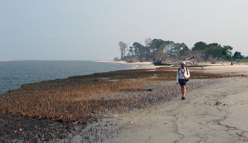
In the preceding video – taken more than four years ago on Sapelo Island on the Georgia coast – I tell such a cautionary tale of what happens when you assume that the animal and plant traces in an old sediment were made at the same time. (Spoiler alert: You would be wrong.)

For more about this relict marsh and the fascinating lessons we can learn from it, please read Fossils In Progress (which includes a short bibliography) and Teaching on an Old Friend, Sapelo Island. Both posts also discuss how to teach students some of these concepts of interpreting fossilization, paleoecology, and geologic time when in the field.

On the 12th Day of Ichnology, My Island Gave to Me: 12 Snails Grazing

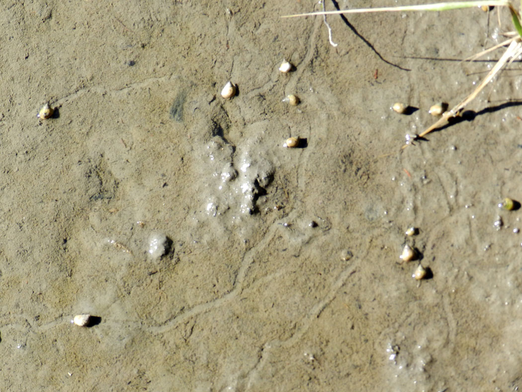
In a celebration of the traces of the Georgia barrier islands and the holidays (in order of importance), over the next 12 days I will attempt to post photographs of Georgia-coast traces, along with brief explanations of them. As a special bonus, I may even point out why they’re interesting. But maybe the visual information provided by the photos of these traces (and sometimes their tracemakers) will do the talking for me.Periwinkles-Grazing-Sapelo-IslandMarsh periwinkles (Littoraria irrorata) on a muddy high-marsh surface of Sapelo Island, Georgia, leaving nicely defined trails through their grazing. (Photograph by Anthony Martin.)

By happy coincidence, this photograph depicts 12 marsh periwinkles (Littoraria irrorata) on a marsh surface, making meandering trails while grazing on delectable algae. Normally this snail does most of its grazing on fungi and algae growing on stems and leaves of smooth cordgrass (Spartina alterniflora). So it was a treat to see these little tykes on a sedimentary surface, leaving some traces comparable to what earth scientists might find as trace fossils in the geologic record.

The trails they make are shallow furrows with millimeter-high levees, which they form by extending, anchoring, and pulling with a muscular foot, which helps the perwinkle’s shell to catch up with the rest of its body. They also leave mucus on their trails, which helps smooth out the ride for them, but also aids in preserving the form of their trails, as the mucus weakly binds the mud underneath where they travel.

A cautionary note for all budding ichnologists out there: notice how some of the trails made by different periwinkles intersect one another. This creates a false “branching” structure that – if fossilized – could be mistaken for a branching burrow made by one animal, which would make you doubly wrong. So if you encounter a trace fossil that looks like this, look at the “burrow” junctions (branching points), and see whether one part of the “burrow” cross-cuts the other, which may be marked by a levee. In other words, be a good scientist and test your hypothesis using, like, you know, evidence-based reasoning.

What will be the subject of the next traces, on the 11th day of Ichnology? I have no idea yet, but suppose we’ll both know by tomorrow. In the meantime, happy trails to you!

Further Information

Littorina irrorata: Marsh Periwinkle. Animal Biodiversity Web.

Littorina irrorata: Marsh Periwinkle. Smithsonian Marine Station at Fort Pierce.

Littorina irrorata: Marsh Periwinkle. Encyclopedia of Life.

Erasing the Tracks of a Monster

Life can certainly imitate art, as can life traces. I was reminded of this last week while doing field work on St. Catherines Island (Georgia), and after encountering traces made by two very different animals, alligators and fiddler crabs. What was unexpected about these traces, though, was how they intersected one another in a way that, for me, evoked scenes from the recent blockbuster summer movie, Pacific Rim.

Alligator-Tracks-Fiddler-Crab-Burrows-1

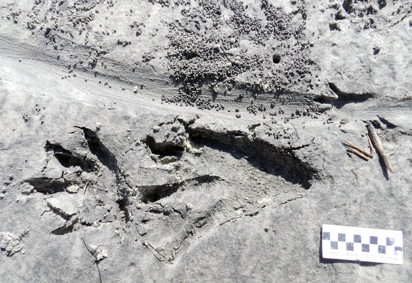
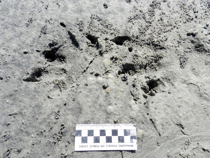
Could these be the tracks of a kaiju, making landfall on the shores of Georgia? Sorry to disappoint you, but they’re just the right-side and very large tracks of an American alligator (Alligator mississippiensis), accompanied by its tail drag-mark, left on a sandy area next to a salt marsh. Note the scale impressions in its rear-foot track, a symbol of the awesome reptilian awesomeness of its tracemaker. But wait: what nefarious nonsense is happening to the tail drag-mark, which is being covered by tiny balls of sand? Who made that hole next to the drag-mark? And what the heck was a raccoon (Procyon lotor) doing in the neighborhood, leaving its track on the tail drag-mark? With such a monster on the loose, shouldn’t that raccoon be hiding in the forest? (Photo by Anthony Martin, taken on St. Catherines Island; scale in centimeters.)

For anyone who has not seen Pacific Rim, you can read what I wrote about its distinctive fictional ichnology here. But what came to my mind while I was doing field work was one of the themes expressed early on in the film: how quickly humanity returned to normalcy following a lull in attacks by gigantic monsters (kaiju) that emerged from the ocean, destroyed major cities, and killed millions of people. It reminded me of how horrific hurricanes can strike a coast, such as the 1893 Sea Islands Hurricane that hit Georgia, but because no hurricane like it has happened there since, coastal developers think it’s hunky-dory to start building on salt marshes.

But enough about malevolent evil as exemplified by kaiju and coastal developers: let’s get back to traces. Last week, I was on St. Catherines Island for a few days with my wife (Ruth) and an undergraduate student (Meredith) to do some field reconnaissance of my student’s proposed study area. The area was covered by storm-washover fans; these are wide, flat, lobe-shaped sandy deposits made by storm waves, which span from the shoreline to more inland on barrier islands. We were trying to find out what traces had been left on these fans – tracks, burrows, scrapings, feces, and so on – which would tell us more about the distribution and behaviors of animals living in and around the washover fans.

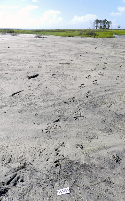
Alligator-Trackway-St-Catherines-2Part of a storm washover fan on St. Catherines Island (Georgia), with the sea to the left and salt marsh (with a patch of forest) in the background. Say, I wonder what made those tracks coming out of the tidal creek and toward the viewer? (Photograph by Anthony Martin.)

It didn’t take long for us to get surprised. Within our first half hour of walking on a washover fan and looking at its traces, we found a trackway left by a huge alligator, split in half by a wavy tail-drag mark. I recognized this alligator from its tracks, as I had seen them in almost exactly the same place more than a year before. Besides their size, though, what was remarkable about these tracks was their closeness to a salt marsh behind the washover fan. When we looked closer, we could see long-established trails cutting through the salt-marsh vegetation, which were the width of a large adult alligator.

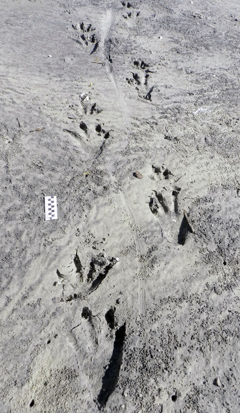
Alligator-Trackway-St-Catherines-1That ain’t no skink: the distinctive tracks and tail drag-mark of a large alligator, strolling through a storm-washover fan and next to a salt marsh. You think these animals are “freshwater only”? Traces disagree. Scale = 10 cm (4 in). (Photograph by Anthony Martin, taken on St. Catherines Island, Georgia.)

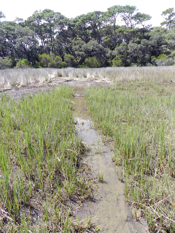
Alligator-Trail-Salt-Marsh-SCIAlligator trail cutting through a salt marsh. Trail width was about 45-50 cm (18-20 in), which is about twice as wide as a raccoon trail. And it wasn’t made by deer or feral hogs either, because, you know, alligators. (Photograph by Anthony Martin, taken on St. Catherines Island, Georgia.)

So although the conventional wisdom about alligators is that these are “freshwater-only” animals, their traces keep contradicting this assumption. Sure enough, in the next few days, we saw more alligator tracks of varying sizes going into and out of tidal creeks, salt marshes, and beaches.

Based on a few traits of these big tracks, such as their crisp outlines (including scale impressions), the alligator had probably walked through this place just after the tide had dropped, only a couple of hours before we got there. But when we looked closer at some of the tracks along the trackway, we were astonished to see that something other than the tides had started to erase them, causing these big footprints to get fuzzy and almost unrecognizable.

The culprits were sand fiddler crabs (Uca pugilator), which are exceedingly abundant at the edge of the storm-washover fans closest to the salt marshes. These crabs are industrious burrowers, making J-shaped burrows with circular outlines corresponding to their body widths. They also scrape the sandy surfaces outside of their burrows to eat algae in the sand, then roll up that sand into little balls, which they deposit on the surface.

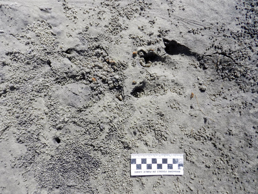
In this instance, after this massive alligator had stomped through their neighborhood, they immediately got back to work: digging burrows, scraping the surface, and making sand balls. Within just a few hours, parts of the alligator trackway was obscured. If these parts had been seen in isolation, not connected to the clear tracks and tail drag mark, I doubt we would have identified these slight depressions as large archosaur tracks.

Alligator-Tracks-Burrowed-Fiddler-CrabsHey, what’s going on here? Who would dare to erase and fill in giant alligator tracks? Don’t they know who they’re dealing with? (Photograph by Anthony Martin, taken on St. Catherines Island, Georgia.)

Alligator-Tracks-Destroyed-Fiddler-Crab-Burrows-1Going, going, gone: alligator tracks nearly obliterated by burrowing, surface scraping, and sand balls caused by feeding of sand fiddler crabs (Uca pugilator). (Photograph by Anthony Martin, taken on St. Catherines Island, Georgia; scale in centimeters.)

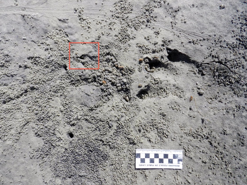
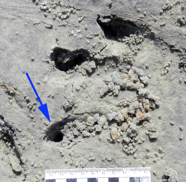
What was even neater, though, was how some of the fiddler crabs took advantage of homes newly created by this alligator. In at least a few tracks, we could see where fiddler crabs had taken over the holes caused by alligator claw marks. In other words, fiddler crabs saw these, said, “Hey, free hole!”, and moved in, not caring what made them.

Alligator-Tracks-Destroyed-Fiddler-Crab-BurrowsDon’t believe me about fiddler crabs moving into alligator claw marks? OK, then what’s that I see poking out of that alligator claw mark (red square)? (Photograph by Anthony Martin, taken on St. Catherines Island, Georgia; scale in centimeters.)

Fiddler-Crab-Burrow-Alligator-Claw-MarkWhy, it’s a small sand fiddler crab! Does it care that its new home is an alligator claw mark? Nope. Does ichnology rule? Yup. (Photograph by Anthony Martin, taken on St. Catherines Island, Georgia.)

Fiddler-Crab-Burrow-Alligator-Claw-2Need a free burrow? Then why start digging a new one when alligator claw marks (arrow) gives you a nice “starter burrow”? Notice the sculpted, round outline, showing the claw mark was modified by a crab. Also check out the sand balls left outside of the other claw marks, meaning these have probably been occupied and mined for food by fiddler crabs, too. (Photograph by Anthony Martin, taken on St. Catherines Island, Georgia; scale in centimeters.)

As a paleontologist, the main lesson learned from this modern example that can be applied to fossil tracks, is this: any tracks made in the same places as small, burrowing invertebrates – especially in intertidal areas – might have been destroyed or otherwise modified immediately by the burrowing and feeding activities of those much smaller animals. The secondary lesson is on how large vertebrate tracks can influence the behaviors of smaller invertebrates, resulting in their traces interacting and blending with one another.

More symbolically, though, these alligator tracks and their erasure by fiddler crabs also conjured thoughts of fictional and real analogues: Pacific Rim and coastal development, respectively. With regard to the latter, it felt too much like how, as soon as a hurricane (a meteorological “monster”) passes through a coastal area, we begin to talk about rebuilding in a way that, on the surface, wipes out all evidence that a hurricane ever happened.

Yet unlike fiddler crabs, we have memories, we have records – including the plotted “tracks” of hurricanes – and thanks to science, we can predict the arrival of future “monsters.” So the preceding little ichnological story also felt like a cautionary tale: pay attention to the tracks while they are still fresh, and be wary of those that vanish too quickly.

Tracking the Wild Cattle of Sapelo Island

(The following is part of a series about traces of key invasive species of mammals on the Georgia barrier islands and the ecological effects of these traces. Here is an introduction to the topic from last month, and the first entry was about the feral horses of Cumberland Island.)

If I were pressed to name my favorite Georgia barrier island, it would be a tough choice, but it would be Sapelo. Many reasons support this preference, both practical and emotional, which I will relate before getting to the topic featured in the title.
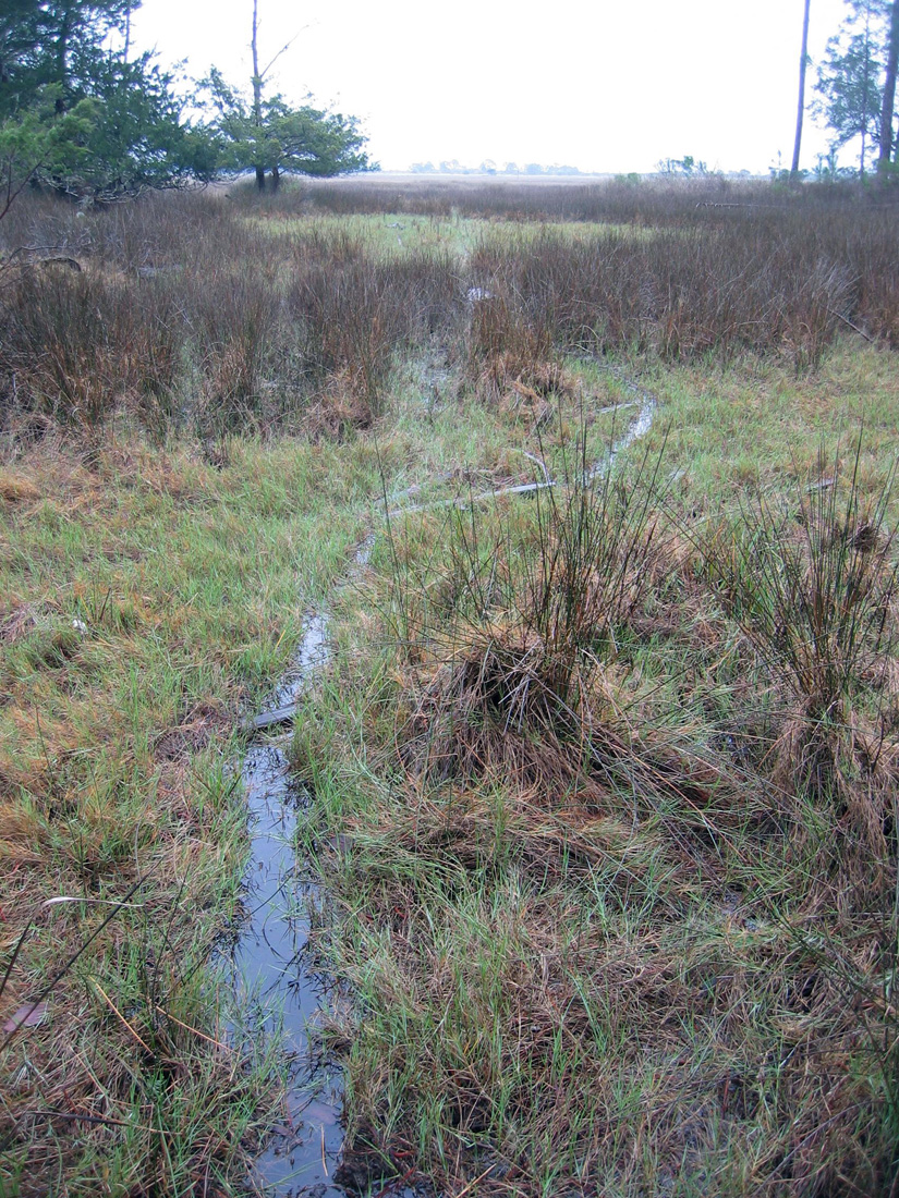
Trails made by feral cattle traveling far into a salt marsh on Sapelo Island, Georgia. But I thought cows only stayed in grassy fields and chewed their cuds? Please read on. (Photograph by Anthony Martin.)

As I mentioned in a previous entry, Sapelo is an excellent place to take university students for teaching basic coastal ecology, geology, ichnology, and taphonomy. Many ecologists consider it as the birthplace of modern ecology, which happened in the 1950s and ‘60s, and it hosted studies that established many basic principles of neoichnology (the study of modern traces) in the 1970s and ‘80s. For the latter, one of the key figures was Robert (Bob) Frey, who was my Ph.D. advisor when I attended the University of Georgia. Sapelo’s human history is also fascinating, dating back to more than 4,000 years ago – evidenced by a prominent Native-American shell ring – and continues through today with Hog Hammock, the only Gullah (“saltwater Geechee”) community left on the Georgia coast.

I have been to Sapelo dozens of times, with or without students, and each time there, I continue to be surprised and delighted by some new observation that reveals itself to those with open eyes and minds. Thus it has everything a field-oriented scientist could want, especially one who likes to learn something different with each visit.

All of these facts and feelings, though, may also lend to an impression that Sapelo is an idyllic and ecologically “pure” place, a true slice of what a Georgia barrier island should aspire to be. Alas, it is not, and like other Georgia barrier islands, Sapelo has been ecologically altered because of exotic plants and animals introduced there during colonial and post-colonial times. Among these species, the most noteworthy on Sapelo is Bos taurus, the only population of wild cattle on any Georgia barrier island and one of the few in the continental U.S.

Unlike the feral horses on Cumberland Island, nearly everyone agrees on the origin of the wild cattle on Sapelo: they are most likely descended from domestic cattle released on the island by millionaire R.J. Reynolds, Jr. (of carcinogenic fame). Although the details are sketchy as to exactly when and why he did this, Reynolds, who owned most of Sapelo from 1933 until his death in 1964, let loose his dairy cows and bulls in the first half of the 20th century. Many generations of these cattle have bred in the wild since, and still roam the island in sufficient numbers to warrant some attention from wildlife biologists, ecologists, and others interested in learning about their behavior and impacts on the local ecosystems.

In my experience, though, the words “wild” and “cattle” are rarely used in everyday conversations about these animals that, through our domestication of them, provide us with milk, cheese, and meat. Ask someone to describe a cow, for instance, and most people will be unflattering: “slow,” “docile,” and “stupid” are among the most common adjectives applied, which is sometimes followed by a giggling reference to the Midwestern U.S. tradition of cow-tipping.
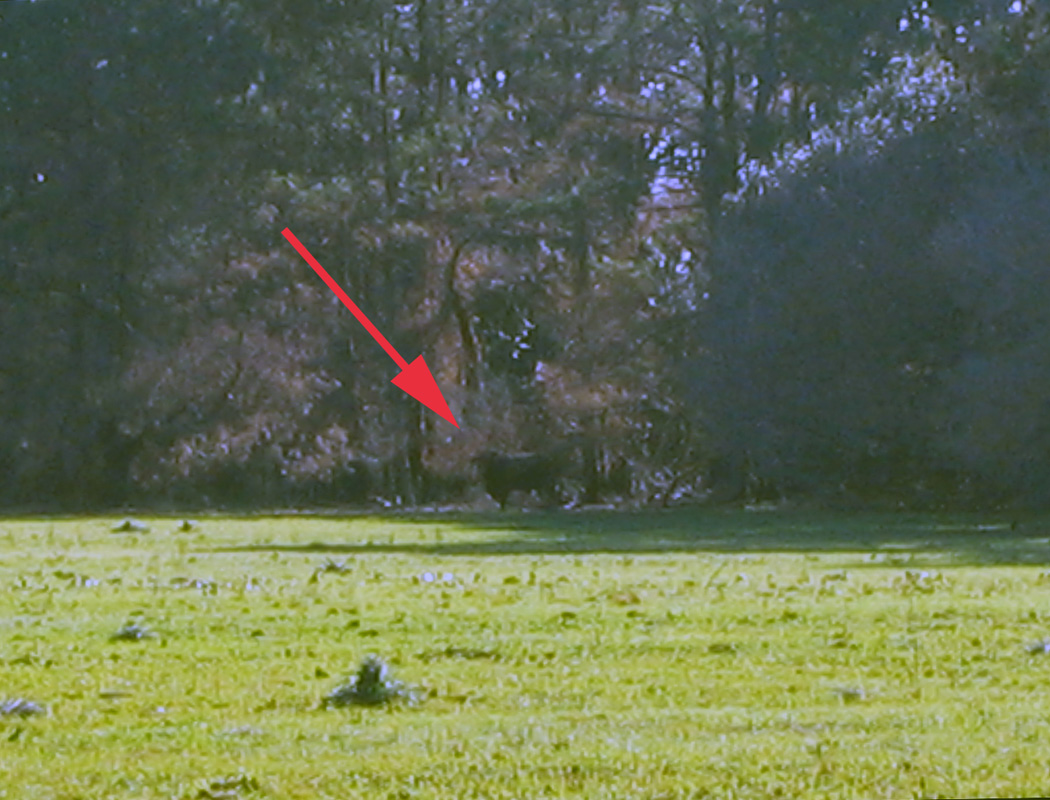
Thinking of tipping this cow? Be my guest, and be sure to forward the resulting video to Animal Planet for others’ lurid entertainment. The “cow” is actually a feral bull, and it was standing its ground at the edge of a field on Sapelo Island, fully aware that we spindly little bipeds were staring at it, and seemingly daring us to get closer. The poor quality of this photo is because I had my camera on maximum digital zoom: my momma didn’t raise no dumb kid. (Photograph by Anthony Martin.)

Yet these cattle are descended from wild species, aurochs (Bos primigenius) that survived the end-Pleistocene mass extinctions. You know, the same extinctions event that wiped out mammoths, mastodons, giant ground sloths, wooly rhinoceroses, saber-toothed cats, dire wolves, and other formidable megafauna of the Pleistocene. Hence aurochs must have had adaptive advantages over their Pleistocene cohorts. This was perhaps was related to their preferred ecosystems of wetland forests and swamps: remember that point with reference to Sapelo. Following the mass extinction, though, people in Eurasia, Africa, and India domesticated aurochs about 8,000 years ago. Through selective breeding, people came up with the present-day varieties we see of Bos taurus, which is considered a subspecies of B. primigenius.

Painting titled The Aurochs, by Heinrich Harder (1858-1935), probably made in 1920. Image is in the public domain and I found it on this Web site, authored by Peter Maas. Contrast how the artist depicted an auroch fighting off a pack of wolves with current expectations of how domestic cattle should behave in the face of pack-hunting predators, and you’ll get a better sense of the actual behaviors shown by wild cattle on Sapelo Island.

I am reminded of this evolutionary heritage whenever I go to Sapelo, because the cattle there are cryptic creatures of the maritime forest. Yes, that’s right: cryptic and living in the forest. A casual day-trip visitor to Sapelo will almost never see one, let alone any of several small herds that roam the island. Whenever an individual bull or herd is encountered in more open, grassy areas, they seemingly revert to Pleistocene behavior and slip into the woods, quickly concealing themselves from the prying eyes of humans. In short, they are not slow, docile, or stupid, and would never allow a person to get close enough to make an short-lived and ill-fated attempt to tip any of them.
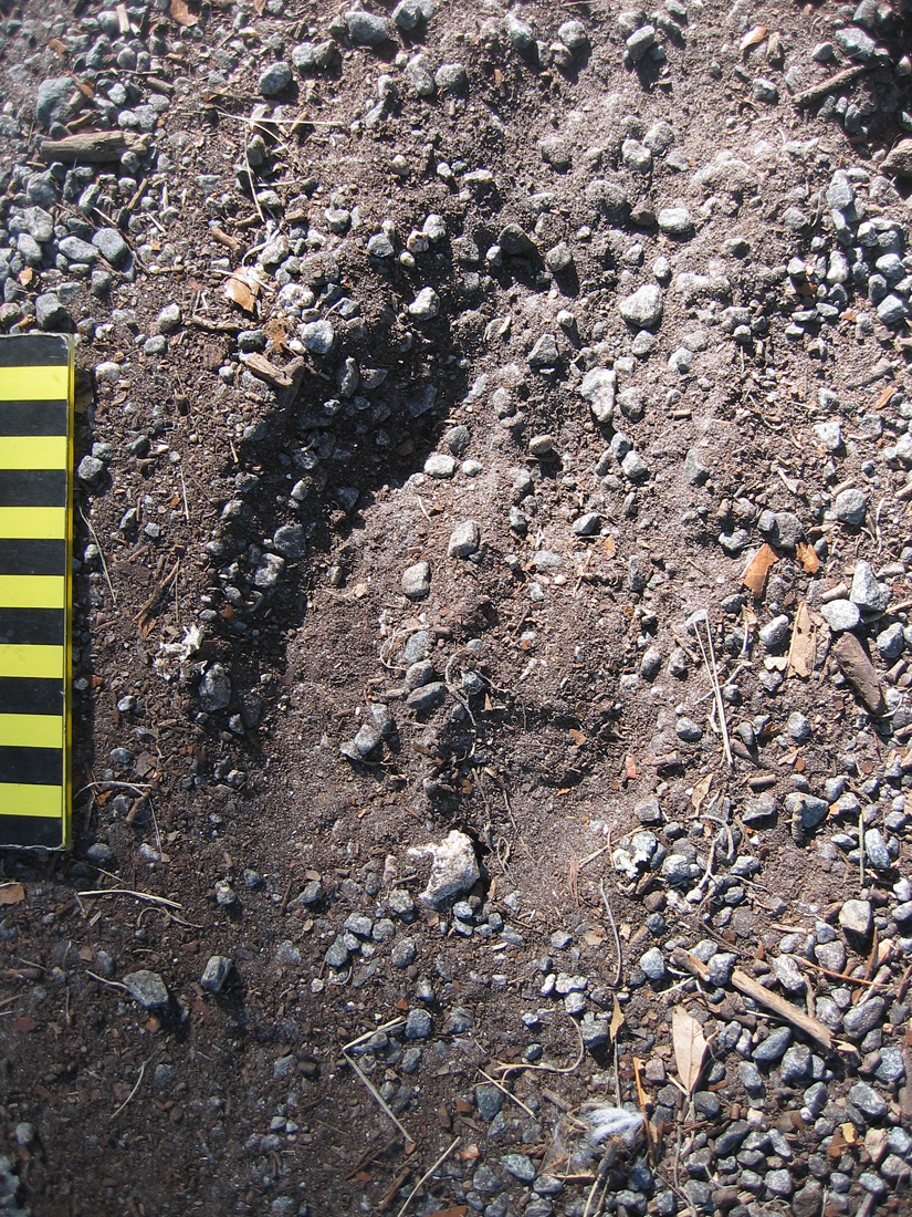
This is about all you’ll see of a recent presence of the feral cattle on Sapelo Island: tracks, and if you are lucky enough to sight one, it will leave a lot more tracks and sign for you to study than that all-too-brief glimpse. Scale is in centimeters, and look closely where the slightly smaller the rear-foot track (manus) registered directly on top of the fron-tfoot (pes) track. (Photograph by Anthony Martin.)

Hence any meaningful study of these cattle and their ecological effects on Sapelo requires the use of – you guessed it – ichnology. Consequently, I have tracked these cattle, sometimes with my students and sometimes by myself, during many visits there. Although these tracking forays have generated many anecdotal yarns of yore about these “wild cows of mystery” worth retelling, I will reluctantly restrict myself here to summarizing their traces and the effects of these traces on the landscapes of Sapelo.

Traces of feral cattle on Sapelo consist largely of their tracks, trails or otherwise trampled areas, feces, and chew marks. In my experience, the vast majority of their traces are on the northern half of the island, although herds or individual bulls will occasionally leave their marks in the southern half when they graze on grassy areas there.

Tracks made by these feral cattle are unmistakable when compared to those of any other hoofed animal on Sapelo – such as white-tailed deer or feral hogs – which is a function of their greater size. Tracks are shaped like robust, upside-down Valentine’s hearts, with two bilaterally symmetrical hoof impressions rounded in the front and back. Tracks are normally about 9-14 cm (3.5-5.5 in) long, although I have seen newborn calf tracks as small as 5-6 cm (2-2.3 in) long; track widths are slightly less (by about 20%) than lengths. These cattle, like deer, spend much of their time walking slowly, so their rear-foot (pes) impressions often overlap behind their front-foot (manus) impressions, but can also overprint in direct register. Trackways typically show a diagonal-walking pattern, although these can be punctuated by frequent “T-stops,” in which tracks form a “T” pattern, with the top of the “T” made by the front feet whenever a trackmaker stopped.
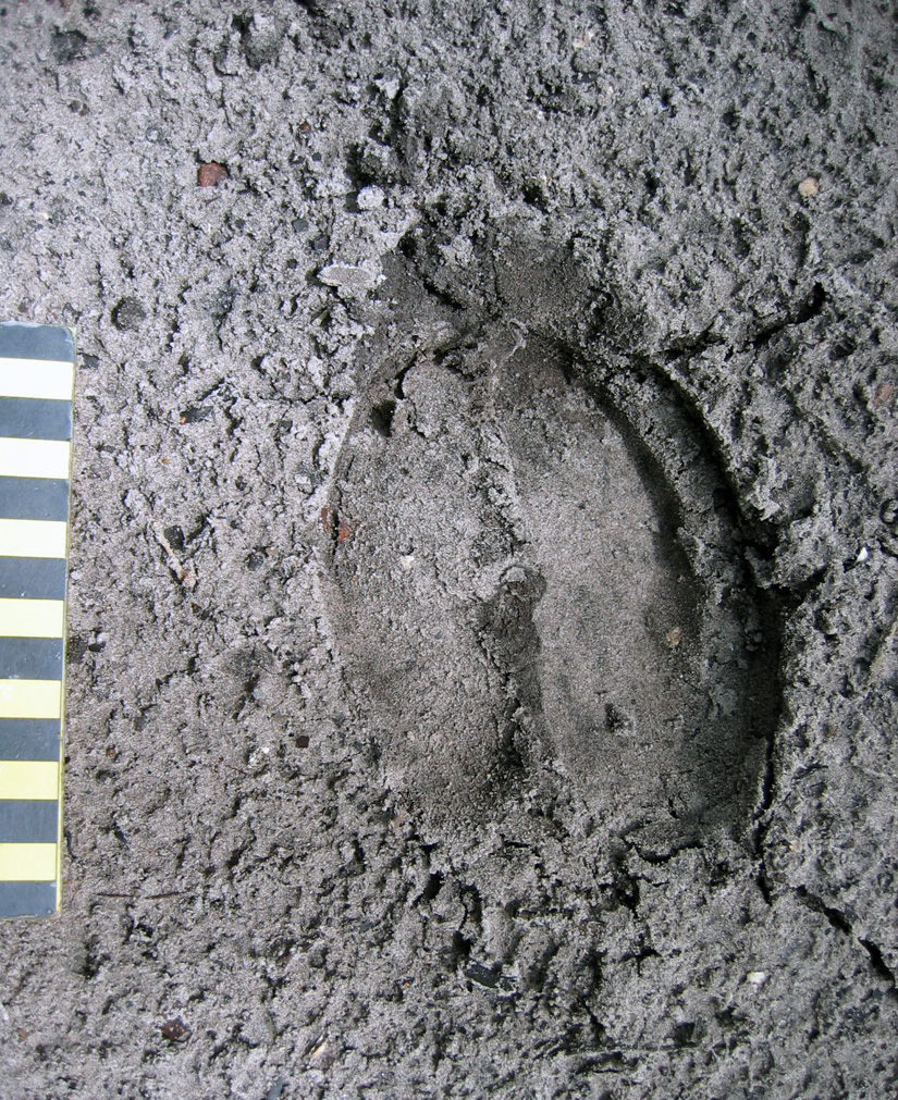
Near-perfect direct register of smaller rear foot into front-foot tracks made by adult feral cow, recorded in exquisite detail in fine-grained sand. Scale in centimeters. (Photograph by Anthony Martin, taken on Sapelo Island.)

Because these cattle, for the most part, obey herding instincts, they habitually follow one another along the same narrow pathways through maritime forests and salt marshes, resulting in well-worn trails that wind between live oaks in forest interiors or cut straight across marshes. Nonetheless, the cattle also like to use the open freeways provided by the sandy roads that criss-cross much of the northern part of the island, which makes tracking them much easier, especially after a hard rain has “cleaned the slate.” When using a road, the cattle break single file and walk parallel or just behind one another, indicated by their overlapping and side-by-side trackways. On forest trails, they often drag their hooves across the tops of logs downed along trails, chipping and otherwise breaking down the wood.

Feral cattle tracks showing different sizes – and hence age structures – of the cattle, with some trackways overlapping (following one another) and some parallel, taking up the entire width of a sandy road on the north end of Sapelo Island. (Photographs by Anthony Martin, composite of three stitched together in Photoshop™.)
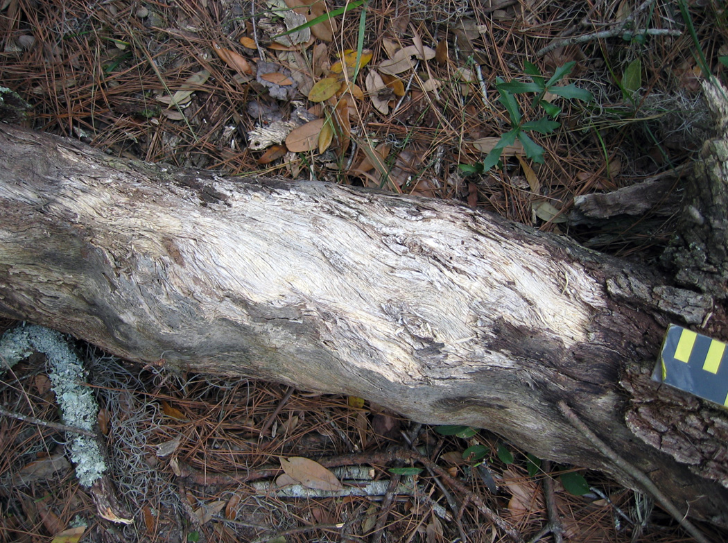
Log on feral-cattle trail, showing chipped wood on surface where hooves dragged across the top, possibly over generations of trail use. White-tailed deer do a similar behavior on their trails, but do not cause such obvious traces. (Photograph by Anthony Martin, taken on Sapelo Island.)

OK, here’s a reminder of something I just said and showed in a photo earlier: these cattle also form trails that wind deeply into the salt marshes. Why? Turns out that instead of restricting themselves to a terrestrial-only diet, they are eating smooth cordgrass (Spartina alterniflora), which grows abundantly in the marshes. This feeding results in their leaving many other traces, such as near-ground-level cropping of Spartina with clean tears, accompanied by considerable trampling of grazed areas. Although I was surprised to discover this for myself several years ago, people who raised cattle on the island in the 19th and early 20th centuries, perhaps through necessity, knew about this alternative foodstuff and fed it to cattle as a substitute for hay. Sure enough, historical references verify the use of smooth cordgrass as part of their diet (of the cattle, not the people, that is).
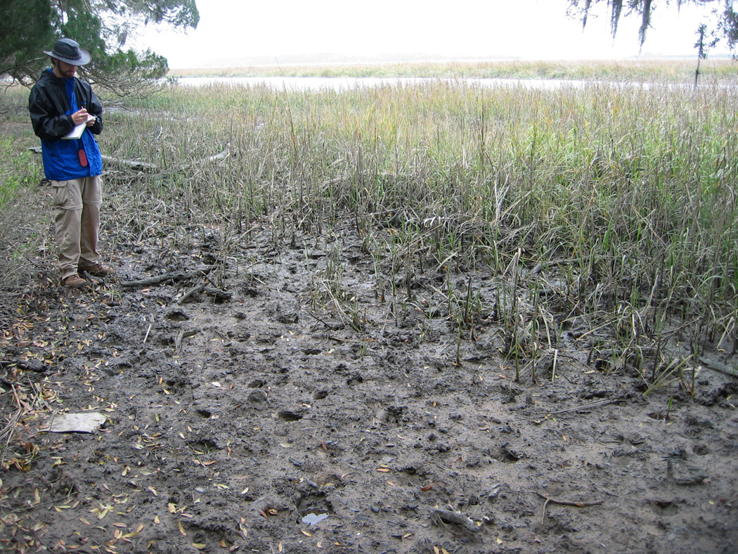
Evidence that feral cattle of Sapelo walk into salt marshes as a herd and eat the smooth cordgrass (Spartina alterniflora) there, based on trampling and overgrazing. Michael Bauman, who was an Emory undergraduate student at the time, for scale. (Photographs by Anthony Martin.)
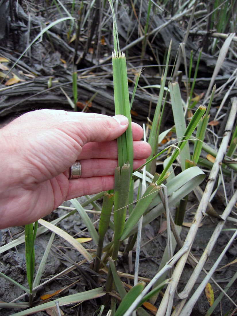
Close-up of traces left on smooth cordgrass from feral cattle grazing, which are at various heights according to the level of their grazing activity. (Photograph by Anthony Martin, taken on Sapelo Island.)

Of course, among the most obvious traces these cattle leave in their wake are the end products of digestion (pun intended), feces. These “cow patties” vary in size depending on both the size of the tracemaker and liquid content of the scat. The bigger the tracemaker and the greater the water content to the plants, the wider the patties, which can exceed dinner-plate size. Similar to the situation on Cumberland Island with its feral horses and their feces, the native dung beetles must not be able to keep up with such a bounty, as I see many unrecycled, dried patties throughout the island, and have nearly stepped on freshly dropped pies that showed no signs of having been discovered by caring dung-beetle mothers.
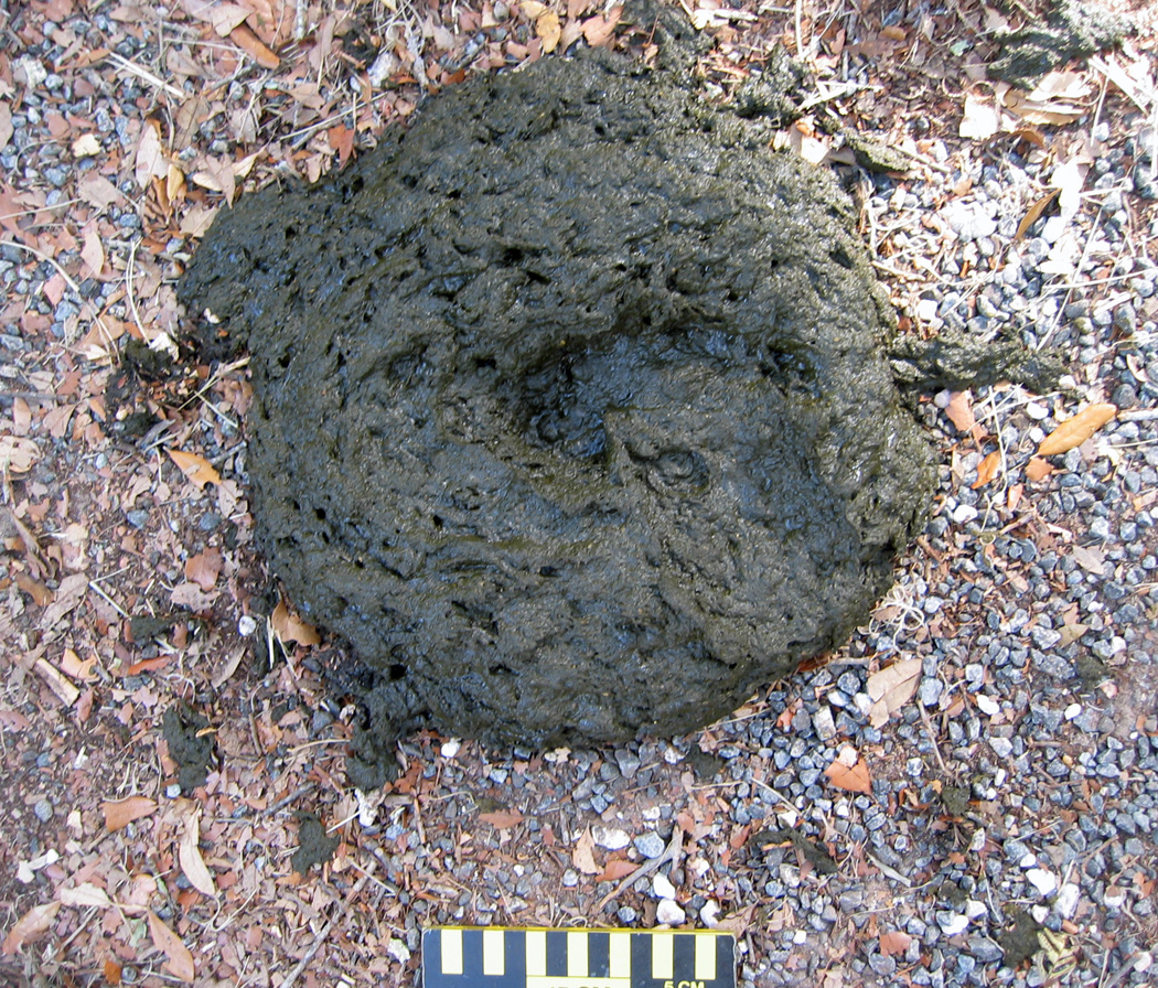
Looks like cow scat. Smells like cow scat. Feels like cow scat. Tastes like cow scat. Good thing we didn’t step in it! But notice that the tracemaker did, leaving a bonus trace (track) on top of its impressive pile. (Photograph taken by Anthony Martin, taken on Sapelo Island.)

Given that the northern part of the island has extensive salt marshes flanking the maritime forest, and places with fresh-water sloughs containing more wetland plants, it makes sense that the cattle would stay mostly in that half of the island. The absence of humans on the north end of the island – other than occasional deer hunters, Department of Natural Resources personnel, or crazy ichnologists – is also a plus, as these cattle avoid people whenever possible.

But how does any of this relate to geology and paleontology? Well, because these feral cattle interact so much with Sapelo salt marshes, I actually included these animals as marginal-marine tracemakers in my upcoming book (Life Traces of the Georgia Coast, just in case you needed reminding). This places these bovines in the same category as feral horses – which negatively affect coastal dunes and salt marshes – and feral hogs, which even go into the intertidal zones of beaches for their foraging.

The biggest difference between the cattle and these other two hoofed species, though, is their impact on the marshes. In all of my years of noting cattle tracks and other sign on Sapelo, I have never seen evidence of their going to the beach, or even to the coastal dunes. Instead, they stay in the forests and wetlands, whether the latter are fresh-water or salt-water ones. This possibly reflects how the cattle, within just a few generations, switched back to auroch behaviors of the Pleistocene, preferring to live in wooded wetlands instead of in the terrestrial grasslands we modern humans keep forcing them to graze.

Thus any paleontologists looking into the fossil record of aurochs or their ancestral species – whether of body fossils or trace fossils – might use these present-day clues when prospecting for fossils. This serves as a great example of why I urge paleontologists to pay attention to invasion ecology and conservation biology, in which “ecologically impure” invasive species give us valuable insights on their evolutionary histories.

What else can we learn about these feral cattle and their ecological and geological impacts on Sapelo, especially through studies of their traces? For one, knowing the actual number of cattle on the island would be useful, as their quantity surely relates to how well the island ecosystems can handle present and future populations. But probably more important than this would be better defining their behaviors in the context of these non-native ecosystems. How to do this with a species that stays hidden so well, one that has apparently reverted to a Pleistocene way of life? Fortunately, behaviors can be defined through the ichnological methods I have outlined here. These methods can then easily augment others normally used by conservation biologists, such as trail cameras and direct observation.

Once this is done, we will know much more about these wild cattle than before, and will no longer have to rely on whispered legends of the mysterious bovines of Sapelo Island. Regardless, there is certainly still room for such stories, perhaps even artwork, operas, plays, movies, and music. Cattle have played such an integral role in the development of humanity, there is every reason to suppose that, as long as they continue to live on Sapelo, they and their traces will continue to intrigue us.

Further Reading

Ajmone-Marsan, P., Fernando Garcia, J., and Lenstra, J.A. 2010. On the origin of cattle: how aurochs became cattle and colonized the world. Evolutionary Anthropology, 19: 148-157.

Bailey, C., and Bledsoe, C. 2000. God, Dr. Buzzard, and the Bolito Man: A Saltwater Geechee Talks about Life. Doubleday, New York: 334 p.

McFeeley, W.S. 1995. Sapelo’s People: A Long Walk into Freedom. W.W. Norton, New York: 200 p.

Sullivan, B. 2000. Sapelo Island (GA): Images of America. Arcadia Publishing,  Mt. Pleasant, South Carolina: 128 p.

Teal, M., and Teal, J.M. 1964. Portrait of an Island. Atheneum, New York: 167 p. [reprinted by University of Georgia Press, Athens, in 1997: 184 p.]

Fossils in Progress

Despite whatever lamentations are made about the “incompleteness” of the fossil record, fossils are actually quite common. This truism is brought home even more so whenever trace fossils – tracks, burrows, and other evidence of organismal behavior – are included in a fossil checklist (as well they should be) when examining any given outcrop of sedimentary rocks formed in the past 550 million years or so.

For example, many a time I have visited an outcrop described previously as “lacking fossils,” and instead found it filled with trace fossils; hence what people meant was “lacking fossils” equals “no body fossils.” Normally these trace fossils are invertebrate burrows, which might be glibly identified as “worm burrows,” but tracks or other trace fossils may also reveal themselves to those who are looking for them. Indeed, this expectation of finding fossils is such that on occasions when geologists find a sedimentary rock layer devoid of either body or trace fossils, this is odd enough to cause geologists to scratch their heads and ask why.

But how do the former bodily remains of plants or animals, or traces of their behaviors, become preserved as fossils in the first place? This question other related ones are answered by the science of taphonomy. Coined by Russian paleontologist Ivan Yefremov, the etymology of this term stems from Greek, in which taphos ( = burial) and nomos (= law). In such a term, he was thus alluding to an expectation that natural processes that result in fossils becoming preserved are orderly and predictable.

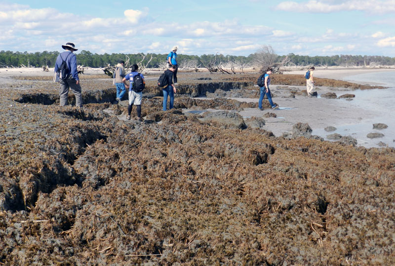
An overview of taphonomy as a field of study would be far too lengthy to explore here, so instead I will use one example from the Georgia coast to show how it is supposed to work. This superb case in point is a relict marsh. It is what’s left of a salt marsh from about 500 years ago, and it has been revealing its nature to paleontologists, geologists, and students for the past few decades.

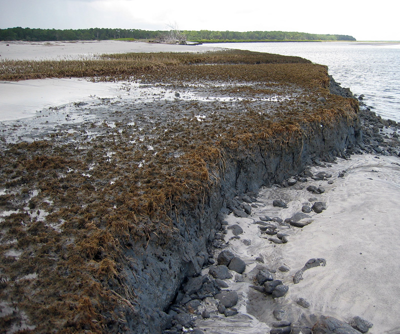
Overall view of relict marsh exposed on Cabretta Beach, Sapelo Island, Georgia. Me for scale, but photo taken 7 years ago, so the scale might now be slightly wider now. (Photograph taken by Ruth Schowalter.)

Just a little more than a week ago, my colleague Steve Henderson and I took a group of students from Emory University to Sapelo Island for a weekend field trip (detailed last week). One of our goals on this trip was to take them to a relict marsh on Cabretta Beach so that they could better appreciate how a sedimentary deposit makes a transition from living ecosystem to inert rock, yet filled with evidence of its formerly teeming life. Similar relict marshes are on St. Catherines Island and other Georgia-coast islands, but when it comes to teaching about taphonomy in the field, I prefer using the one on Sapelo.

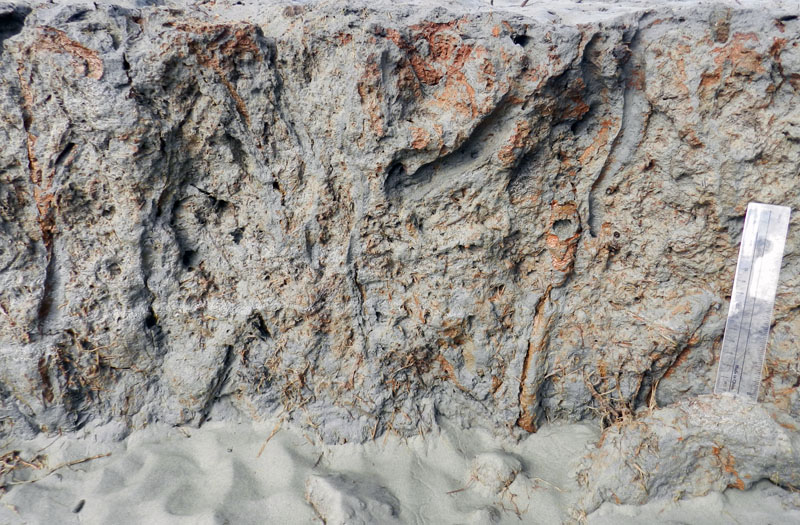
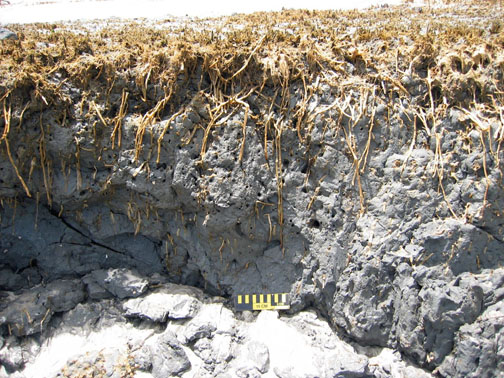
Closer view of relict marsh on Sapelo Island, showing 500-year-old remains of smooth cordgrass (Spartina alterniflora), cross section of its muddy sediments, and quartz sand deposited on top by tides, waves, and wind. (Photograph by Anthony Martin.)

As mentioned in a previous entry, modern salt marsh on the Georgia coast have a few key components that make them among the most productive of all ecosystems: smooth cordgrass (Spartina alterniflora), marsh periwinkles (Littoraria irrorata), mud fiddler crabs (Uca pugnax), and ribbed mussels (Geukensia demissa). So if a Georgia salt marsh were to be buried quickly – say, by a storm that dumps a thick layer of sand on it – what would be preserved? The Cabretta relict marsh partially answers that question, showing us incipient trace and body fossils of these biota. They are not quite fossils, but on their way there, giving us a glimpse of the fossilization process well before it is completed.

For example, the tall, green or golden stalks of smooth cordgrass that we see today, adorned my millions of marsh periwinkles (Littoraria irrorata), are absent from the relict marsh. Only the lowermost ochre-colored stubs and extensive root systems remain, and traces made by the roots below what was the marsh surface.

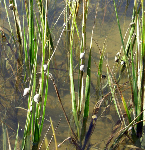
Modern smooth cordgrass (Spartina alterniflora) and its constant companions, marsh periwinkles (Littoraria irrorata) on Sapelo Island, Georgia.

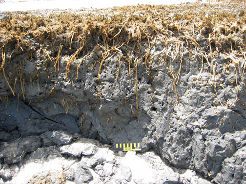
Cross-sectional view of relict marsh, what is left from a formerly magnificent marsh: stubs, roots, root traces, and not many periwinkles. (Both photographs by Anthony Martin.)

Once in a while, I also find old marsh periwinkle shells scattered on the surface of the relict marsh. These are made of calcium carbonate and will dissolve in slightly acidic waters, so these might not last for long once exposed. The real reason for why these tend to disappear quickly, though, is modern hermit crabs. Hermit crabs encounter these periwinkle shells on the relict marsh surface, say “Hey, free shells!”, then happily trot away with these, not caring that their “new” homes are actually 500 years old.

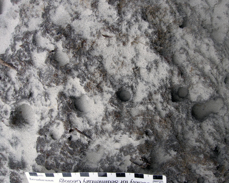
No mud-fiddler crab remains were apparent on the surface, nor have I seen them in 20-30 visits to this relict marsh. This is not surprising, as their exoskeletons are made of chitin and dissolve more quickly than molluscan shells. Nonetheless, their burrows are always abundantly evident on the surface as perfectly round holes, which are sometimes accompanied by new burrows made by modern fiddler crabs, as well as bivalves that will bore into this firmground.

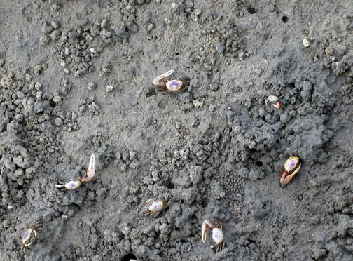
Modern salt marsh surface on Sapelo Island with mud fiddler crabs (Uca pugnax) showing off a few of the behavioral traits they do best: eating, fighting, mating, and burrowing. Note that burrows, surface scrapings, and pellets are a few of the traces they make. Which of these traces get preserved?

Close-up of eroded relict marsh surface, showing cross-sections of old fiddler-crab burrows now being filled with modern beach sand. Think of how this will look in the fossil record. (Scale in centimeters).

Longitudinal view of former fiddler-crab burrows associated with smooth-cordgrass root traces. Fill the deeper parts of these burrows with sand, and they’re more likely to get preserved as trace fossils. Scale to right is 15 cm (6 in) long. (All photographs by Anthony Martin.)

Modern ribbed mussels are harder for us to see in the field because we would have to wade into soft, deep, sulfurous mud to get close to them, and however amusing that might be, we don’t have time to do our laundry before getting back into our rental vans for the ride home. So the students take our word for it that those mussels are indeed in the marsh, then we point to the old ones clumped on the relict-marsh surface that are still in life position.

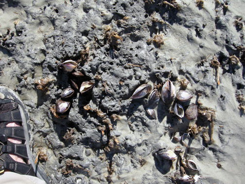
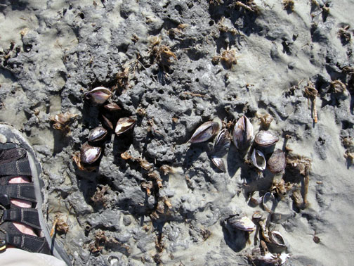
Cluster of ribbed mussels (Guekensia demissa) directly associated with stubs of smooth cordgrass on relict marsh surface. Now that they’re exposed, how long will these shells last on the surface? (Photograph by Anthony Martin.)

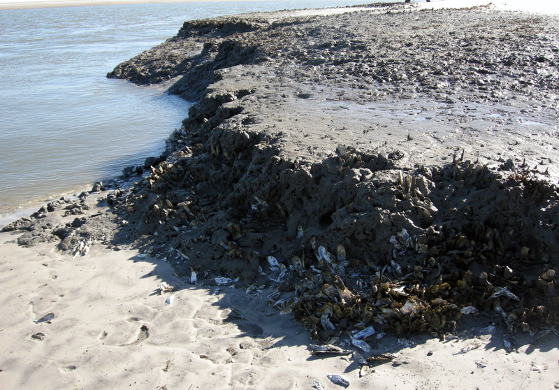
Oysters (Crassostrea virginica) are less common in the relict marsh, but given the right exposure, these can be observed on some visits too. These clumps of oyster shells mark the edges of tidal creeks that wound through the marsh.

(Top) Modern salt marsh with tidal creek cutting through it and oyster bank exposed at low tide, Sapelo Island.

Former oyster bank peeking out of relict marsh, formerly buried for about 500 years, now revealed by erosion of the modern shoreline. (Both photographs by Anthony Martin.)

Because it was all too easy to spot the similarities between this relict marsh and a modern one less than 100 meters (330 feet) from where we stood, I then asked about other differences. For instance, take the fact that we were standing on the relict marsh while discussing its traits: could we do the same in the modern marsh nearby? No, was the universal answer, and I affirmed that they would likely be up to their waists in ribbed-mussel-produced mud. (I asked for volunteers to test this hypothesis, and they very smartly declined.)

This led to a discussion of why the relict marsh could be so firm, which introduced them to the concept of diagenesis: how a sedimentary deposit can change over time, an important consideration in taphonomy. Such alterations are especially apparent in muds, which lose considerable volume as these lose their water content, causing a “softground” to become a “firmground,” then eventually a “hardground.” The students were surprised when I told them that the relict marsh acting as the floor of our “classroom” was likely 2-3 times as thick as what was there now.

Would these students so blithely walk around on a modern salt marsh? I don’t think so, and please don’t experiment with this yourself. Nevertheless, a relict marsh, thanks to dehydration of its muds and compaction, is just fine for exploring on foot. (Photograph by Anthony Martin.)

We spent only about an hour at the relict marsh before regretfully walking back to our field vehicle, followed by a ferry ride to the mainland part of Georgia and a long drive home to Atlanta. Yet I felt assured that the lessons about taphonomy, ancient environments, ichnology, and diagenesis imparted by this relict marsh encompassed enough material to fill 4-5 class sessions in an indoor classroom. Moreover, if we had been all enclosed by four walls and a ceiling, and without a former marsh underfoot, there was no guarantee that these concepts would be understood or retained.

This is why we geoscientist-educators take our students outside, enriching our collective awareness of how environments change through time and how we piece together the clues left behind from ancient environments. It’s memorable, it’s fun, and it works. But don’t take my word for it. Whether you’re an educator or student, try it yourself sometime, whether on the Georgia coast or elsewhere, and see what happens.

Further Reading

Basan, P.B., and Frey, R.W. 1977. Actual-palaeontology and neoichnology of salt marshes near Sapelo Island, Georgia. In Crimes, T.P., and Harper, J.C. (editors), Trace Fossils 2. Liverpool, Seel House Press: 41-70.

Edwards, J.M. and Frey, R.W. 1977. Substrate characteristics within a Holocene salt marsh, Sapelo Island, Georgia. Senckenbergiana Maritima, 9: 215-259.

Frey, R.W. and P.B. Basan. 1981. Taphonomy of relict Holocene salt marsh deposits, Cabretta Island, Georgia. Senckenbergiana Maritima, 13: 111-155.

Frey, R.W., Basan, P.B. and Scott, R.M. 1973. Techniques for sampling salt marsh benthos and burrows. American Midland Naturalist, 89: 228-234.

Letzsch, W.S. and Frey, R.W. 1980. Deposition and erosion in a Holocene salt marsh, Sapelo Island, Georgia. Journal of Sedimentary Research, 50: 529-542.

Morris, R. W. and H. B. Rollins. 1977. Observations on intertidal organism associations on St. Catherines Island, Georgia. I. General description and paleoecological implications. Bulletin of the American Museum of Natural History, 159: 87-128.

Smith, J.M., and Frey, R.W. 1985. Biodeposition by the ribbed mussel Geukensia demissa in a salt marsh, Sapelo Island, Georgia. Journal of Sedimentary Research, 55: 817-825.

Georgia Salt Marshes: Places Filled with Traces

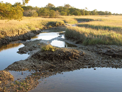
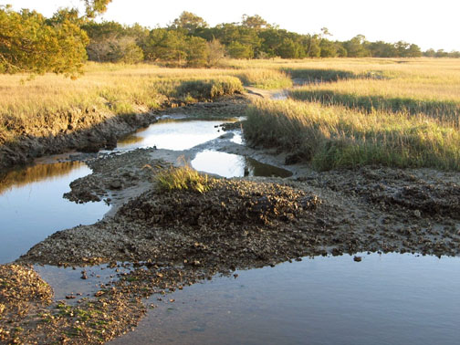
The Georgia coast has long captured the attention of scientists interested in its biological and geological systems and how these two realms overlap. For example, starting in the 1950s, ecologists – people who study the connections between living and non-living things in ecosystems – began investigating the exchange of energy and matter between the plants and animals of the Georgia barrier islands. In particular, they were interested in the Georgia salt marshes, most of which are between the mainland and the upland portions of the barrier islands. Why study salt marshes in Georgia, and not somewhere else? And how do the traces of plants and animals in these marshes, such as root disturbances, scrapings, burrows, and feces, actually play a major role in the functioning of these ecosystems?

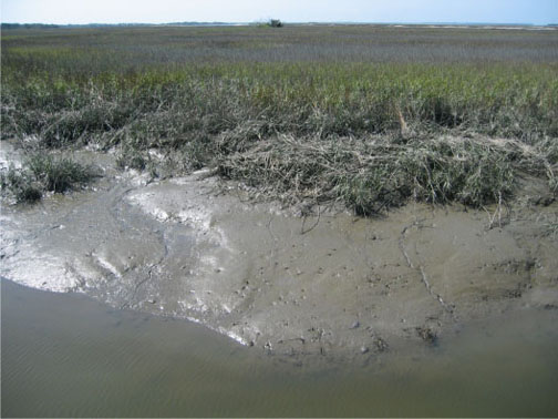
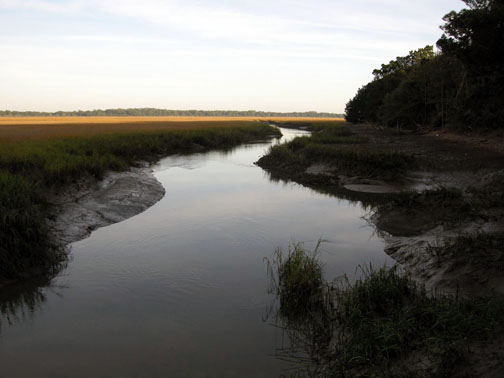
The muddy bank of a tidal creek in a typical salt marsh on St. Catherines Island, Georgia. See the traces? No? It’s a trick question: it’s made of nothing but traces. Photograph by Anthony Martin.

Georgia salt marshes are flat, extensive coastal “prairies” dominated by a tall, marine-adapted grass, smooth cordgrass (Spartina alterniflora) in their lowermost parts. These ecosystems turned out to be fantastic places for scientists to study basic principles of ecology, and are among the most productive of all ecosystems, besting or equaling tropical rain forests in this respect. Georgia salt marshes also represent about one-third of all salt marshes in the eastern U.S. by area. How did this happen?

Such an unusual concentration of salt marshes along the relatively small Georgia coastline is a result of several factors. One is its semi-tropical climate, only rarely dipping below freezing, which allows marsh plants and animals to thrive and actively participate in their ecosystems nearly year-round. Another is the high tidal range of the Georgia coast of about 2.5-3 meters (8-10 feet), which causes enormous amounts of organic material – living and nonliving – to get cycled in and out of the marshes by this moving water.

A third reason, and perhaps the most important, is what people did not do to the marshes, which was to develop them in ways that would have completely altered their original ecological characters. (Take a look at the barrier islands of New Jersey as examples of what could have happened in Georgia.) Salt marshes that were not drained, filled in, paved over, or otherwise irreparably altered could be studied for what they were, not what we supposed.

Salt marsh and tidal creek adjacent to a maritime forest on Cumberland Island. Fortunately, this is a typical sight on the Georgia barrier islands, which gladdens ecologists and lots of other people who prefer to see their landscapes unpaved.

The scientists interested in the Georgia salt marshes, among them Eugene (“Gene”) Odum, Mildred Teal, and John Teal, were astonished by the amount of organic matter produced in these marshes, especially in their lower parts, which were appropriately called low marsh. Amazingly, much of this flux is controlled by tides and just five species of organisms you can easily see any given day in these marshes:

  • Smooth cordgrass (Spartina alterniflora)
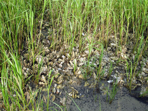
  • Ribbed mussels (Geukensia demissa)
  • Eastern oysters (Crassostrea virginica)
  • Marsh periwinkles (Littoraria irrorata)
  • Mud fiddler crabs (Uca pugnax)

Just to oversimplify matters, but to assure that you get the big picture, the flow of matter and energy goes like this. Smooth cordgrass is the primary producer of organic material in the salt marshes, converting sunlight into food for it and, as it turns out, lots of other organisms. This is relatively easy for these plants because they are powered by intense Georgia sunlight much of the year. Smooth cordgrass also has extensive and complicated root systems, which help to hold most of the marsh muds in place when marshes are flushed by the tides. These roots locally change the chemistry of the surrounding mud and otherwise leave visible traces of their deeply penetrating networks, which are noticeable long after the plants had died and decayed.

Cross-section of a relict salt marsh preserved on Sapelo Island, Georgia, buried for about 500 years but just now being exhumed by shoreline erosion. See how deeply those roots of smooth cordgrass (Spartina alterniflora) penetrate the mud and still hold it in place? Modern ones do the same thing. Scale = 15 cm (6 in).

What produces the mud in a marsh? Mostly the ribbed mussels, oysters, and similar suspension-feeding animals, which: suck in water made cloudy by suspended clays; consume any useful organics that might be in that water; and excrete massive amounts of mud-filled feces, packaged with mucous as sand-sized particles. The oysters, along with cordgrass roots, stabilize the banks of tidal creeks, keeping these from washing away with each ebb tide.

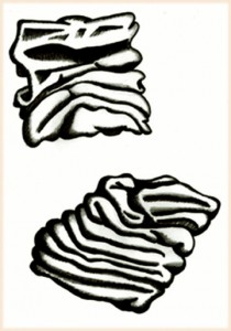
If you’ve ever wondered what ribbed mussel (Geukensia demissa) feces look like, you’re in luck. Each one is only about 1 millimeter (0.04 inches) across, which makes them behave more like sand instead of much tinier clay particles. Also think of them as little packets of mud shrink-wrapped by mucous. Illustration by Anthony Martin, based on a figure by Smith and Frey (1985).

A view of what used to be a marsh surface – the relict marsh on Sapelo Island, that is – with stubs of long-dead smooth cordgrass accompanied by equally long-dead clusters of ribbed mussels (Geukensia demissa). Back in the day (about 500 years ago), these mussels were happily pumping out mud-filled feces, and their modern descendants are still doing the same thing. Sandal (left) is size 8½ (mens). Photograph by Anthony Martin.

Prominent clumps of eastern oysters (Crassostrea virginica), exposed at low tide in the middle of a tidal creek on Sapelo Island. These not only help to produce mud, but keep it in place, while also slowing down flow and helping to deposit mud. Photograph by Anthony Martin.

A close-up look at more oysters surrounded by smooth cordgrass, with both working together to bind and accumulate mud on Sapelo Island. Now that’s ecological teamwork! Photograph by Anthony Martin.

Both the cordgrass and oysters also baffle and otherwise slow down the water flow, causing mud – fecal or otherwise – to get deposited. In short, a Georgia salt marsh with its thick deposits of beautifully dark, rich, gooey mud, much of which consists of the traces of mussels and oysters, would cease to exist without these bivalves and smooth cordgrass, and would become more like an open lagoon.

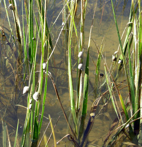
Meanwhile, marsh periwinkles are constantly moving up and down the stalks and leaves of the smooth cordgrass, grazing on algae growing on the cordgrass. This activity causes visible damage to the plants, tearing them into small bits and pieces that fall onto the marsh surface.

Marsh periwinkles (Littoraria irrorata) doing what they do best, which is graze on the stalks and leaves of smooth cordgrass, leaving many traces from damaging these plants while also contributing plant debris to the marsh surface. Photograph by Anthony Martin, taken on Sapelo Island.

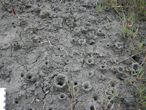
Fungi and bacteria further break down this “gentle rain from heaven” of cordgrass debris once it reaches the marsh surface. Here, mud fiddler crabs consume this stuff, along with any algae that might be growing on marsh surfaces. Their scrape marks and discarded balls of processed sediment are everywhere to be seen on the marsh surface and add to the sediment load of a marsh. Furthermore, as we may have learned in grade school, all animals poop, so in this way these fiddler crabs and other species of crabs living in the salt marshes donate even more enriched organic material. They also dig millions of burrows, some adorned by prominently pelleted turrets, churning the uppermost part of the marsh mud like earthworms would do to a soil in a forest or field.

Mud fiddler crabs (Uca pugnax) and their many traces on a salt marsh surface, including feeding pellets, scrape marks, and burrows. Photo by Anthony Martin, taken on Sapelo Island.

Mud-fiddler crab burrows exposed at low tide in a marsh, many with pellet-lined turrets. Why do they make these structures? Good question, which I’ll try to answer in the future. Photo by Anthony Martin, taken on Sapelo Island.

Hence you cannot go to a Georgia salt marsh and say, “I can’t see any traces,” unless you are closing your eyes or are otherwise sight deprived. The entire salt marsh is composed of traces, and these traces, which are the products of plant and animal behavior, actually control the ecology of the salt marshes. Thus I often refer to Georgia salt marshes as examples of “ichnological landscapes,” places that are the sum of all traces. This concept then better prepares us for viewing these and other Georgia coastal environments as places where geologists can begin to understand how organisms can leave their marks – both big and small – in the geologic record.

Further Reading:

Craige, B.J. 2001. Eugene Odum: Ecosystem Ecologist and Environmentalist. University of Georgia Press, Athens, Georgia: 226 p.

Odum, E.P. 1968. Energy flow in ecosystems; a historical review. American Zoologist, 8: 11-18.

Odum, E.P., and Smalley, A.E. 1959. Comparison of population energy flow of a herbivorous and a deposit-feeding invertebrate in a salt marsh ecosystem. Proceedings of the National Academy of Sciences, 45: 617-622.

Smith, J.M., and Frey, R.W. 1985. Biodeposition by the ribbed mussel Geukensia demissa in a salt marsh, Sapelo Island, Georgia. Journal of Sedimentary Research, 55: 817-825.

Teal, J.M. 1962. Energy flow in the salt marsh ecosystem of Georgia. Ecology, 43: 614-624.

Teal, J.M., and Teal, M. 1983. Life and Death of a Salt Marsh. Random House, New York: 274 p.

Teal, M., and Teal, J.M. 1964. Portrait of an Island. Atheneum, New York: 167 p. [reprinted by University of Georgia Press in 1997, 184 p.]